Yola North
LGA in Adamawa State, Nigeria
9°12′00″N 12°29′00″E / 9.2°N 12.4833°E / 9.2; 12.4833 Nigeria
 (2022)[1]

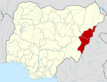
Yola North is a Local Government Area of Adamawa State, Nigeria. It includes Jimeta. It is a suburb of Yola (Yola South).
Yola is the administrative capital of Adamawa State in Nigeria's northeastern region.[2]
Climate/Geography
Yola North LGA experiences two distinct seasons—the dry and the rainy—with an average temperature of 33 degrees Celsius. The well-known Mandara Mountains range is located in the LGA, and the average wind speed in the region is 10 km/h.[3][4]
References
- ^ "Yola North (Local Government Area, Nigeria) - Population Statistics, Charts, Map and Location". www.citypopulation.de. Retrieved 2024-02-05.
- ^ International Journal of Applied Science and Engineering Research. Integrated Publishing Association.
- ^ "Yola North Local Government Area". www.manpower.com.ng. Retrieved 2024-08-09.
- ^ "Yola North, Nigeria Weather Conditions | Weather Underground". www.wunderground.com. Retrieved 2024-08-09.
- v
- t
- e
Adamawa StateState capital: Yola
- Demsa
- Fufore
- Ganye
- Guyuk
- Gombi
- Girei
- Hong
- Jada
- Lamurde
- Madagali
- Maiha
- Mayo Belwa
- Michika
- Mubi North
- Mubi South
- Numan
- Shelleng
- Song
- Toungo
- Yola North
- Yola South
 | This Adamawa state location article is a stub. You can help Wikipedia by expanding it. |
- v
- t
- e


