Toungo, Nigeria
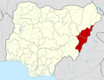
LGA and town in Adamawa State, Nigeria
8°7′N 12°3′E / 8.117°N 12.050°E / 8.117; 12.050 Nigeria
 (2022)[1]

Toungo is a town and Local Government Area of Adamawa State, Nigeria.[2]
Climate
Toungo has a tropical wet and dry or savanna climate and is zero meters (0 feet) above sea level (Aw classification). The district averages a yearly temperature of 32.97oC (91.35oF), which is 3.51% higher than the national average for Nigeria. Toungo generally experiences 147.68 wet days (40.46% of the time) and receives about 123.47 millimeters (4.86 inches) of precipitation each year.[3]
References
- ^ "Toungo (Local Government Area, Nigeria) - Population Statistics, Charts, Map and Location". www.citypopulation.de. Retrieved 2024-02-05.
- ^ Nigeria, Media (2022-02-17). "History Of Toungo LGA, Adamawa State". Media Nigeria. Retrieved 2023-08-06.
- ^ "Toungo, Adamawa, NG Climate Zone, Monthly Averages, Historical Weather Data". weatherandclimate.com. Retrieved 2023-10-04.
- v
- t
- e
Adamawa StateState capital: Yola
- Demsa
- Fufore
- Ganye
- Guyuk
- Gombi
- Girei
- Hong
- Jada
- Lamurde
- Madagali
- Maiha
- Mayo Belwa
- Michika
- Mubi North
- Mubi South
- Numan
- Shelleng
- Song
- Toungo
- Yola North
- Yola South
 | This Adamawa state location article is a stub. You can help Wikipedia by expanding it. |
- v
- t
- e


