Federal electoral district in Ontario, Canada
Sarnia—Lambton Ontario electoral district Ontario electoral district |
|---|
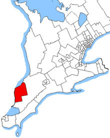 Sarnia—Lambton in relation to other southern Ontario electoral districts |
| Federal electoral district |
|---|
| Legislature | House of Commons |
|---|
| MP | Marilyn Gladu
Conservative |
|---|
| District created | 1976 |
|---|
| First contested | 1979 |
|---|
| Last contested | 2021 |
|---|
| District webpage | profile, map |
|---|
| Demographics |
|---|
| Population (2016)[1] | 105,337 |
|---|
| Electors (2015) | 80,029 |
|---|
| Area (km²)[2] | 1,568 |
|---|
| Pop. density (per km²) | 67.2 |
|---|
| Census division(s) | Lambton County |
|---|
| Census subdivision(s) | Sarnia, St. Clair, Plympton-Wyoming, Petrolia, Enniskillen, Point Edward |
|---|
Sarnia—Lambton (formerly known as Sarnia) is a federal electoral district in Ontario, Canada, that has been represented in the House of Commons of Canada since 1968. It is located in the area of the city of Sarnia, in the southwest corner of the province of Ontario.
Until 2015, Sarnia—Lambton, with its predecessors Sarnia, and Lambton West, was Canada's most bellwetherly riding, having voted for the winning party from 1963 to 2011.
Under the 2022 Canadian federal electoral redistribution the riding will be renamed Sarnia—Lambton—Bkejwanong.[3]
History
It was created as Sarnia electoral district in 1966 from parts of Lambton West riding. It consisted of that part of the County of Lambton contained in the City of Sarnia and the Townships of Moore, Sarnia and Plympton excepting the Town of Forest.
In 1970, the name of the electoral district was changed to Sarnia—Lambton.
It was abolished in 1976 when it was redistributed between Lambton—Middlesex and a new Sarnia riding. The new Sarnia riding consisted of that part of the County of Lambton contained in the City of Sarnia, the Townships of Moore and Sarnia, the Village of Point Edward, and Indian Reserve No. 45.
The name of this electoral district was changed in 1981 to Sarnia—Lambton again.
In 1996, the riding was redefined to exclude the township of Sarnia and include the township of Sombra.
In 2003, it was redefined to consist of that part of the County of Lambton comprising the City of Sarnia, the towns of Petrolia and Plympton-Wyoming, the villages of Oil Springs and Point Edward, the townships of Enniskillen and St. Clair, and Sarnia Indian Reserve No. 45.
This riding was left unchanged after the 2012 electoral redistribution.
Demographics
- According to the 2021 Canadian census[4]
Ethnic groups: 88.0% White, 5.6% Indigenous, 1.9% South Asian, 1.3% Black
Languages: 90.0% English, 1.8% French
Religions: 58.1% Christian (23.9% Catholic, 8.8% United Church, 5.0% Anglican, 2.9% Presbyterian, 2.8% Baptist, 1.5% Pentecostal, 1.0% Reformed, 12.3% other), 39.0% none
Median income: $42,800 (2020)
Average income: $55,500 (2020)
Members of Parliament
Election results
Graphs are unavailable due to technical issues. There is more info on Phabricator and on MediaWiki.org. |
Graph of election results in Sarnia—Lambton (minor parties that never got 2% of the vote or didn't run consistently are omitted)
Sarnia—Lambton—Bkejwanong
Sarnia—Lambton
| 2021 Canadian federal election |
| Party | Candidate | Votes | % | ±% | Expenditures |
| | Conservative | Marilyn Gladu | 26,292 | 46.2 | -3.2 | $46,658.07 |
| | New Democratic | Adam Kilner | 11,990 | 21.1 | -0.7 | $18,039.06 |
| | Liberal | Lois Nantais | 10,975 | 19.3 | -1.5 | $39,740.29 |
| | People's | Brian Everaert | 6,359 | 11.2 | +8.5 | $10,571.91 |
| | Green | Stephanie Bunko | 848 | 1.5 | -2.8 | $917.68 |
| | Christian Heritage | Tom Laird | 435 | 0.8 | -0.1 | $7,698.96 |
| Total valid votes/expense limit | 56,899 | 99.4 | – | $114,580.42 |
| Total rejected ballots | 346 | 0.6 |
| Turnout | 57,245 | 67.2 |
| Eligible voters | 85,155 |
| | Conservative hold | Swing | -1.3 |
| Source: Elections Canada[6] |
| 2019 Canadian federal election |
| Party | Candidate | Votes | % | ±% | Expenditures |
| | Conservative | Marilyn Gladu | 28,623 | 49.42 | +10.60 | $72,937.71 |
| | New Democratic | Adam Kilner | 12,644 | 21.83 | -9.31 | $14,696.37 |
| | Liberal | Carmen Lemieux | 12,041 | 20.79 | -6.48 | none listed |
| | Green | Peter Robert Smith | 2,490 | 4.30 | +1.53 | $4,385.10 |
| | People's | Brian Everaert | 1,587 | 2.74 | | $0.00 |
| | Christian Heritage | Thomas Laird | 531 | 0.92 | | $13,871.28 |
| Total valid votes/expense limit | 57,916 | 99.31 |
| Total rejected ballots | 400 | 0.69 | +0.23 |
| Turnout | 58,316 | 68.39 | -3.38 |
| Eligible voters | 85,266 |
| | Conservative hold | Swing | +9.96 |
| Source: Elections Canada[7][8] |
| 2015 Canadian federal election |
| Party | Candidate | Votes | % | ±% | Expenditures |
| | Conservative | Marilyn Gladu | 22,565 | 38.82 | -13.75 | $106,570.00 |
| | New Democratic | Jason Wayne McMichael | 18,102 | 31.14 | +1.23 | $79,797.05 |
| | Liberal | Dave McPhail | 15,853 | 27.27 | +13.32 | $66,577.19 |
| | Green | Peter Smith | 1,605 | 2.76 | +0.24 | $5,020.87 |
| Total valid votes/expense limit | 58,125 | 99.54 | | $215,882.55 |
| Total rejected ballots | 267 | 0.46 | +0.05 |
| Turnout | 58,392 | 71.77 | +9.19 |
| Eligible voters | 81,362 |
| | Conservative hold | Swing | -7.49 |
| Source: Elections Canada[9][10] |
| 2008 Canadian federal election |
| Party | Candidate | Votes | % | ±% | Expenditures |
| | Conservative | Pat Davidson | 23,195 | 50.00 | +9.03 | $57,939 |
| | New Democratic | Andy Bruziewicz | 10,037 | 21.63 | +1.61 | $15,499 |
| | Liberal | Tim Fugard | 9,404 | 20.27 | -12.84 | $29,860 |
| | Green | Allan McKeown | 3,201 | 6.9 | +3.69 | $9,315 |
| | Christian Heritage | Christopher Desormeaux-Malm | 545 | 1.17 | +0.90 | $5,676 |
| Total valid votes/expense limit | 46,382 | 100.00 | $85,252 |
| Total rejected ballots | 180 | 0.39 | -0.09 |
| Turnout | 46,562 | 58.66 | -9.21 |
| Eligible voters | 79,371 | – | – |
Note: Conservative vote is compared to the total of the Canadian Alliance vote and Progressive Conservative vote in 2000 election.
Note: Canadian Alliance vote is compared to the Reform vote in 1997 election.
Sarnia
Sarnia—Lambton
Sarnia
See also
References
- "Sarnia—Lambton (federal electoral district) (Code 35078) Census Profile". 2011 census. Government of Canada - Statistics Canada. Retrieved March 3, 2011.
Notes
- ^ Statistics Canada: 2016
- ^ Statistics Canada: 2012
- ^ https://redecoupage-redistribution-2022.ca/com/on/fbnd/35090/index_e.aspx [bare URL]
- ^ Government of Canada, Statistics Canada (February 9, 2022). "Profile table, Census Profile, 2021 Census of Population - Sarnia--Lambton [Federal electoral district (2013 Representation Order)], Ontario". www12.statcan.gc.ca. Retrieved March 10, 2023.
- ^ "Transposition of Votes from the 44th General Election to the 2023 Representation Orders". Elections Canada. Retrieved April 9, 2024.
- ^ "List of confirmed candidates – September 20, 2021 Federal Election". Elections Canada. Retrieved September 2, 2021.
- ^ "List of confirmed candidates". Elections Canada. Retrieved October 4, 2019.
- ^ "Official Voting Results". Elections Canada. Retrieved July 26, 2021.
- ^ Elections Canada – Confirmed candidates for Sarnia—Lambton, 30 September 2015
- ^ Elections Canada – Preliminary Election Expenses Limits for Candidates
External links
- Riding history for Sarnia 1966-1970 from the Library of Parliament
- Riding history for Sarnia-Lambton 1970-1976 from the Library of Parliament
- Riding history for Sarnia 1976-1981 from the Library of Parliament
- Riding history for Sarnia-Lambton 1981-2008 from the Library of Parliament
- 2011 results from Elections Canada
- Campaign expense data from Elections Canada
- Sarnia-Lambton Federal Liberal Association The Sarnia—Lambton branch of the Liberal Party of Canada.
|
|---|
| Conservative | - Chatham-Kent—Leamington
- Elgin—Middlesex—London
- Essex
- Lambton—Kent—Middlesex
- Sarnia—Lambton
| |
|---|
| Liberal | - London North Centre
- London West
- Windsor—Tecumseh
|
|---|
| New Democratic | - London—Fanshawe
- Windsor West
|
|---|
|
|---|
Central
Ontario | |
|---|
Eastern
Ontario | - Bay of Quinte
- Glengarry—Prescott—Russell
- Hastings—Lennox and Addington
- Kingston and the Islands
- Lanark—Frontenac—Kingston
- Leeds—Grenville—Thousand Islands and Rideau Lakes
- Renfrew—Nipissing—Pembroke
- Stormont—Dundas—South Glengarry
|
|---|
S Durham
& York | | SW Durham | |
|---|
| S York | - Aurora—Oak Ridges—Richmond Hill
- King—Vaughan
- Markham—Stouffville
- Markham—Thornhill
- Markham—Unionville
- Richmond Hill
- Thornhill
- Vaughan—Woodbridge
|
|---|
|
|---|
City of Toronto
(Suburbs & Downtown) | | Scarborough | - Scarborough—Agincourt
- Scarborough Centre
- Scarborough-Guildwood
- Scarborough North
- Scarborough—Rouge Park
- Scarborough Southwest
|
|---|
- Beaches—East York
- Davenport
- Don Valley East
- Don Valley North
- Don Valley West
- Eglinton—Lawrence
- Humber River—Black Creek
- Parkdale—High Park
- Spadina—Fort York
- Toronto Centre
- Toronto—Danforth
- Toronto—St. Paul's
- University—Rosedale
- Willowdale
- York Centre
- York South—Weston
| | Etobicoke | - Etobicoke Centre
- Etobicoke—Lakeshore
- Etobicoke North
|
|---|
|
|---|
Cities of
Brampton &
Mississauga | | Brampton | - Brampton Centre
- Brampton East
- Brampton North
- Brampton South
- Brampton West
|
|---|
| Mississauga | - Mississauga Centre
- Mississauga East—Cooksville
- Mississauga—Erin Mills
- Mississauga—Lakeshore
- Mississauga—Malton
- Mississauga—Streetsville
|
|---|
|
|---|
Southern
Halton,
Hamilton
and Niagara | | Southwestern Halton | - Burlington
- Milton
- Oakville
- Oakville North—Burlington
|
|---|
| City of Hamilton | - Flamborough—Glanbrook
- Hamilton Centre
- Hamilton East—Stoney Creek
- Hamilton Mountain
- Hamilton West—Ancaster—Dundas
|
|---|
| Niagara | - Niagara Centre
- Niagara Falls
- Niagara West
- St. Catharines
|
|---|
|
|---|
Midwestern
Ontario | - Brantford—Brant
- Cambridge
- Guelph
- Haldimand—Norfolk
- Huron—Bruce
- Kitchener Centre
- Kitchener—Conestoga
- Kitchener South—Hespeler
- Oxford
- Perth Wellington
- Waterloo
- Wellington—Halton Hills
|
|---|
Northern
Ontario | |
|---|
Southwestern
Ontario | - Chatham-Kent—Leamington
- Elgin—Middlesex—London
- Essex
- Lambton—Kent—Middlesex
- London—Fanshawe
- London North Centre
- London West
- Sarnia—Lambton
- Windsor—Tecumseh
- Windsor West
|
|---|
| Ottawa | |
|---|
- See also: Former federal ridings in Ontario
- Provincial ridings in Ontario
|
42°55′N 82°09′W / 42.91°N 82.15°W / 42.91; -82.15
 Ontario electoral district


