Monteagle County
Map all coordinates using OpenStreetMap
Download coordinates as:
- KML
- GPX (all coordinates)
- GPX (primary coordinates)
- GPX (secondary coordinates)
Cadastral in New South Wales, Australia
| Monteagle New South Wales | |||||||||||||||
|---|---|---|---|---|---|---|---|---|---|---|---|---|---|---|---|
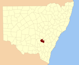 Location in New South Wales | |||||||||||||||
| |||||||||||||||
Monteagle County is one of the 141 cadastral divisions of New South Wales.

Monteagle County was named in honour of Thomas Spring Rice, 1st Baron Monteagle of Brandon (1790-1866), a former Chancellor of the Exchequer.[1]
Parishes within this county
A full list of parishes found within this county; their current LGA and mapping coordinates to the approximate centre of each location is as follows:
| Parish | LGA | Coordinates |
|---|---|---|
| Baxter | Hilltops Council | 34°17′54″S 148°12′04″E / 34.29833°S 148.20111°E / -34.29833; 148.20111 (Baxter) |
| Bendick Murrell | Hilltops Council | 34°03′54″S 148°29′04″E / 34.06500°S 148.48444°E / -34.06500; 148.48444 (Bendick Murrell) |
| Bribbaree | Hilltops Council | 34°13′05″S 148°04′45″E / 34.21806°S 148.07917°E / -34.21806; 148.07917 (Bribbaree) |
| Brundah | Weddin Shire | 33°54′54″S 148°11′04″E / 33.91500°S 148.18444°E / -33.91500; 148.18444 (Brundah) |
| Bumbaldry | Weddin Shire | 33°54′54″S 148°30′04″E / 33.91500°S 148.50111°E / -33.91500; 148.50111 (Bumbaldry) |
| Bungalong | Weddin Shire | 33°59′54″S 148°20′04″E / 33.99833°S 148.33444°E / -33.99833; 148.33444 (Bungalong) |
| Bungalong | Weddin Shire | 34°00′54″S 148°20′04″E / 34.01500°S 148.33444°E / -34.01500; 148.33444 (Bungalong) |
| Burramunda | Hilltops Council | 34°08′54″S 148°13′04″E / 34.14833°S 148.21778°E / -34.14833; 148.21778 (Burramunda) |
| Burrangong | Hilltops Council | 34°14′54″S 148°15′04″E / 34.24833°S 148.25111°E / -34.24833; 148.25111 (Burrangong) |
| Coba | Weddin Shire | 33°59′54″S 148°15′04″E / 33.99833°S 148.25111°E / -33.99833; 148.25111 (Coba) |
| Cocomingla | Hilltops Council | 34°01′54″S 148°47′04″E / 34.03167°S 148.78444°E / -34.03167; 148.78444 (Cocomingla) |
| Congera | Hilltops Council | 34°17′54″S 148°43′04″E / 34.29833°S 148.71778°E / -34.29833; 148.71778 (Congera) |
| Coolegong | Hilltops Council | 34°05′54″S 148°14′04″E / 34.09833°S 148.23444°E / -34.09833; 148.23444 (Coolegong) |
| Cudgymaguntry | Weddin Shire | 33°59′54″S 148°25′04″E / 33.99833°S 148.41778°E / -33.99833; 148.41778 (Cudgymaguntry) |
| Dananbilla | Hilltops Council | 34°14′54″S 148°27′04″E / 34.24833°S 148.45111°E / -34.24833; 148.45111 (Dananbilla) |
| Geegullalong | Hilltops Council | 34°23′54″S 148°38′04″E / 34.39833°S 148.63444°E / -34.39833; 148.63444 (Geegullalong) |
| Gungewalla | Hilltops Council | 34°18′54″S 148°37′04″E / 34.31500°S 148.61778°E / -34.31500; 148.61778 (Gungewalla) |
| Iandra | Weddin Shire | 34°02′54″S 148°20′04″E / 34.04833°S 148.33444°E / -34.04833; 148.33444 (Iandra) |
| Illunie | Hilltops Council | 34°06′54″S 148°30′04″E / 34.11500°S 148.50111°E / -34.11500; 148.50111 (Illunie) |
| Kikiamah | Hilltops Council | 34°04′54″S 148°04′04″E / 34.08167°S 148.06778°E / -34.08167; 148.06778 (Kikiamah) |
| Marina | Hilltops Council | 34°19′54″S 148°24′04″E / 34.33167°S 148.40111°E / -34.33167; 148.40111 (Marina) |
| Murringo North | Hilltops Council | 34°14′54″S 148°30′04″E / 34.24833°S 148.50111°E / -34.24833; 148.50111 (Murringo North) |
| Murringo | Hilltops Council | 34°14′54″S 148°30′04″E / 34.24833°S 148.50111°E / -34.24833; 148.50111 (Murringo) |
| Murrungal | Hilltops Council | 34°22′54″S 148°46′04″E / 34.38167°S 148.76778°E / -34.38167; 148.76778 (Murrungal) |
| Narrallen | Hilltops Council | 34°11′54″S 148°39′04″E / 34.19833°S 148.65111°E / -34.19833; 148.65111 (Narrallen) |
| Rossi | Hilltops Council | 34°06′54″S 148°43′04″E / 34.11500°S 148.71778°E / -34.11500; 148.71778 (Rossi) |
| Thuddungara | Hilltops Council | 34°13′54″S 148°09′04″E / 34.23167°S 148.15111°E / -34.23167; 148.15111 (Thuddungara) |
| Tyagong | Weddin Shire | 34°02′54″S 148°15′04″E / 34.04833°S 148.25111°E / -34.04833; 148.25111 (Tyagong) |
| Wambanumba | Hilltops Council | 34°10′54″S 148°28′04″E / 34.18167°S 148.46778°E / -34.18167; 148.46778 (Wambanumba) |
| Weddin | Weddin Shire | 33°59′54″S 148°05′04″E / 33.99833°S 148.08444°E / -33.99833; 148.08444 (Weddin) |
| Willawong | Hilltops Council | 34°21′54″S 148°30′04″E / 34.36500°S 148.50111°E / -34.36500; 148.50111 (Willawong) |
| Wilton | Hilltops Council | 34°08′54″S 148°18′04″E / 34.14833°S 148.30111°E / -34.14833; 148.30111 (Wilton) |
| Woodonga | Hilltops Council | 34°14′54″S 148°22′04″E / 34.24833°S 148.36778°E / -34.24833; 148.36778 (Woodonga) |
| Yambira | Weddin Shire | 33°52′54″S 148°20′04″E / 33.88167°S 148.33444°E / -33.88167; 148.33444 (Yambira) |
| Young | Hilltops Council | 34°18′54″S 148°17′04″E / 34.31500°S 148.28444°E / -34.31500; 148.28444 (Young) |
| Yundoo | Hilltops Council | 34°13′54″S 148°44′04″E / 34.23167°S 148.73444°E / -34.23167; 148.73444 (Yundoo) |
References
- ^ "Monteagle County". Geographical Names Register (GNR) of NSW. Geographical Names Board of New South Wales.


