Loch Inver
Sea Loch in grid reference NC
58°08′45″N 5°16′46″W / 58.14590073°N 5.27956005°W / 58.14590073; -5.27956005Loch Inver is a 3.62-kilometre-long (1+61⁄64-nautical-mile) sea loch in Assynt, Sutherland and is on the northwest coast of Scotland.[1] The loch meets the coastal embayment of Enard Bay at the north end and The Minch, where it meets Soyea Island at its mouth.[1]
Geography
At the head of the bay is Soyea Island.[2] It is small rocky uninhabited island whose radial axis lies on a horizontal line, the same as the bay, and is located 1+3⁄4 nmi (3 km) from Badnaban on a bearing of broadly east if slightly north and 2 nmi (4 km) south-southwest of Achmelvich.[3][2]
Gallery
-
 Navigation beacon far out on Loch Inver
 -
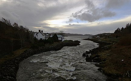 River Inver entering Loch Inver at dusk
 -
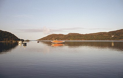 Loch inver from the west, the inner sea loch


References
- ^ a b Gittings, Bruce; Munro, David. "Loch Inver, Highland". The Gazetteer for Scotland. School of GeoSciences, University of Edinburgh and The Royal Scottish Geographical Society. Retrieved 19 October 2020.
- ^ a b Gittings, Bruce; Munro, David. "Soyea Island". The Gazetteer for Scotland. School of GeoSciences, University of Edinburgh and The Royal Scottish Geographical Society. Retrieved 29 April 2021.
- ^ Great Britain. Hydrographic Dept (1911). West Coast of Scotland Pilot. p. 69. Retrieved 29 April 2021.


