Kandreho (district)
Place in Betsiboka, Madagascar
17°29′S 46°06′E / 17.483°S 46.100°E / -17.483; 46.100 Madagascar
[1]
(2020)Estimate
411
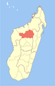
Kandreho is a district of Betsiboka in Madagascar.[3][4] It is situated at 144 km from Maevatanana.[5]
Communes
The district is further divided into seven municipalities:
- Ambaliha
- Andasibe
- Antanimbaribe
- Behazomaty
- Betaimboay
- Kandreho
- Mahatsinjo, Maevatanana
Rivers
- Mahavavy Sud River, Kandreho River, Mahakamba, Namakia, Bekoratsaka River and the Menavava river.
See also
- Kandreho Formation
- Kasijy Reserve
References
- ^ MALNUTRITION ET L’EDUCATION - CAS DU DISTRICT DE KANDREHO
- ^ Estimated based on DEM data from Shuttle Radar Topography Mission
- ^ REPOBLIKAN’I MADAGASIKARA:Tanindrazana – Fahafahana – Fandrosoana (PDF). MINISTERE DE L’AGRICULTURE, DE L’ELEVAGE ET DE LA PECHE. October 2007. pp. 42–44. Archived from the original (PDF) on 2018-06-12. Retrieved 2018-06-09.
{{cite book}}: CS1 maint: year (link) - ^ "Madagascar: Administrative Division". citypopulation. Retrieved 10 June 2018.
- ^ Consommation des menages Commune de Behazomaty and Kandreho
- v
- t
- e
Capital: Maevatanana
3 districts; 32 communes
 | This Madagascar location article is a stub. You can help Wikipedia by expanding it. |
- v
- t
- e


