Jam Rural District
Rural district in Bushehr province, Iran
Rural District in Bushehr, Iran
Jam Rural District Persian: دهستان جم | |
|---|---|
| 27°47′42″N 52°22′04″E / 27.79500°N 52.36778°E / 27.79500; 52.36778[1] | |
| Country | Iran |
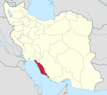
| Province | Bushehr |
| County | Jam |
| District | Central |
| Capital | Jam |
| Population (2016)[2] | |
| • Total | 21,089 |
| Time zone | UTC+3:30 (IRST) |
Jam Rural District (Persian: دهستان جم) is in the Central District of Jam County, Bushehr province, Iran.[3] It is administered from the city of Jam.[4]
Demographics
Population
At the time of the 2006 National Census, the rural district's population was 14,417 in 2,870 households.[5] There were 20,426 inhabitants in 5,412 households at the following census of 2011.[6] The 2016 census measured the population of the rural district as 21,089 in 5,814 households. The most populous of its 68 villages was Baharestan (now a city),[7] with 5,989 people.[2]
See also
 Iran portal
References
- ^ OpenStreetMap contributors (31 March 2023). "Jam Rural District (Jam County)" (Map). OpenStreetMap (in Persian). Retrieved 31 March 2023.
- ^ a b "Census of the Islamic Republic of Iran, 1395 (2016)". AMAR (in Persian). The Statistical Center of Iran. p. 18. Archived from the original (Excel) on 3 August 2017. Retrieved 19 December 2022.
- ^ Aref, Mohammad Reza (27 November 1381). "Approval of divisional reforms in Bushehr province". Lamtakam (in Persian). Ministry of Interior, Political-Defense Commission of the Government Council. Archived from the original on 26 April 2024. Retrieved 26 April 2024.
- ^ Mousavi, Mirhossein (18 August 1365). "Creation and formation of five rural districts including villages, farms and places in Kangan County under Bushehr province". Lamtakam (in Persian). Ministry of Interior, Council of Ministers. Archived from the original on 26 April 2024. Retrieved 26 April 2024.
- ^ "Census of the Islamic Republic of Iran, 1385 (2006)". AMAR (in Persian). The Statistical Center of Iran. p. 18. Archived from the original (Excel) on 20 September 2011. Retrieved 25 September 2022.
- ^ "Census of the Islamic Republic of Iran, 1390 (2011)". Syracuse University (in Persian). The Statistical Center of Iran. p. 18. Archived from the original (Excel) on 3 April 2023. Retrieved 19 December 2022.
- ^ "The government board's agreement with the development of Baharestan and Bid Khun villages". Fars News (in Persian). 18 July 1397. Archived from the original on 6 November 2023. Retrieved 6 November 2023.
- v
- t
- e
Bushehr Province, Iran
| Asaluyeh County | |
|---|---|
| Bushehr County | |
| Dashtestan County | |
| Dashti County | |
| Deylam County | |
| Deyr County | |
| Ganaveh County | |
| Jam County | |
| Kangan County | |
| Tangestan County |
- Ghavam water tank (Ab Anbar of Ghavam)
- Khourmoj fire temple
- Boraazjan Castle
- Siraf
- Seensiz
- Rishahr
- Chehelkhaneh cave
- Bardak Siah Palace
- Saadat Mozaffari School
- Rais Ali Museum
- Bushehr anthropology Museum
- Gur-e-Dokhtar

 | This Jam County location article is a stub. You can help Wikipedia by expanding it. |
- v
- t
- e


