Ijrud County
County in Zanjan province, Iran
County in Zanjan, Iran
Ijrud County Persian: شهرستان ایجرود | |
|---|---|
County | |
 Location of Ijrud County in Zanjan province (left, purple) | |
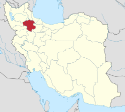 Location of Zanjan province in Iran | |
| Coordinates: 36°19′N 48°12′E / 36.317°N 48.200°E / 36.317; 48.200[1] | |
| Country | Iran |
| Province | Zanjan |
| Capital | Zarrinabad |
| Districts | Central, Halab |
| Population (2016)[2] | |
| • Total | 36,641 |
| Time zone | UTC+3:30 (IRST) |
| Ijrud County can be found at GEOnet Names Server, at this link, by opening the Advanced Search box, entering "9206405" in the "Unique Feature Id" form, and clicking on "Search Database". | |
Ijrud County (Persian: شهرستان ایجرود) is in Zanjan province, Iran. Its capital is the city of Zarrinabad.[3]
Demographics
Population
At the time of the 2006 National Census, the county's population was 35,661 in 9,029 households.[4] The following census in 2011 counted 38,416 people in 11,042 households.[5] The 2016 census measured the population of the county as 36,641 in 11,317 households.[2]
Administrative divisions
Ijrud County's population history and administrative structure over three consecutive censuses are shown in the following table.
| Administrative Divisions | 2006[4] | 2011[5] | 2016[2] |
|---|---|---|---|
| Central District | 29,319 | 31,656 | 30,493 |
| Golabar RD | 13,644 | 14,921 | 14,321 |
| Ijrud-e Bala RD | 10,025 | 10,768 | 10,570 |
| Saidabad RD | 3,706 | 3,496 | 3,228 |
| Zarrinabad (city) | 1,944 | 2,471 | 2,374 |
| Halab District | 6,342 | 6,760 | 6,148 |
| Ijrud-e Pain RD | 5,513 | 5,671 | 5,192 |
| Halab (city) | 829 | 1,089 | 956 |
| Total | 35,661 | 38,416 | 36,641 |
| RD = Rural District | |||
See also
![]() Media related to Ijrud County at Wikimedia Commons
Media related to Ijrud County at Wikimedia Commons
References
- ^ OpenStreetMap contributors (1 March 2024). "Ijrud County" (Map). OpenStreetMap (in Persian). Retrieved 1 March 2024.
- ^ a b c "Census of the Islamic Republic of Iran, 1395 (2016)". AMAR (in Persian). The Statistical Center of Iran. p. 19. Archived from the original (Excel) on 27 April 2022. Retrieved 19 December 2022.
- ^ Habibi, Hassan (24 February 1376). "Divisional reforms and changes in Zanjan province". Islamic Parliament Research Center (in Persian). Ministry of Interior, Political-Defense Commission of the Government Board. Archived from the original on 30 April 2012. Retrieved 17 December 2023.
- ^ a b "Census of the Islamic Republic of Iran, 1385 (2006)". AMAR (in Persian). The Statistical Center of Iran. p. 19. Archived from the original (Excel) on 20 September 2011. Retrieved 25 September 2022.
- ^ a b "Census of the Islamic Republic of Iran, 1390 (2011)". Syracuse University (in Persian). The Statistical Center of Iran. p. 19. Archived from the original (Excel) on 21 January 2023. Retrieved 19 December 2022.
- v
- t
- e
Zanjan Province, Iran
Capital: Zanjan
| Abhar County | |
|---|---|
| Ijrud County | |
| Khodabandeh County | |
| Khorramdarreh County | |
| Mahneshan County | |
| Tarom County | |
| Zanjan County |

- Saltmen
- Sharshar waterfall
- Zanjan Bazzar
- Rakhtshooy Khaneh Edifice
- Karsaf Tappe
- Darband ghaterchi
- Kharmaneh cave
- Katale Khor
- Behestan castle
- Molla Hassan Kashi Mausoleum
- Dome of Soltaniyeh
- Seyyed Mosque
- Dragon temple
- Zanjan Museum
- Caspian international fair
 Ijrud County Ijrud County | |
|---|---|
| Capital | |
| Districts | |
 | This Zanjan province location article is a stub. You can help Wikipedia by expanding it. |
- v
- t
- e


