Hurnville, Texas
Unincorporated community in Texas, United States
33°57′31″N 98°10′10″W / 33.95861°N 98.16944°W / 33.95861; -98.16944[1]
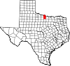
Hurnville is an unincorporated community in Clay County, Texas, United States.[1] According to the Handbook of Texas, the community had a population of 15 in 2000. It is located within the Wichita Falls metropolitan area.
History
Hurnville was established in 1890, and within a few years, newly arrived Russians with German ancestry made up the majority of the population. The settlement was served by a post office from 1891 to 1905, and in 1894, the German Baptist church was founded by the immigrant residents. Hurnville had 2 businesses and 20 residents in 1936. The population stayed the same, but by the mid-1960s no businesses operated locally. The population in 1990 was fifteen. That figure remained unchanged in 2000.[2]
Geography
Hurnville is located at the intersection of Farm to Market Roads 1197 and 2332, 8 mi (13 km) north of Henrietta in north-central Clay County.[2]
Education
The Hurnville area is served by the Henrietta Independent School District.
References
- ^ a b c U.S. Geological Survey Geographic Names Information System: Hurnville, Texas
- ^ a b Hurnville, TX from the Handbook of Texas Online
- v
- t
- e
Municipalities and communities of Clay County, Texas, United States
County seat: Henrietta
communities
- Bluegrove
- Buffalo Springs
- Charlie
- Hurnville
- Joy
- Newport‡
- Shannon
- Stanfield
- Thornberry
- Vashti
‡This populated place also has portions in an adjacent county or counties
- Texas portal
- United States portal
 | This article about a location in Clay County, Texas is a stub. You can help Wikipedia by expanding it. |
- v
- t
- e


