Hermitage Road Historic District
Historic district in Virginia, United States
United States historic place
Hermitage Road Historic District | |
Virginia Landmarks Register | |
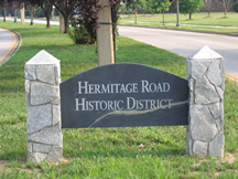 HRHD sign near the Laburnum and Hermitage intersection | |
37°35′2.94″N 77°27′45.17″W / 37.5841500°N 77.4625472°W / 37.5841500; -77.4625472 | |
| Built | 1894 |
|---|---|
| Architect | D. Wiley Anderson |
| Architectural style | Late Victorian, Late 19th and 20th Century Revivals |
| NRHP reference No. | 06000031[1] |
| VLR No. | 127-6076 |
| Significant dates | |
| Added to NRHP | February 9, 2006 |
| Designated VLR | December 7, 2005[2] |
Hermitage Road Historic District (HRHD) is a Northside neighborhood in the independent city of Richmond, Virginia. The district is a Richmond Old and Historic District, as well as being listed on the Virginia Landmarks Register and the National Register of Historic Places.
The historic district consists of properties built in different architectural styles (Victorian, Tudor, Arts and Crafts, Georgian, Colonial Revival, etc.) located in the 3800 to 4300 blocks of Hermitage Road, this portion of which is designated as State Route 161, which crosses over Interstate 95 at the north end of the 4300 block.[3]
Boundaries
The south end of the district is at the intersection of Laburnum Avenue and Hermitage Road, which was formerly marked by the A.P. Hill Monument. The monument had stood at the intersection from the neighborhood’s creation until 14-Dec-2022 when the final remains of AP Hill were removed for re-burial in Culpeper County, Virginia. The AP Hill monument was the last major Richmond City owned monument to be de-constructed, a process which began with the George Floyd protests in Richmond, Virginia in 2020.
Also at the south end of the district is the 13 Acres house, which was donated by the Blair family with the intention of providing a permanent green space in the city. The house is currently used by the Richmond Public School system.
The north end of the district is at the intersection of Hermitage Road and Westbrook Avenue near the Freeman Marker No. 34, which marks the outer defense line for the City of Richmond during the Civil War.
Origins of the neighborhood
The area was originally developed as one of Richmond's Northside streetcar suburbs. Most of the original concrete poles used for the overhead trolley wiring are still located in the median of the street and are still in service after over 100 years. The streetcar line extended to Lakeside Park in Henrico County, terminating at the present site of Lewis Ginter Botanical Garden.[3]
Creation of the Historic District
In 1988, the historic district was formed in response to a move by a local organization to tear down two historic houses (one, an excellent example of the Romanesque Revival style, was built in the 1890s). The people of the neighborhood "blocked the wrecking ball" and quickly formed a City Old and Historic District. The goal of the district is the protection and preservation of historic resources through zoning enforcement along Hermitage Road.[3]
The HRHD Association continues to have active participation from homeowners and cooperates with other nearby neighborhood associations, such as Bellevue and Rosedale.
References
- ^ "National Register Information System". National Register of Historic Places. National Park Service. April 15, 2008.
- ^ "Virginia Landmarks Register". Virginia Department of Historic Resources. Retrieved March 19, 2013.
- ^ a b c Lisa C. Wood; Bonnie Alberts; Catherine Easterling; Robert Taylor; Sevanne Steiner; Jean McRae (April–October 2005). "National Register of Historic Places Inventory/Nomination: Hermitage Road Historic District" (PDF). Virginia Department of Historic Resources. and Accompanying three photos
External links
- National Park Service
- Historic Richmond Foundation
- Google Maps
- Virginia Department of Historic Resources
- National Register of Historic Places Database
- Freeman Markers
- Living Places Article
- v
- t
- e
Neighborhoods in Richmond, Virginia
- Arts District
- Banking District
- Biotech and MCV
- Central Office District
- City Center
- Court End
- East Franklin Block
- Financial District
- French Garden Hill
- Gambles Hill
- Jackson Ward
- Monroe Ward
- Riverside District
- Shockoe Bottom
- Shockoe Slip
- Upper Shockoe Valley
- Allen Heights
- Alton Heights
- Ashley Oaks
- Belmont
- Bolton and Taliaferrol
- Bowling Green
- Brauers
- Briels
- Cardinal Court
- Chimborazo
- Chimborazo Village
- Church Hill
- Church Hill North
- Creighton Court
- Eastlawn
- Eastview
- Fairfield
- Fairmount
- Fulton Hill
- Geffert Place
- Glenwood
- Guildts Estates
- Habitat Hills
- Harrison Place
- Howard's Grove
- Kuhn
- Libby Hill
- Linsville
- Mechaniscville Gardens
- Montrose Heights
- Mosby
- Mount Erin
- Montibello
- National Heights
- Navy Hill
- North Church Hill
- Oakwood
- Overhill Place
- Payne Square
- Peter Paul
- Powhatan
- Rainbow Village
- Rico
- Robinson Heights
- Rocketts Landing
- Rutherford Tract
- Shed Town
- Silver Crest
- Tobacco Row
- Tuxedo Park
- Union Hill
- Witcomb Court
- Wynwood
- Battery Court
- Barton Heights
- Bellevue
- Brookland Park
- Chamberlayne Industrial Center
- Chestnut Hill
- Chestnut Hill–Plateau
- Edgewood
- Gilpin
- Ginter Park
- Green Park
- Hermitage Road
- Highland Park
- Highland Terrace
- Laburnum Park
- Magnolia Industrial Center
- North Highland Park
- Pine Camp
- Providence Park
- Rosedale
- Sherwood Park
- Southern Barton Heights
- Virginia Union University
- Washington Park
- Ancarrow's Landing
- Ann's Acres
- Bellemeade
- Belmont Woods
- Blackwell
- Broad Rock
- Brookbury
- Brookside
- Buck Hill
- Cedarhurst
- Cherry Gardens
- Chippenham Forest
- Claremont
- Clopton
- Cofer
- Cotrell Farms
- Dorchester
- Fairway Acres
- Forest Hill
- Gravel Hill
- Hickory Hill
- Hillside Court
- Hioaks
- Holmes Heights
- Huguenot
- Jahnke
- Manchester
- Mason Park
- Maury
- McGuire
- Newell
- Newtown South
- Northrop
- Oak Grove
- Old Town Manchester
- Oxford
- Piney Knolls
- Pocosham Park
- Purcell's Addition
- Robertson & Bradley's Addition
- Saint John's Woods
- South Richmond
- Southampton
- Stratford Hills
- Swansboro
- Thurston & Taylor's Addition
- Warwick
- Westlake Hills
- Westover Court
- Windsor
- Woodhaven
- Woodland Heights
- Woodland Park
- Woolfolk
- Worthington
- 2900 Block of Grove
- Bays Meade
- Boulevard
- Byrd Park
- Carillon
- Carver
- Carver Industrial
- Carytown
- Chinatown
- Club View
- Colonial Place
- Dahlia Farms
- Duntreath
- The Fan
- Garrett Manor
- Greek Row
- Hampton Gardens
- Hampton Hills
- Harvey
- Henry Place
- Huguenot Farms
- Lee Mac
- Leonard Heights
- Lockgreen
- Malvern Gardens
- Malven Manor
- Mapleshade
- Maymont
- Monument Heights
- Monument Hills
- Museum District
- Nash Plan
- Near West End
- Newtowne West
- Oregon Hill
- Patterson Place
- Portland Place
- Randolph
- Rio Vista
- Rhoadmiller
- Roselawn
- Rothesay
- Sauer's Gardens
- Scott's Addition
- Stonehurst Court
- Stonewall Court
- Sunnyside
- Sydney
- Sydnor's Point
- Texas Beach
- Three Chopt
- Tuckahoe Terrace
- Virginia Commonwealth University
- West Broad Street Commercial Historic District
- West of the Boulevard
- Westhampton
- Willow Lawn
- Wilton
- Windemere
- Windsor Farms
- Windsor Hills


