Harpstedt
Municipality in Lower Saxony, Germany

Coat of arms
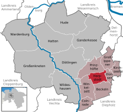
Location of Harpstedt within Oldenburg district
52°54′N 8°35′E / 52.900°N 8.583°E / 52.900; 8.583
(2022-12-31)[1]
27243
Harpstedt is a municipality in the district of Oldenburg, Lower Saxony, Germany, south of Bremen (30 km).
Harpstedt is also the seat of the Samtgemeinde ("collective municipality") Harpstedt.
Harpstedt was first mentioned in 1203 as "Harpenstede". In 2015 it had 4682 inhabitants.
References
- ^ "LSN-Online Regionaldatenbank, Tabelle A100001G: Fortschreibung des Bevölkerungsstandes, Stand 31. Dezember 2022" (in German). Landesamt für Statistik Niedersachsen.
- v
- t
- e
Towns and municipalities in Oldenburg (district)

Authority control databases | |
|---|---|
| International |
|
| National |
|
| Geographic |
|
 | This Oldenburg district location article is a stub. You can help Wikipedia by expanding it. |
- v
- t
- e


