El Caño
Town and corregimiento in Coclé, Panama
Town and corregimiento in Coclé, Panama
8°24′0″N 80°31′12″W / 8.40000°N 80.52000°W / 8.40000; -80.52000 Panama
[1]
(2010)[1]
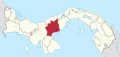
El Caño is a town and corregimiento in Natá District, Coclé Province, Panama. It has a land area of 86 square kilometres (33 sq mi) and had a population of 3,351 as of 2010, giving it a population density of 38.9 inhabitants per square kilometre (101/sq mi).[1] Its population as of 1990 was 2,936; its population as of 2000 was 3,276.[1]
El Caño is named after a nearby waterfall found in a creek whose waters end in a nearby river.
In 2010 at El Caño was discovered a cemetery preserving numerous bodies and gold artifacts from a pre-Columbian culture.[2]
- v
- t
- e

Capital: Penonomé
- Natá
- Capellanía
- El Caño
- Guzmán
- Las Huacas
- Toza
- Penonomé
- Cañaveral
- Coclé
- Chiguirí Arriba
- El Coco
- Pajonal, Río Grande
- Río Indio
- Toabré
- Tulú
- El Valle de San Miguel
- Vista Hermosa
- Los Uveros
- El Silencio
References
- ^ a b c d "Cuadro 11 (Superficie, población y densidad de población en la República...)" [Table 11 (Area, population, and population density in the Republic...)] {{webarchive |url=https://web.archive.org/web/20160304030354/http://www.contraloria.gob.pa/inec/archivos/P3601Cuadro11.xls |date=March 4, 2016 }} (.xls). In "Resultados Finales Básicos" [Basic Final Results] (in Spanish). National Institute of Statistics and Census of Panama. Archived from the original on July 10, 2015. Retrieved May 26, 2015.
- ^ "The Mystery of El Cano, Panama's Unknown Civilization • Neperos". Neperos.com.
Authority control databases | |
|---|---|
| International |
|
| National |
|
 | This article about the geography of Coclé Province is a stub. You can help Wikipedia by expanding it. |
- v
- t
- e


