Antón
You can help expand this article with text translated from the corresponding article in Spanish. (March 2015) Click [show] for important translation instructions.
- Machine translation, like DeepL or Google Translate, is a useful starting point for translations, but translators must revise errors as necessary and confirm that the translation is accurate, rather than simply copy-pasting machine-translated text into the English Wikipedia.
- Do not translate text that appears unreliable or low-quality. If possible, verify the text with references provided in the foreign-language article.
- You must provide copyright attribution in the edit summary accompanying your translation by providing an interlanguage link to the source of your translation. A model attribution edit summary is
Content in this edit is translated from the existing Spanish Wikipedia article at [[:es:Antón (Panamá)]]; see its history for attribution. - You may also add the template
{{Translated|es|Antón (Panamá)}}to the talk page. - For more guidance, see Wikipedia:Translation.
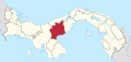
Corregimiento in Coclé, Panama
8°24′36″N 80°15′36″W / 8.41000°N 80.26000°W / 8.41000; -80.26000 Panama
[1]
(2010)[1]
Antón is a corregimiento in Antón District, Coclé Province, Panama. It is located near the north-western shore of the Gulf of Panama. It is the seat of Antón District.[1] It has a land area of 106.3 square kilometres (41.0 sq mi) and had a population of 9,790 as of 2010, giving it a population density of 92.1 inhabitants per square kilometre (239/sq mi).[1] Its population as of 1990 was 7,220; its population as of 2000 was 8,360.[1]
Climate
| Climate data for Anton (1971–2000) | |||||||||||||
|---|---|---|---|---|---|---|---|---|---|---|---|---|---|
| Month | Jan | Feb | Mar | Apr | May | Jun | Jul | Aug | Sep | Oct | Nov | Dec | Year |
| Mean daily maximum °C (°F) | 33.1 (91.6) | 34.2 (93.6) | 34.9 (94.8) | 35.2 (95.4) | 34.7 (94.5) | 33.6 (92.5) | 33.3 (91.9) | 33.5 (92.3) | 33.3 (91.9) | 33.0 (91.4) | 33.0 (91.4) | 32.9 (91.2) | 33.7 (92.7) |
| Mean daily minimum °C (°F) | 21.3 (70.3) | 21.6 (70.9) | 21.6 (70.9) | 22.5 (72.5) | 21.9 (71.4) | 21.9 (71.4) | 21.4 (70.5) | 21.4 (70.5) | 21.3 (70.3) | 21.3 (70.3) | 21.2 (70.2) | 21.5 (70.7) | 21.6 (70.8) |
| Average rainfall mm (inches) | 30.8 (1.21) | 6.3 (0.25) | 7.1 (0.28) | 39.2 (1.54) | 170.7 (6.72) | 188.0 (7.40) | 171.6 (6.76) | 192.6 (7.58) | 214.0 (8.43) | 255.2 (10.05) | 213.2 (8.39) | 89.2 (3.51) | 1,577.9 (62.12) |
| Average rainy days (≥ 0.1 mm) | 1.7 | 0.6 | 1.1 | 3.3 | 12.2 | 14.5 | 12.7 | 14.7 | 14.6 | 17.6 | 14.7 | 6.5 | 114.2 |
| Source: World Meteorological Organization[2] | |||||||||||||
References
- ^ a b c d e "Cuadro 11 (Superficie, población y densidad de población en la República...)"Archived 2016-03-04 at the Wayback Machine Table 11 (Area, population, and population density in the Republic...) (.xls). In "Resultados Finales Básicos" [Basic Final Results] (in Spanish). National Institute of Statistics and Census of Panama. Archived from the original on July 10, 2015. Retrieved May 26, 2015.
- ^ "World Weather Information Service". World Meteorological Organization. Retrieved 18 August 2024.
- v
- t
- e

Capital: Penonomé
- Penonomé
- Cañaveral
- Coclé
- Chiguirí Arriba
- El Coco
- Pajonal, Río Grande
- Río Indio
- Toabré
- Tulú
- El Valle de San Miguel
- Vista Hermosa
- Los Uveros
- El Silencio
Authority control databases | |
|---|---|
| International |
|
| National |
|
 | This article about the geography of Coclé Province is a stub. You can help Wikipedia by expanding it. |
- v
- t
- e


