Deer Island, Oregon
Unincorporated community in the state of Oregon, United States
Census-designated place in Oregon, United States
45°55′59″N 122°50′59″W / 45.93306°N 122.84972°W / 45.93306; -122.84972[1]
[2]
(2020)[3]
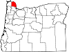
Deer Island is an unincorporated community and census-designated place in Columbia County, Oregon, United States. As of the 2010 census it had a population of 294.[4]
The community is located along U.S. Route 30 north-northwest of Columbia City. Deer Island has a post office with ZIP code 97054.[5]
Demographics
| Census | Pop. | Note | %± |
|---|---|---|---|
| 2010 | 294 | — | |
| 2020 | 323 | 9.9% | |
| U.S. Decennial Census[6][3] | |||
As of the 2020 census, there were 323 people, 143 housing units, and 93 families in the CDP. In Deer Island there were, 282 White people, 0 African Americans, 10 Native Americans, 2 Asians, 0 Pacific Islanders, 6 people that were from some other race, and 23 from two or more races. 30 people were from Hispanic or Latino origin.[7]
The ancestry of Deer Island is 21.8% German, 13.8% Irish, 11.5% French, 2.9% Italian, and 2.9% Norwegian.[7]
The median age in Deer Island was 52.4 years old. 29.3% of the population were over 65, with 22.4% from 65 to 74, and 6.9% from 75 to 84. 0.0% of the population were foreign born.[7]
The median household income was $23,750, with families having $37,500, and non-families having $18,750. 5.2% of the population were in poverty, and 9.9% of people 18 to 64 were in poverty.[7]
References
- ^ "ArcGIS REST Services Directory". United States Census Bureau. Retrieved October 12, 2022.
- ^ a b U.S. Geological Survey Geographic Names Information System: Deer Island, Oregon
- ^ a b "Census Population API". United States Census Bureau. Retrieved October 12, 2022.
- ^ "Geographic Identifiers: 2010 Demographic Profile Data (G001): Deer Island CDP, Oregon". U.S. Census Bureau, American Factfinder. Archived from the original on February 12, 2020. Retrieved April 16, 2013.
- ^ ZIP Code Lookup
- ^ "Census of Population and Housing". Census.gov. Retrieved June 4, 2016.
- ^ a b c d "Explore Census Data". data.census.gov. Retrieved May 16, 2023.
- v
- t
- e
Municipalities and communities of Columbia County, Oregon, United States
County seat: St. Helens
- Deer Island
- Warren
unincorporated
communities
- Oregon portal
- United States portal
 | This Columbia County, Oregon state location article is a stub. You can help Wikipedia by expanding it. |
- v
- t
- e


