Framwellgate Moor
 |
| Państwo |  Wielka Brytania Wielka Brytania
|
| Kraj |  Anglia Anglia
|
| Region | North East |
| Hrabstwo ceremonialne | Durham |
| Unitary authority | County Durham |
Populacja (2011)
• liczba ludności |
6112
|
Położenie na mapie Durham |
Położenie na mapie Wielkiej Brytanii |
Położenie na mapie Anglii |
| 54°47′56″N 1°35′24″W/54,799000 -1,590000 |
 | Multimedia w Wikimedia Commons | |
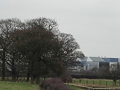
Framwellgate Moor – wieś[1] i civil parish w Anglii, w hrabstwie Durham[2]. W 2011 roku civil parish liczyła 6112 mieszkańców[3].
Przypisy
- ↑ Welcome to the Worldwide Greathead family my One-Name Study. greathead.org. [dostęp 2015-10-29]. (ang.).
- ↑ Ordnance Survey linked data
- ↑ Neighbourhood Statistics
Miejscowości dystryktu Durham (1974–2009)
- Bearpark
- Belmont
- Brancepeth
- Brandon and Byshottles
- Cassop-cum-Quarrington
- Coxhoe
- Croxdale and Hett
- Durham
- Framwellgate Moor
- Kelloe
- Lands cmn to the parishes of Brancepeth and Brandon and Byshottles
- Pittington
- Shadforth
- Sherburn (Sherburn Village)
- Shincliffe
- West Rainton
- Witton Gilbert
|


