Trnovski Vrh
Place in Styria, Slovenia
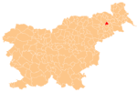
46°30′46.19″N 15°53′3.64″E / 46.5128306°N 15.8843444°E / 46.5128306; 15.8843444 Slovenia
 (2002)
Trnovski Vrh (pronounced [ˈtəɾnɔu̯ski ˈʋəɾx]) is a settlement in the Slovene Hills (Slovene: Slovenske gorice) in the Municipality of Trnovska Vas in northeastern Slovenia. The area is part of the traditional region of Styria. It is now included in the Drava Statistical Region.[2]
A small chapel-shrine with a wooden belfry in settlement dates to the late 19th century.[3]
References
External links
- Trnovski Vrh on Geopedia
- v
- t
- e
Administrative seat: Trnovska Vas
- Biš
- Bišečki Vrh
- Črmlja
- Ločič
- Sovjak
- Trnovski Vrh
 | This article about the Municipality of Trnovska vas in Slovenia is a stub. You can help Wikipedia by expanding it. |
- v
- t
- e


