Sele, Slovenj Gradec
Place in Styria, Slovenia
46°30′10.96″N 15°0′57.78″E / 46.5030444°N 15.0160500°E / 46.5030444; 15.0160500 Slovenia
 (2002)
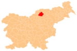
Sele (pronounced [ˈseːlɛ]) is a settlement in the City Municipality of Slovenj Gradec in northern Slovenia. The area is part of the traditional region of Styria. The entire municipality is now included in the Carinthia Statistical Region.[2]
The parish church in the settlement is dedicated to Saint Roch (Slovene: sveti Rok) and belongs to the Roman Catholic Archdiocese of Maribor. It dates to the late 15th century.[3] A second church in the east of the settlement dedicated to Saint Nicholas and was built in the early 14th century.[4]
References
External links
- Sele on Geopedia
- v
- t
- e
Administrative seat: Slovenj Gradec
| Current |
|
|---|---|
| Former |
|
- Holy Spirit Chapel
- Rothenturn Mansion
- St. Elizabeth's Parish Church
| Authority control databases |
|
|---|
 | This article about the Municipality of Slovenj Gradec in Slovenia is a stub. You can help Wikipedia by expanding it. |
- v
- t
- e


