Poor's Allotment
51°41′19″N 2°38′14″W / 51.688475°N 2.637178°W / 51.688475; -2.637178
Poor's Allotment (grid reference ST560990) is a 28.57-hectare (70.6-acre) biological Site of Special Scientific Interest in Gloucestershire, notified in 1954.[1][2] The site is listed in the 'Forest of Dean Local Plan Review' as a Key Wildlife Site (KWS).[3]
The site is now part of a larger nature reserve of 60 hectares (The Park & Poor's Allotment (grid reference ST558992)) managed by the Gloucestershire Wildlife Trust. The Park's conservation interest is now managed in partnership with the Forestry Commission who are the land owners. Poor’s Allotment is owned by trustees from the parish of Tidenham.[4]
Location and history
The site partly overlies carboniferous rocks of the Forest of Dean. Some of the site is heath vegetation which is over Drybrook sandstone, and some is vegetation which grows on the calcareous soils on Drybrook limestone. This nature of this site is, therefore, of significant regional importance because of this complexity of habitats.[1]
The land (as its name would indicate) was historically allocated under an Enclosure Award (1814) and was to be managed for the benefit of the poor. The parishes involved were Lancaut and Tidenham. It remains rough grazing land and it is a local viewpoint.[1]
Habitat and flora
This is acidic grassland and lowland heath with areas of dense bracken. In the south-east the limestone soils support calcareous grassland and broad-leaved woodland.[1]
Heathland species include Common bent, Sheep's Fescue and Creeping Fescue. There are extensive areas of Western Gorse and Ling. Also recorded are Bell Heather, Cross-leaved Heath, Bilberry, Sheep's Sorrel and Heath Bed-straw. The calcareous limestone grassland includes a range of fescue species and herbs such as Rock Rose, Thyme, Stemless Thistle, Salad Burnet and Bird's-foot Trefoil. The wooded areas include Oak, Holly, Yew, Field Maple and Whitebeam. Ground flora includes Dog's Mercury and Bluebell[1]
Recently noted scarce plants are Flea Sedge, Soft-leaved sedge, Autumn-ladies tresses, Star sedge and Lesser skullcap. Alder buckthorn also occurs.
There is a spring which feeds a pond towards the centre of the site. This area supports invertebrates. Wetland plants flourish along the edges.[1]
References
- ^ a b c d e f Natural England SSSI information on the citation
- ^ Forest of Dean District Local Plan Review, adopted November 2005, Appendix D 'Nature Conservation Site Designations Within the Forest of Dean District', Sites of Special Scientific Interest
- ^ Forest of Dean District Local Plan Review, adopted November 2005, Appendix D 'Nature Conservation Site Designations Within the Forest of Dean District', Key Wildlife Sites
- ^ The Park & Poor's Allotment description
SSSI Source
- Natural England SSSI information on the citation
- Natural England SSSI information on the Poor's Allotment units
External links
- Natural England (SSSI information)
- A stile into Poor's Allotment
- Poor's Allotment
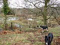
- Spring and pond on Poor's Allotment
- Footpath on Poor's Allotment
- v
- t
- e
- Ashleworth Ham
- Astridge Wood
- Badgeworth
- Barnsley Warren
- Barton Bushes
- Bigsweir Woods
- Blaisdon Hall
- Bourton Down
- Box Farm Meadows
- Boxwell
- Brassey
- Brooks Head Grove
- Buckshraft Mine & Bradley Railway Tunnel
- Bull Cross, The Frith and Juniper Hill
- Bushley Muzzard, Brimpsfield
- Caerwood and Ashberry Goose House
- Chaceley Meadow
- Clarke's Pool Meadow
- Cleeve Common
- Cockleford Marsh
- Collinpark Wood
- Coombe Hill Canal
- Coombe Hill
- Cotswold Commons and Beechwoods
- Cotswold Water Park
- Crickley Hill and Barrow Wake
- Daneway Banks
- Dean Hall Coach House & Cellar
- Devil's Chapel Scowles
- Dingle Wood
- Dixton Wood
- Dymock Woods
- Edge Common
- Elmlea Meadows
- Frampton Pools
- Highbury Wood
- Hobbs Quarry
- Hornsleasow Roughs
- Hucclecote Meadows
- Innsworth Meadow
- Juniper Hill, Edgeworth
- Kempley Daffodil Meadow
- Kingscote and Horsley Woods
- Lark Wood
- Leckhampton Hill and Charlton Kings Common
- Lineover Wood
- Lower Woods
- Lower Wye Gorge
- May Hill
- Midger
- Minchinhampton Common
- Nagshead
- Old Bow and Old Ham Mines
- Old River Severn, Upper Lode
- Pennsylvania Fields, Sedbury
- Poor's Allotment
- Puckham Woods
- Range Farm Fields
- River Wye
- Rodborough Common
- Rough Bank, Miserden
- Salmonsbury Meadows
- Selsley Common
- Severn Estuary
- Severn Ham, Tewkesbury
- Shorn Cliff and Caswell Woods
- Slade Brook
- Soudley Ponds
- Speech House Oaks
- Stenders Quarry
- Stinchcombe Hill
- Strawberry Banks
- Swanpool Wood and Furnace Grove
- Swift's Hill
- Sylvan House Barn
- The Hudnalls
- The Malvern Hills
- Tudor Farm Bank
- Turvey's Piece
- Upper Severn Estuary
- Upham Meadow and Summer Leasow
- Upper Wye Gorge
- Walmore Common
- Westbury Brook Ironstone Mine
- Whelford Meadow
- Wigpool Ironstone Mine
- Wildmoorway Meadows
- Winson Meadows
- Woodchester Park
- Workman's Wood
- Wotton Hill
- Yarley Meadows
- Neighbouring areas
- Avon
- Herefordshire
- Oxfordshire
- Wiltshire
- Worcestershire