Platte Colony, South Dakota
Census-designated place in South Dakota, United States
43°28′04″N 99°07′34″W / 43.46778°N 99.12611°W / 43.46778; -99.12611[1]
[2]
(2020)[3]
57361 (Platte)
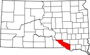
Platte Colony is a Hutterite colony[4] and census-designated place (CDP) in Charles Mix County, South Dakota, United States. It was first listed as a CDP prior to the 2020 census.[2] The population of the CDP was 299 at the 2020 census.[5]
It is in the northwest corner of the county, 20 miles (32 km) northwest of Platte, the nearest incorporated place. It is 2 miles (3 km) northeast of Lake Francis Case, a reservoir on the Missouri River.
Demographics
| Census | Pop. | Note | %± |
|---|---|---|---|
| 2020 | 299 | — | |
| U.S. Decennial Census[6] | |||
References
- ^ "ArcGIS REST Services Directory". United States Census Bureau. Retrieved October 15, 2022.
- ^ a b c U.S. Geological Survey Geographic Names Information System: Platte Colony, South Dakota
- ^ "Census Population API". United States Census Bureau. Retrieved October 15, 2022.
- ^ Friesen, Bert (May 2021). "Platte Hutterite Colony (Platte, South Dakota, USA)". Global Anabaptist Mennonite Encyclopedia Online. Retrieved September 10, 2021.
- ^ "U.S. Census Bureau: Platte Colony CDP, South Dakota". www.census.gov. United States Census Bureau. Retrieved February 5, 2022.
- ^ "Census of Population and Housing". Census.gov. Retrieved June 4, 2016.
- v
- t
- e
Municipalities and communities of Charles Mix County, South Dakota, United States
County seat: Lake Andes
- Clearfield Colony
- Lakeview Colony
- Marty
- Platte Colony
communities
- South Dakota portal
- United States portal
 | This South Dakota state location article is a stub. You can help Wikipedia by expanding it. |
- v
- t
- e


