Papara, Ivory Coast
Town in Ivory Coast, near Mali border
Town and sub-prefecture in Savanes, Ivory Coast
10°37′N 6°15′W / 10.617°N 6.250°W / 10.617; -6.250 Ivory Coast
 (2014)[1]
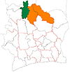
Papara is a town in the far north of Ivory Coast. It is a sub-prefecture of Tengréla Department in Bagoué Region, Savanes District. A border crossing with Mali is three kilometres east of town. Papara is the northernmost sub-prefecture in Ivory Coast.
Papara was a commune until March 2012, when it became one of 1126 communes nationwide that were abolished.[2]
In 2014, the population of the sub-prefecture of Papara was 8,866.[3]
Villages
The 11 villages of the sub-prefecture of Papara and their population in 2014 are:[3]
- Basso (126)
- Doubasso (621)
- Kapegue (391)
- Kokari (352)
- Kolonza (883)
- Koulousson (1 069)
- Papara (2 264)
- Ziekoundougou (128)
- Iribasso (505)
- Tiongoli (988)
- Zanasso (1 539)
Notes
- ^ "Côte d'Ivoire". geohive.com. Retrieved 11 December 2015.
- ^ "Le gouvernement ivoirien supprime 1126 communes, et maintient 197 pour renforcer sa politique de décentralisation en cours", news.abidjan.net, 7 March 2012.
- ^ a b "RGPH 2014, Répertoire des localités, Région Bagoué" (PDF). ins.ci. Retrieved 5 August 2019.
- v
- t
- e
Departments and sub-prefectures of Bagoué Region, Savanes DistrictRegional seat: Boundiali
* also a commune
 | This Savanes District location article is a stub. You can help Wikipedia by expanding it. |
- v
- t
- e


