Old Stephensburg, Kentucky
Unincorporated community in Kentucky, United States
Unincorporated community in Kentucky, United States
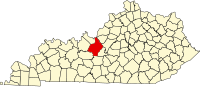
37°36′52″N 86°01′13″W / 37.61444°N 86.02028°W / 37.61444; -86.02028Old Stephensburg is an unincorporated community in Hardin County, Kentucky, United States.[1]
Notes
- ^ a b "Old Stephensburg, Kentucky". Geographic Names Information System. United States Geological Survey, United States Department of the Interior.
- v
- t
- e
Municipalities and communities of Hardin County, Kentucky, United States
County seat: Elizabethtown
- Elizabethtown
- Muldraugh‡
- Radcliff
- Sonora
- Upton‡
- Vine Grove
- West Point
unincorporated
communities
- Big Spring‡
- Eastview
- Glendale
- Hardin Springs
- Howe Valley
- Limp
- Nolin
- Old Stephensburg
- Saint John
- Star Mills
- Stephensburg
- White Mills
‡This populated place also has portions in an adjacent county or counties
- Kentucky portal
- United States portal
 | This Hardin County, Kentucky state location article is a stub. You can help Wikipedia by expanding it. |
- v
- t
- e


