Nayband Rural District
Rural district in Bushehr province, Iran
Rural District in Bushehr, Iran
Nayband Rural District Persian: دهستان نای بند | |
|---|---|
| 27°20′25″N 52°41′11″E / 27.34028°N 52.68639°E / 27.34028; 52.68639[1] | |
| Country | Iran |
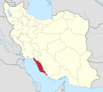
| Province | Bushehr |
| County | Asaluyeh |
| District | Chah-e Mobarak |
| Capital | Zobar |
| Population (2016)[2] | |
| • Total | 5,625 |
| Time zone | UTC+3:30 (IRST) |
Nayband Rural District (Persian: دهستان نای بند) is in Chah-e Mobarak District of Asaluyeh County, Bushehr province, Iran. Its capital is the village of Zobar.[3] The previous capital of the rural district was the village of Chah-e Mobarak[4] (now a city).[5]
Demographics
Population
At the time of the 2006 National Census, the rural district's population (as a part of the former Asaluyeh District of Kangan County) was 10,437 in 1,632 households.[6] The following census in 2011 counted 13,220 people in 2,709 households.[7] The 2016 census measured the population of the rural district as 5,625 in 1,298 households, by which time the district had been separated from the county in the establishment of Asaluyeh County. The rural district was transferred to the new Chah-e Mobarak District.[3] The most populous of its eight villages was Besatin, with 1,244 people.[2]
See also
 Iran portal
References
- ^ OpenStreetMap contributors (29 March 2023). "Nayband Rural District (Asaluyeh County)" (Map). OpenStreetMap (in Persian). Retrieved 29 March 2023.
- ^ a b "Census of the Islamic Republic of Iran, 1395 (2016)". AMAR (in Persian). The Statistical Center of Iran. p. 18. Archived from the original (Excel) on 3 August 2017. Retrieved 19 December 2022.
- ^ a b Rahimi, Mohammad Reza (29 September 2013). "Approval letter regarding country divisions in Bushehr province". Islamic Parliament Research Center of the Islamic Republic of Iran (in Persian). Ministry of Interior. Archived from the original on 10 January 2013. Retrieved 29 March 2023.
- ^ Mousavi, Mirhossein (18 August 1365). "Creation and formation of five rural districts including villages, farms and places in Kangan County under Bushehr province". Lamtakam (in Persian). Ministry of Interior, Council of Ministers. Archived from the original on 26 April 2024. Retrieved 26 April 2024.
- ^ "In Asaluyeh County, Chah-e Mobarak Municipality was opened". Mehr News (in Persian). 21 March 2016. Archived from the original on 6 November 2023. Retrieved 6 November 2023.
- ^ "Census of the Islamic Republic of Iran, 1385 (2006)". AMAR (in Persian). The Statistical Center of Iran. p. 18. Archived from the original (Excel) on 20 September 2011. Retrieved 25 September 2022.
- ^ "Census of the Islamic Republic of Iran, 1390 (2011)". Syracuse University (in Persian). The Statistical Center of Iran. p. 18. Archived from the original (Excel) on 3 April 2023. Retrieved 19 December 2022.
- v
- t
- e
Bushehr Province, Iran
| Asaluyeh County | |
|---|---|
| Bushehr County | |
| Dashtestan County | |
| Dashti County | |
| Deylam County | |
| Deyr County | |
| Ganaveh County | |
| Jam County | |
| Kangan County | |
| Tangestan County |
- Ghavam water tank (Ab Anbar of Ghavam)
- Khourmoj fire temple
- Boraazjan Castle
- Siraf
- Seensiz
- Rishahr
- Chehelkhaneh cave
- Bardak Siah Palace
- Saadat Mozaffari School
- Rais Ali Museum
- Bushehr anthropology Museum
- Gur-e-Dokhtar
| |||||||||||||||||||||
|---|---|---|---|---|---|---|---|---|---|---|---|---|---|---|---|---|---|---|---|---|---|
| Capital | |||||||||||||||||||||
| Districts |
| ||||||||||||||||||||


