Nasirabad District
District of Balochistan in Pakistan
Naseerabad District ضلع نصیر آباد | |
|---|---|
District of Balochistan | |
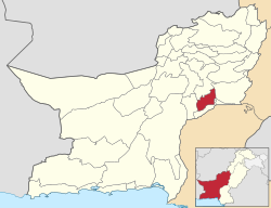 Map of Balochistan with Nasirabad District highlighted | |
| Country |  Pakistan Pakistan |
| Province |  Balochistan Balochistan |
| Division | Nasirabad |
| Named for | Mir Nasir Khan I |
| Headquarters | Dera Murad Jamali |
| Government | |
| • Type | District Administration |
| • Deputy Commissioner | Muhammad Qasim |
| • District Police Officer | N/A |
| • District Health Officer | N/A |
| Area | |
| • District of Balochistan | 3,387 km2 (1,308 sq mi) |
| Population (2023)[1] | |
| • District of Balochistan | 563,315 |
| • Density | 170/km2 (430/sq mi) |
| • Urban | 19.7% |
| Time zone | UTC+5 (PST) |
Nasirabad (Urdu: ضلع نصیر آباد) is a district in the centre-west of Balochistan, Pakistan. The district's headquarters are located at Dera Murad Jamali. The district shares its boundaries in the east with Dera Bugti and in the west with Jhal Magsi, Jafarabad district is in the district’s south, and Bolan district is in its north.
The division is named after the Khan of Kalat, Mir Nasir Khan I, who was one of the most respected rulers of Kalat; he ruled Kalat from (1747-1794), and founded the Brahvi-Baloch Confederation, with its center in Khanate of Kalat.[2]
Nasirabad District was first part of state of Kalat until the formation of Kalat District on February 3, 1954. Nasirabad was then seprated from Kalat district in 1974, while in 1987 the new district of Jafarabad was cleaved out of it.[3] For three years, from July 1987 to December 1990, it was known as Tahseel Tamboo. Tamboo is a small village 40km west of Dera Murad Jamali.[4]This District is named after Naseer Ahmed who served there as Deputy commissioner and later became Commissioner of Naseerabad Division.
Administrative divisions
Tehsils
The district is administratively subdivided into four Tehsils, these are:[5]
- Dera Murad Jamali (district headquarters)
- Chhatter
- Baba Kot
- Tamboo
Union councils
These tehsils are further divided into union councils. Currently, there are 31 union councils and one municipal committee in the district:
Tehsil Dera Murad Jamali
- Municipal Committee Dera Murad Jamali
- Union Council Quba Sher Khan Sharqi
- Union Council Quba Sher Khan Gharbi
- Union Council Naseer Khan Umrani
- Union Council Jhuder Shimali
- Union Council Bedar Androon Sharqi
- Union Council Bedar Gharbi
- Union Council Manjhoti Sharqi
- Union Council Sardar Shahzada Khan Umrani
- Union Council Sikandarabad
- Union Council Manjhoti Gharbi
- Union Council Jhuder Janubi
Tehsil Chhatter
- Union Council Chhatter
- Union Council Phuleji
- Union Council Shah Pur
- Union Council Daulat Ghari Mir Nabi Bakhsh Khan
- Union Council Daulat Ghari Mir Hassan Khosa
- Union Council Shori Drabi
Tehsil Tamboo
- Union Council Manjhoo Shoori
- Union Council Aeri
- Union Council Gola Wah
- Union Council Ali Abad Shumali
- Union Council Mir Behram Khan Buledi
- Union Council Qadir Abad
- Union Council Kharoos Wah
- Union Council Fateh Mohammad
- Union Council Mir Wah
- Union Council Abdullah Bari
- Union Council Ali Abad
Tehsil Baba Kot
- Union Council Garhi Rehman
- Union Council Baba Kot
- Union Council Kuhna Tamboo
Demographics
At the time of the 2023 census, 43.21% of the population spoke Balochi, 22.27% Brahui, 21.16% Sindhi and 12.15% Saraiki as their first language.[1]
References
- ^ a b "Population by Mother Tongue, Sex and Rural/Urban, Census-2023" (PDF). Pakistan Bureau of Statistics.
- ^ "Balochistan-Nasirabad -". Retrieved 9 August 2024.
- ^ PCO 1999, p. 13.
- ^ "BHC Dera Murad Jamali History". bhc.gov.pk. Retrieved 9 August 2024.
- ^ \"Tehsils & Unions in the District of Nasirabad – Government of Pakistan". Archived from the original on 26 March 2012.
- ^ "Population by Sex, Religion and Rural/Urban, Census - 2023" (PDF). Pakistan Bureau of Statistics.
Bibliography
- 1998 District census report of Nasirabad. Census publication. Vol. 26. Islamabad: Population Census Organization, Statistics Division, Government of Pakistan. 1999.
External links
Wikimedia Commons has media related to Nasirabad District.
- Nasirabad District at www.balochistan.gov.pk
- Nasirabad District at www.balochistanpolice.gov.pk
- v
- t
- e
Provincial capital: Quetta

- Jafarabad
- Jhal Magsi
- Kachhi
- Nasirabad
- Sohbatpur
- Usta Muhammad
a - formerly part of Quetta Division; b - formerly part of Kalat Division; c - formerly part of Zhob Division ; d - abolished
Authority control databases | |
|---|---|
| International |
|
| National |
|
28°32′40″N 68°13′14″E / 28.54444°N 68.22056°E / 28.54444; 68.22056


