Mount Tūtoko
Mountain in Fiordland National Park, New Zealand

Mount Tūtoko
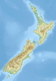
Location in the South Island, New Zealand
Mount Tūtoko is the highest peak in Fiordland National Park, in southwest New Zealand. It lies between the Hollyford Valley and Milford Sound, 15 kilometres due north of the Homer Tunnel at the northern end of the Darran Mountains. The glacier-covered mountain rises to a height of 2,723 metres (8,934 ft) and is visible from the Hollyford Track.[2] Two slightly lower summits lie just to the south of the main peak.
The first ascent of Tūtoko was by Samuel Turner and Peter Graham in 1924, climbing by way of the northwest ridge.
The name of the mountain was officially gazetted as Mount Tūtoko on 21 June 2019.[3] The mountain is thought to have been named after Tūtoko, a Māori chief who lived at Martin's Bay, close to the mouth of the Hollyford River.
See also
References
External links
Wikimedia Commons has media related to Mount Tūtoko.
- "Mount Tutoko" Mountain-Forecast.com
- 1966 Encyclopedia of New Zealand page
- v
- t
- e
Fiordland, New Zealand
- Doubtful Sound / Patea
- Deep Cove
- Hāwea / Bligh Sound
- Hinenui / Nancy Sound
- Bradshaw Sound
- Milford Sound
- Taiari / Chalky Inlet
- Charles Sound
- Caswell Sound
- Tamatea / Dusky Sound
- Thompson Sound
- Sutherland Sound
- George Sound
- Breaksea Sound
- Dagg Sound
- Rakituma / Preservation Inlet
- Big Bay
- Martins Bay
- Pearl Harbour
- Te Waewae Bay
- Anchor Island
- Arran Island
- Bauza Island
- Bay Rock
- Belle Vue Island
- Breaksea Island
- Brig Rock
- Buncrana Island
- Centre Island
- Chalky Island
- Coal Island
- Cooper Island
- Elizabeth Island
- Great Island
- Indian Island
- Long Island
- Pomona Island
- Resolution Island
- Secretary Island
- Hawea (Clio Rocks)
- Kahukura (Gold Arm)
- Kutu Parera (Gaer Arm)
- Moana Uta (Wet Jacket Arm)
- Piopiotahi (Milford Sound)
- Taipari Roa (Elizabeth Island)
- Taumoana (Five Finger Peninsula)
- Te Awaatu Channel (The Gut)
- Te Hapua (Sutherland Sound)
- Te Tapuwae o Hua (Long Sound)
- Darran Mountains
- Franklin Mountains
- Humboldt Mountains
- Hunter Mountains
- Kepler Mountains
- Murchison Mountains
- Wick Mountains
- Mitre Peak
- Mount Edgecumbe
- Mount Grono
- Mount Luxmore
- Mount Moturau
- Mount Richardson
- Mount Titiroa
- Mount Tūtoko
- Aan River
- Arthur River
- Awarua River
- Big River
- Bowen River
- Camelot River
- Carrick River
- Castle River
- Cavendish River
- Cleddau River
- Clinton River
- Coal River
- Dark River
- Donne River
- Doon River
- Dry Awarua River
- Edith River
- Eglinton River
- Electric River
- Elizabeth River
- Forgotten River
- George River
- Glaisnock River
- Gray River
- Grebe River
- Gulliver River
- Hollyford River
- Irene River
- John o'Groats River
- Juno River
- Kaipo River
- Light River
- Lyvia River
- Mike River
- Misty River
- Monowai River
- Namu River
- Newton River
- Olivine River
- Pandora River
- Pitt River
- Pyke River
- Rea River
- Red Pyke River
- Rooney River
- Seaforth River
- Shag River
- Spey River
- Stillwater River
- Talbot River
- Thurso River
- Transit River
- Tūtoko River
- Waiau River
- Waikōau River
- Wairaurāhiri River
- Waitutu River
- Walker River
- Wapiti River
- Whitewater River
- Wild Natives River
- Wilmot River
- Wilson River
- Windward River
- Wolff River
- Manapouri
- Milford Sound
- Port Craig
- Te Anau
 | This Fiordland, New Zealand geography article is a stub. You can help Wikipedia by expanding it. |
- v
- t
- e


