Mount Tire'm
Mountain in Maine, United States

Mount Tire'm
Oxford County, Maine, U.S.
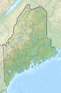
Mount Tire'm is a small 1,060-foot (320 m) mountain adjacent to Keoka Lake in the town of Waterford, Maine. The Daniel Brown Trail offers access to the summit; its trailhead is on Plummer Hill Road just northwest of the village of Waterford. Views on clear days near the summit include vistas of Keoka Lake and Pleasant Mountain, the home of the Shawnee Peak Ski Area.[2]
References
- v
- t
- e
- Boundary Peak
| Mahoosuc Range |
|
|---|---|
| Others |
- Baker Mountain
- Bauneg Beg Mountain
- Big Moose Mountain
- Big Spencer Mountain
- Black Cap Mountain
- Black Nubble
- Blueberry Mountain
- Borestone Mountain
- Boundary Bald Mountain
- Bradbury Mountain
- Cadillac Mountain
- Caribou Mountain
- Catherine Mountain
- Clark Mountain
- Coburn Mountain
- Crocker Mountain
- Crotch Hill
- Doubletop Mountain
- Douglas Mountain
- East Kennebago Mountain
- Eaton Mountain
- Elephant Mountain (Oxford County)
- Elephant Mountain (Piscataquis County)
- Fort Mountain
- Great Pond Mountain
- Greenwood Mountain
- Hamlin Peak
- High Peaks
- Kennebago Divide
- Kibby Mountain
- Lead Mountain
- Mars Hill
- Mount Abraham
- Mount Bigelow
- Mount Blue
- Mount Coe
- Mount Jefferson
- Mount Katahdin
- Mount Kineo
- Mount Redington
- Mount Tire'm
- Mount Waldo
- Moxie Mountain
- North Brother
- Noyes Mountain
- Pleasant Mountain
- Rollins Mountain
- Saddleback Horn
- Saddleback Junior
- Saddleback Mountain (Franklin County)
- Saddleback Mountain (Piscataquis County)
- Sandy Bay Mountain
- Shutdown Mountain
- Snow Mountain (Franklin County)
- Snow Mountain (Oxford County)
- South Brother
- South Crocker Mountain
- Spaulding Mountain
- Stetson Mountain
- Sugarloaf Mountain
- Titcomb Mountain
- Traveler Mountain
- Tumbledown Mountain
- West Kennebago Mountain
- Western Maine Mountains
- White Cap Mountain (Franklin County)
- White Cap Mountain (Piscataquis County)
 | This Maine state location article is a stub. You can help Wikipedia by expanding it. |
- v
- t
- e


