Manappattu
Village in Puducherry, India
11°47′58″N 79°47′17″E / 11.799453°N 79.787983°E / 11.799453; 79.787983 India
India607 402
Manappattu is a village[1] in Bahour Commune of Bahour taluk in the Union Territory of Puducherry, India. It lies east of NH-45A at a distance of 2 km from it.
Geography
Manappattu is bordered by Bahour in the west, Pillaiyarkuppam in the north, Bay of Bengal in east and Krishnavaram, Pudukuppam in the south.
Villages
Following are the list of villages under Manappattu Village Panchayat.
- Manappattu
- Kanniakoil
- Kattukuppam
- Varakalodaipet
Road Network
Manappattu is connected by Kanniakoil - Manappattu road. Also Pannithittu - Pudukuppam road connects Manappattu.
Gallery
-
 Map of Manappattu Village Panchayat
 -
 Rural Health Training Centre, Manapattu, Bahour Commune
 -
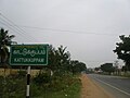 Kattukuppam, Manapattu Village Panchayat, Bahour Commune
 -
 Manappattu Road and Bahour Road meeting at Kanniyakoil


Politics
Manappattu is a part of Bahour (Union Territory Assembly constituency) which comes under Puducherry (Lok Sabha constituency)
References
- ^ "Archived copy" (PDF). Archived from the original (PDF) on 27 September 2013. Retrieved 17 March 2013.
{{cite web}}: CS1 maint: archived copy as title (link)
External links
- Official website of the Government of the Union Territory of Puducherry[permanent dead link]


