Malka (river)
River in Kabardino-Balkaria


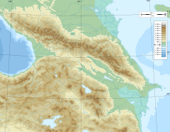
• coordinates
The Malka (Russian: Малка), also known as Balyksu (Russian: Балыксу), is a river in Kabardino-Balkaria in Russia, which forms the northwest part of the Terek basin.[1] It is 210 kilometres (130 mi) long, and its drainage basin covers 10,000 square kilometres (3,900 sq mi).[2] The Malka originates in the glaciers on the northern slopes of Mount Elbrus, flows north and then east. Near the point where it joins the great northwest bend of the Terek it receives several northeast-flowing rivers such as the Baksan. The town of Prokhladny is along the Malka.
References
- v
- t
- e

- Iokanga
- Kem
- Malaya Belaya
- Mezen
- Nautsiyoki
- Niva
- Northern Dvina
- Onega
- Pechora
- Usa
- Ponoy
- Varzuga
- Voronya
- Kuma
- Sulak
- Terek
- Malka
- Sunzha
- Ural
- Ilek
- Sakmara
- Volga
- Aktay
- Anish
- Bolshaya Kokshaga
- Bolshoy Cheremshan
- Bolshoy Irgiz
- Bezdna
- Chapayevka
- Dubna
- Ilet
- Kama
- Kashinka
- Kazanka
- Kerzhenets
- Kostroma
- Kotorosl
- Kudma
- Malaya Kokshaga
- Maly Irgiz
- Medveditsa
- Mologa
- Nerl
- Nyomda
- Oka
- Rutka
- Samara
- Selizharovka
- Sheksna
- Shosha
- Sogozha
- Sok
- Suda
- Sura
- Sviyaga
- Tereshka
- Tsivil
- Tvertsa
- Unzha
- Uzola
- Vetluga
- Vazuza
- Yeruslan
- Alazeya
- Amguema
- Anabar
- Bolshaya Kuonamka
- Malaya Kuonamka
- Suolama
- Udya
- Bogdashkina
- Chaun
- Chegitun
- Chondon
- Buor-Yuryakh
- Nuchcha
- Gusinaya
- Indigirka
- Allaikha
- Badyarikha
- Bolshaya Ercha
- Byoryolyokh
- Chibagalakh
- Druzhina
- Elgi
- Khastakh
- Kuydusun
- Kyuyente
- Moma
- Nera
- Selennyakh
- Shandrin
- Shangina
- Uyandina
- Ioniveyem
- Khatanga
- Kheta
- Kotuy
- Khroma
- Kolyma
- Anyuy
- Ayan-Yuryakh
- Bakhapcha
- Balygychan
- Beryozovka
- Buyunda
- Debin
- Korkodon
- Kulu
- Omolon
- Popovka
- Ozhogina
- Sededema
- Seymchan
- Sugoy
- Taskan
- Tenka
- Yasachnaya
- Zyryanka
- Kyuyol-Yuryakh
- Lena
- Aldan
- Batamay
- Begidyan
- Belyanka
- Biryuk
- Bolshoy Patom
- Buotama
- Byosyuke
- Chaya
- Chechuy
- Cherendey
- Chuya
- Derba
- Dzhardzhan
- Dyanyshka
- Eyekit
- Ichera
- Ilga
- Khanchaly
- Khoruongka
- Kenkeme
- Kirenga
- Kuta
- Kyuelenke
- Kyundyudey
- Linde
- Lungkha
- Lyapiske
- Lyutenge
- Markha
- Markhachan
- Menda
- Menkere
- Molodo
- Motorchuna
- Muna
- Myla
- Namana
- Natara
- Nuora
- Nyuya
- Olyokma
- Peleduy
- Pilyuda
- Sinyaya
- Sitte
- Sobolokh-Mayan
- Suola
- Tamma
- Tayura
- Tikyan
- Tuolba
- Tutura
- Tympylykan
- Tyugyuene
- Uel-Siktyakh
- Undyulyung
- Ura
- Vilyuy
- Vitim
- Nadym
- Ob
- Aley
- Barnaulka
- Biya
- Chaya
- Chulym
- Irtysh
- Kazym
- Kasmala
- Katun
- Ket
- Kievsky Yogan
- Parabel
- Sob
- Synya
- Tom
- Tromyogan
- Tym
- Vasyugan
- Vakh
- Vatinsky Yogan
- Olenyok
- Omoloy
- Palyavaam
- Pegtymel
- Pur
- Pyasina
- Sellyakh
- Sundrun
- Maly Khomus-Yuryakh
- Taz
- Khudosey
- Tolka
- Uele
- Volchya
- Yana
- Yenisey
- Abakan
- Angara
- Bakhta
- Bazaikha
- Bolshaya Kheta
- Bolshoy Pit
- Kacha
- Kan
- Kem
- Khantayka
- Khemchik
- Kureyka
- Mana
- Nizhnyaya Tunguska
- Podkamennaya Tunguska
- Sym
- Tanama
- Turukhan
- Yeloguy
 Russia portal
 Category


26/10/1942-1943 Germans crossed the River Mlaka, near Nalchik and Malchik to get to Grozny, "The Terrible"
 | This Kabardino-Balkaria location article is a stub. You can help Wikipedia by expanding it. |
- v
- t
- e
 | This article related to a river in the North Caucasian Federal District of Russia is a stub. You can help Wikipedia by expanding it. |
- v
- t
- e


