M85 expressway (Hungary)
Road in Hungary
You can help expand this article with text translated from the corresponding article in Hungarian. (April 2018) Click [show] for important translation instructions.
- View a machine-translated version of the Hungarian article.
- Machine translation, like DeepL or Google Translate, is a useful starting point for translations, but translators must revise errors as necessary and confirm that the translation is accurate, rather than simply copy-pasting machine-translated text into the English Wikipedia.
- Do not translate text that appears unreliable or low-quality. If possible, verify the text with references provided in the foreign-language article.
- You must provide copyright attribution in the edit summary accompanying your translation by providing an interlanguage link to the source of your translation. A model attribution edit summary is
Content in this edit is translated from the existing Hungarian Wikipedia article at [[:hu:M85-ös autóút (Magyarország)]]; see its history for attribution. - You may also add the template
{{Translated|hu|M85-ös autóút (Magyarország)}}to the talk page. - For more guidance, see Wikipedia:Translation.
 | |
|---|---|
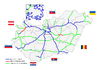
| M85-ös autóút | |
  in use in use  planned planned  other highways other highways | |
 M85 near Enese | |
| Route information | |
| Part of | |
| Length | 83 km (52 mi) 95 km (59 mi) planned |
| Existed | 2008–present |
| Major junctions | |
| From | |
| Major intersections |
|
| To | Sopron A 3 border with A 3 border with  Austria Austria |
| Location | |
| Country | Hungary |
| Counties | Győr-Moson-Sopron |
| Major cities | Győr, Csorna, Sopron |
| Highway system | |
| |


The M85 expressway (Hungarian: M85-ös autóút) is a Hungarian expressway connecting Győr to Sopron. It will eventually connect M1 motorway to the Austrian border.
Timeline
| Section | Length | Opened | Notes |
|---|---|---|---|
| Győr nyugat (M1) – Enese | 8.0 km (4.97 mi) | 16 June 2015[1] | Built between 2013 – 2015. |
| Enese bypass | 7.0 km (4.35 mi) | 21 December 2011 | Built between 2009 – 2011. |
| Enese – Kóny | 3.0 km (1.86 mi) | 16 June 2015[1] | Built between 2013 – 2015. |
| Kóny – Csorna | 6.0 km (3.73 mi) | 9 September 2015[2] | Built between 2013 – 2015. |
| Csorna bypass I. | 5.0 km (3.11 mi) | 9 September 2015[2] | Segment I. (East), built between 2013 – 2015. Common route with M86 expressway. This section was extended 2x3 lane. |
| Csorna bypass II. (M86 junction - Csorny nyugat) | 4.5 km (2.80 mi) | 15 December 2017[3] | Segment II. (West), built between 2015 – 2017. |
| Csorna nyugat – Sopron kelet | 51.0 km (31.69 mi) | 16 December 2020 | Built between 2017 – 2020. |
| Sopron kelet – Balf | 2.5 km (1.55 mi) | 9 June 2021 | Built between 2017 – 2021. |
| Balf – Sopron észak | 6.4 km (3.98 mi) | 10 December 2021 | Built between 2018 – 2021. |
| Sopron észak to the border | 4.6 km (2.86 mi) | Planned in 2024 | Under construction, with Sopron Tunnel |
Route description
- The route is full length expressway. The maximum speed limit is 110 km/h, with
 .
.

| County | km | Type | Destination | Notes | |
|---|---|---|---|---|---|
 Győr-Moson-Sopron | 0 |  |  Main road 1 – Győr / Main road 1 – Győr /
| The eastern terminus of the  expressway. expressway. Kilometrage starting point Roundabout and interchange junction | |
| 8 |  | Rábapatona | |||
| 10 | | Lébény, Bezi / Enese, Tét | |||
| 16 | | Kóny / Rábcakapi | Connecting to petrol station and Truck parking. | ||
| 21 | |  Main road 85 – Csorna Main road 85 – Csorna | |||
| 23 |  |
| The northern terminus of the common road with M85-M86 expressways, and E65 route. The eastern part of Csorna bypass. The northern terminus of 2x3 lane road. | ||
 | over the Győr–Sopron railway line | ||||
| 25 | | over the Pápa–Csorna railway line | |||
| 27 | |
| The southern terminus of the common road with M85-M86 expressways, and E65 route. The southern part of Csorna bypass. The southern terminus of 2x3 lane road. | ||
| | over the Hegyeshalom–Szombathely railway line | ||||
| 32 | | Jobaháza, Farád / Csorna nyugat | nyugat means West | ||
| 40 |  | Babóti pihenőhely | parking, WC, and water (petrol station in the future) pihenőhely means Rest area | ||
| 44 | | Beled, Hövej / Kapuvár | |||
| 53 | | Fertőd, Fertőendréd | Connecting to Main road 85. | ||
| 55 | | Széchenyi pihenőhely | parking, WC, and water | ||
| 60 | | Kőszeg, Lövő / Fertőszentmiklós | |||
| 68 | | under the Győr–Sopron railway line | |||
| 72 | |  Main road 84 – Nagycenk / Sárvár Main road 84 – Nagycenk / Sárvár | Connection to Sopron, and the Lake Balaton. | ||
| 78 | | Hutbájd pihenőhely | parking, WC, and water Tengelysúlymérő állomás means weigh in motion (trafic controll) | ||
| 79 | | over the Győr–Sopron railway line | |||
 | Ikva híd | híd means Bridge | |||
| 82 | | Main road 84 – Kópháza (border) / Sopron Centrum | |||
| 85 | | Sopron-Balf / Sopron-Pihenőkereszt | |||
| 89 | | Sopron észak / Fertőrákos | észak means North | ||
| 90 |  | Soproni alagút | Length: 780 m alagút means Tunnel | ||
| 93 | | Main road 84 – Sopron nyugat / Ágfalva | nyugat means West Western under construction section | ||
| 94 | | Scarbantia pihenőhely | Planned | ||
| 95 | Soporn (H) – Klingenbach (AT) border crossing A 3 – Eisenstadt towards to Vienna | Planned | |||
1.000 mi = 1.609 km; 1.000 km = 0.621 mi
| |||||

Maintenance
The operation and maintenance of the road by Hungarian Concession Infrastructure Development Plc.. This activity is provided by these highway engineers.
Payment
Hungarian system has 2 main type in terms of salary:
1, time-based fee vignettes (E-matrica);
- Cars, vans and motorbikes up to 3.5 tonnes only need to buy a single vignette which costs 6,400 Hungarian forint (Ft) for 10 days, 10,360 Ft for 1 month and 57,260 Ft for a year, from 1 January 2024.[4]
2, county vignettes (Megyei matrica); the highway can be used instead of the national sticker with the following county stickers:
Type of county vignette Available section Győr-Moson-Soporn full length (0 km – 83 km)
See also
 Hungary portal
 Roads portal


References
- ^ a b "M85: átadták a Győr-Kóny szakaszt - fotók, videó". Archived from the original on 2017-12-22. Retrieved 2017-12-21.
- ^ a b "Már a miénk az M85-ös Csorna és Kóny között! - fotók". Archived from the original on 2015-09-24. Retrieved 2017-12-21.
- ^ "M85: pénteken átadják a csornai elkerülőt - Áder János is ott lesz". Archived from the original on 2017-12-15. Retrieved 2017-12-15.
- ^ "National Toll Payment Services PLC - E-vignette rates from 1 January 2024". toll-charge.hu. Archived from the original on 10 January 2024. Retrieved 18 January 2024.
External links
Wikimedia Commons has media related to Autópálya M85.
- Exit list of M85
- National Toll Payment Services Plc. (in Hungarian, some information also in English)
- National Infrastructure Developer Ltd.
- v
- t
- e

- M0
- M1
- M3
- M4
- M5
- M6
- M7
- M8
- M15
- M30
- M31
- M35
- M43
- M44
- M60
- M70

- M2
- M4
- M9
- M19
- M25
- M51
- M76
- M80
- M85
- M86
- R67
- M10
- M32
- M34
- M49
- M81
- M83
- M87
- M90
- M100
- Southern highway
- R8
- R21
- R47
- R83
 | This Hungarian road or road transport-related article is a stub. You can help Wikipedia by expanding it. |
- v
- t
- e


