List of listed buildings in Stow, Scottish Borders
This is a list of listed buildings in the parish of Stow in the Scottish Borders, Scotland.
Map all coordinates using OpenStreetMap
Download coordinates as:
- KML
- GPX (all coordinates)
- GPX (primary coordinates)
- GPX (secondary coordinates)
List
| Name | Location | Date Listed | Grid Ref. [note 1] | Geo-coordinates | Notes | LB Number [note 2] | Image |
|---|---|---|---|---|---|---|---|
| Bowland Bridge (Over Gala Water) | 55°39′06″N 2°52′04″W / 55.651568°N 2.867701°W / 55.651568; -2.867701 (Bowland Bridge (Over Gala Water)) | Category C(S) | 17406 |  Upload Photo | |||
| 3-10 (Inclusive Nos) Galabank | 55°42′06″N 2°53′10″W / 55.701711°N 2.885981°W / 55.701711; -2.885981 (3-10 (Inclusive Nos) Galabank) | Category B | 17394 | Upload Photo | |||
| Mitchelston Farm Including Ancillary Buildings And Garden Walls | 55°43′24″N 2°51′29″W / 55.723232°N 2.858113°W / 55.723232; -2.858113 (Mitchelston Farm Including Ancillary Buildings And Garden Walls) | Category C(S) | 17395 | Upload Photo | |||
| Burn House Doocot | 55°43′59″N 2°53′38″W / 55.732923°N 2.893917°W / 55.732923; -2.893917 (Burn House Doocot) | Category C(S) | 17401 | Upload Photo | |||
| 11-15 (Odd Nos) Townfoot, Post Office | 55°41′32″N 2°51′39″W / 55.692185°N 2.860917°W / 55.692185; -2.860917 (11-15 (Odd Nos) Townfoot, Post Office) | Category C(S) | 51302 | Upload Photo | |||
| Crookston House, Former Stables Including Boundary Walls | 55°45′15″N 2°54′48″W / 55.754165°N 2.913412°W / 55.754165; -2.913412 (Crookston House, Former Stables Including Boundary Walls) | Category C(S) | 51298 | Upload Photo | |||
| 168 Galashiels Road, Manorhead House Including Stables Cottage, Boundary Walls, Gatepiers And Railings | 55°41′42″N 2°51′51″W / 55.695101°N 2.864036°W / 55.695101; -2.864036 (168 Galashiels Road, Manorhead House Including Stables Cottage, Boundary Walls, Gatepiers And Railings) | Category B | 19107 | Upload Photo | |||
| Bowland Policies, North Gate Lodge | 55°39′01″N 2°52′11″W / 55.650368°N 2.869613°W / 55.650368; -2.869613 (Bowland Policies, North Gate Lodge) | Category B | 17397 | Upload Photo | |||
| Old Crookston House | 55°45′33″N 2°55′06″W / 55.759223°N 2.918406°W / 55.759223; -2.918406 (Old Crookston House) | Category B | 17396 | Upload Photo | |||
| Crookston House Including Gates, Gatepiers And Quadrant Walls | 55°45′16″N 2°55′00″W / 55.754446°N 2.9167°W / 55.754446; -2.9167 (Crookston House Including Gates, Gatepiers And Quadrant Walls) | Category B | 13895 | Upload Photo | |||
| Crookston House, South Gate Lodge | 55°45′03″N 2°54′54″W / 55.750936°N 2.915073°W / 55.750936; -2.915073 (Crookston House, South Gate Lodge) | Category C(S) | 51010 | Upload Photo | |||
| Bowland Policies, Dryburn (House, Mill Buildings And Dam Bridge) | 55°39′16″N 2°52′25″W / 55.654311°N 2.873642°W / 55.654311; -2.873642 (Bowland Policies, Dryburn (House, Mill Buildings And Dam Bridge)) | Category C(S) | 51296 | Upload Photo | |||
| Burn House, North Lodge, Former Stables | 55°44′01″N 2°54′02″W / 55.73353°N 2.900604°W / 55.73353; -2.900604 (Burn House, North Lodge, Former Stables) | Category C(S) | 51297 | Upload Photo | |||
| 175 And 177 Galashiels Road (Former School) Including 179 Galashiels Road (Former Schoolmaster's House) And Boundary Walls | 55°41′43″N 2°51′47″W / 55.695144°N 2.863098°W / 55.695144; -2.863098 (175 And 177 Galashiels Road (Former School) Including 179 Galashiels Road (Former Schoolmaster's House) And Boundary Walls) | Category C(S) | 51299 | Upload Photo | |||
| Bankhouse Farm (Former Coaching Inn) | 55°43′14″N 2°53′47″W / 55.720649°N 2.896439°W / 55.720649; -2.896439 (Bankhouse Farm (Former Coaching Inn)) | Category C(S) | 19053 | Upload Photo | |||
| Townfoot, Town Hall | 55°41′31″N 2°51′36″W / 55.691832°N 2.86005°W / 55.691832; -2.86005 (Townfoot, Town Hall) | Category B | 51301 |  Upload another image | |||
| Stow Parish Church, St Mary of Wedale | 55°41′23″N 2°51′44″W / 55.689786°N 2.862216°W / 55.689786; -2.862216 (Stow Parish Church, St Mary of Wedale) | Category B | 17403 |  Upload another image | |||
| Old Stow Kirk and Burial Ground | 55°41′29″N 2°51′42″W / 55.691461°N 2.861665°W / 55.691461; -2.861665 (Old Stow Kirk and Burial Ground) | Category B | 17404 |  Upload another image | |||
| Bowland House Including Garden Cottages, Walled Garden And Garage Block | 55°38′59″N 2°52′51″W / 55.649669°N 2.880737°W / 55.649669; -2.880737 (Bowland House Including Garden Cottages, Walled Garden And Garage Block) | Category B | 17407 | Upload Photo | |||
| Symington House Including Gate Lodge And Boundary Walls | 55°43′28″N 2°53′56″W / 55.724423°N 2.898866°W / 55.724423; -2.898866 (Symington House Including Gate Lodge And Boundary Walls) | Category C(S) | 51300 | Upload Photo | |||
| Torquhan House Including Gate Lodge And Gatepiers, Walled Garden And Stable Block | 55°43′12″N 2°52′54″W / 55.71991°N 2.88176°W / 55.71991; -2.88176 (Torquhan House Including Gate Lodge And Gatepiers, Walled Garden And Stable Block) | Category B | 17402 | Upload Photo | |||
| Luggate Water Bridge | 55°40′48″N 2°52′34″W / 55.679992°N 2.876107°W / 55.679992; -2.876107 (Luggate Water Bridge) | Category B | 17399 | 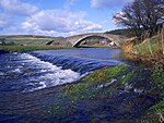 Upload another image | |||
| Burn House | 55°43′59″N 2°53′46″W / 55.732951°N 2.896211°W / 55.732951; -2.896211 (Burn House) | Category B | 17400 | Upload Photo | |||
| Plenploth Farmhouse With Boundary Walls | 55°43′39″N 2°53′44″W / 55.727466°N 2.895528°W / 55.727466; -2.895528 (Plenploth Farmhouse With Boundary Walls) | Category C(S) | 13900 | Upload Photo |
Key
The scheme for classifying buildings in Scotland is:
- Category A: "buildings of national or international importance, either architectural or historic; or fine, little-altered examples of some particular period, style or building type."[1]
- Category B: "buildings of regional or more than local importance; or major examples of some particular period, style or building type, which may have been altered."[1]
- Category C: "buildings of local importance; lesser examples of any period, style, or building type, as originally constructed or moderately altered; and simple traditional buildings which group well with other listed buildings."[1]
In March 2016 there were 47,288 listed buildings in Scotland. Of these, 8% were Category A, and 50% were Category B, with the remaining 42% being Category C.[2]
Notes
- ^ Sometimes known as OSGB36, the grid reference (where provided) is based on the British national grid reference system used by the Ordnance Survey.
• "Guide to National Grid". Ordnance Survey. Retrieved 12 December 2007.
• "Get-a-map". Ordnance Survey. Retrieved 17 December 2007. - ^ Historic Environment Scotland assign a unique alphanumeric identifier to each designated site in Scotland, for listed buildings this always begins with "LB", for example "LB12345".
References
- All entries, addresses and coordinates are based on data from Historic Scotland. This data falls under the Open Government Licence
- ^ a b c "What is Listing?". Historic Environment Scotland. Retrieved 29 May 2018.
- ^ Scotland's Historic Environment Audit 2016 (PDF). Historic Environment Scotland and the Built Environment Forum Scotland. pp. 15–16. Retrieved 29 May 2018.
- v
- t
- e
- Abbey St Bathans
- Ancrum
- Ashkirk
- Ayton
- Bedrule
- Bowden
- Broughton, Glenholm and Kilbucho
- Bunkle and Preston
- Caddonfoot
- Castleton
- Cavers
- Channelkirk
- Chirnside
- Cockburnspath
- Coldingham
- Coldstream
- Crailing
- Cranshaws
- Drumelzier
- Duns
- Earlston
- Eccles
- Eckford
- Eddleston
- Ednam
- Edrom
- Ettrick
- Eyemouth
- Fala and Soutra
- Fogo
- Foulden
- Galashiels
- Gordon
- Greenlaw
- Hawick
- Heriot
- Hobkirk
- Hownam
- Hume
- Hutton
- Innerleithen
- Jedburgh
- Kelso
- Kirkhope
- Kirkurd
- Ladykirk
- Langton
- Lauder
- Legerwood
- Lilliesleaf
- Linton
- Longformacus
- Lyne
- Makerstoun
- Manor
- Maxton
- Melrose
- Mertoun
- Minto
- Mordington
- Morebattle
- Nenthorn
- Newlands
- Oxnam
- Peebles
- Penicuik
- Polwarth
- Roberton
- Roxburgh
- Selkirk
- Skirling
- Smailholm
- Southdean
- Sprouston
- St Boswells
- Stichill
- Stobo
- Stow
- Swinton
- Teviothead
- Traquair
- Tweedsmuir
- Westruther
- Whitsome
- Yarrow
- Yetholm


