List of listed buildings in Kinghorn, Fife
This is a list of listed buildings in the parish of Kinghorn in Fife, Scotland.
Map all coordinates using OpenStreetMap
Download coordinates as:
- KML
- GPX (all coordinates)
- GPX (primary coordinates)
- GPX (secondary coordinates)
List
| Name | Location | Date Listed | Grid Ref. [note 1] | Geo-coordinates | Notes | LB Number [note 2] | Image |
|---|---|---|---|---|---|---|---|
| 6 Cuinzie Neuk Including Stairway Within To No 7 | 56°04′14″N 3°10′27″W / 56.070558°N 3.174159°W / 56.070558; -3.174159 (6 Cuinzie Neuk Including Stairway Within To No 7) | Category B | 36248 |  Upload Photo | |||
| 36 North Overgate | 56°04′22″N 3°10′29″W / 56.072825°N 3.17479°W / 56.072825; -3.17479 (36 North Overgate) | Category B | 36263 | Upload Photo | |||
| Raith Estate, Heather Lodge | 56°06′27″N 3°12′19″W / 56.107574°N 3.205274°W / 56.107574; -3.205274 (Raith Estate, Heather Lodge) | Category B | 9684 | Upload Photo | |||
| Easter Balbardie House Formerly East Balbardie Farmhouse And Steading | 56°05′29″N 3°13′39″W / 56.09145°N 3.227562°W / 56.09145; -3.227562 (Easter Balbardie House Formerly East Balbardie Farmhouse And Steading) | Category C(S) | 9701 | Upload Photo | |||
| Glassmount Dovecot | 56°05′00″N 3°12′48″W / 56.083451°N 3.213311°W / 56.083451; -3.213311 (Glassmount Dovecot) | Category B | 9705 | Upload Photo | |||
| 21-35 (Odd Nos), High Street, Cross Buildings | 56°04′12″N 3°10′28″W / 56.069963°N 3.174398°W / 56.069963; -3.174398 (21-35 (Odd Nos), High Street, Cross Buildings) | Category B | 46842 | Upload Photo | |||
| 2-6 (Even Nos) High Street Including Gatepiers | 56°04′14″N 3°10′29″W / 56.070635°N 3.174611°W / 56.070635; -3.174611 (2-6 (Even Nos) High Street Including Gatepiers) | Category C(S) | 46844 | Upload Photo | |||
| 1 Kilcruik Road Including Gatepiers, Gates And Boundary Walls | 56°04′20″N 3°10′40″W / 56.072274°N 3.177906°W / 56.072274; -3.177906 (1 Kilcruik Road Including Gatepiers, Gates And Boundary Walls) | Category B | 46847 | Upload Photo | |||
| Rossland Place, Railway Bridge No 72 | 56°04′05″N 3°10′32″W / 56.068181°N 3.175581°W / 56.068181; -3.175581 (Rossland Place, Railway Bridge No 72) | Category C(S) | 46858 | Upload Photo | |||
| St Leonard's Place, Archway Motors, Former St Leonard's Mill | 56°04′19″N 3°10′29″W / 56.07181°N 3.174824°W / 56.07181; -3.174824 (St Leonard's Place, Archway Motors, Former St Leonard's Mill) | Category C(S) | 46860 | Upload Photo | |||
| 4 St Leonard's Place, Former Gatehouse To St Leonard's Mill Including Boundary Walls | 56°04′18″N 3°10′27″W / 56.0717°N 3.174049°W / 56.0717; -3.174049 (4 St Leonard's Place, Former Gatehouse To St Leonard's Mill Including Boundary Walls) | Category C(S) | 46861 | Upload Photo | |||
| Abden Farm | 56°04′35″N 3°10′25″W / 56.076297°N 3.17353°W / 56.076297; -3.17353 (Abden Farm) | Category B | 46863 | Upload Photo | |||
| Kilrie House, Walled Garden | 56°05′40″N 3°12′58″W / 56.094341°N 3.216048°W / 56.094341; -3.216048 (Kilrie House, Walled Garden) | Category C(S) | 46872 | Upload Photo | |||
| Lambert's Mill Bridge | 56°05′46″N 3°14′14″W / 56.096036°N 3.237127°W / 56.096036; -3.237127 (Lambert's Mill Bridge) | Category C(S) | 46873 | Upload Photo | |||
| 34 And 36 Nethergate | 56°04′12″N 3°10′21″W / 56.069935°N 3.172614°W / 56.069935; -3.172614 (34 And 36 Nethergate) | Category B | 36245 | Upload Photo | |||
| 2-12 (Even Nos) Castle Wyn (Formerly 24 High Street) | 56°04′13″N 3°10′30″W / 56.070199°N 3.175048°W / 56.070199; -3.175048 (2-12 (Even Nos) Castle Wyn (Formerly 24 High Street)) | Category C(S) | 36249 | Upload Photo | |||
| 25 North Overgate Including Boundary Walls | 56°04′20″N 3°10′29″W / 56.072333°N 3.174631°W / 56.072333; -3.174631 (25 North Overgate Including Boundary Walls) | Category B | 36253 | Upload Photo | |||
| 2 Glamis Road Including Boundary Walls | 56°04′21″N 3°10′30″W / 56.072563°N 3.175023°W / 56.072563; -3.175023 (2 Glamis Road Including Boundary Walls) | Category C(S) | 36254 | Upload Photo | |||
| 6, 7 And 9 Townhead And Barclay Road, Including Boundary Walls | 56°04′21″N 3°10′36″W / 56.07251°N 3.176757°W / 56.07251; -3.176757 (6, 7 And 9 Townhead And Barclay Road, Including Boundary Walls) | Category C(S) | 36257 | Upload Photo | |||
| Nether Pitteadie (Formerly North Pitteadie Farm) Including Dovecot, Walled Garden And Ancillary Buildings, Gatepiers And Boundary Walls | 56°05′41″N 3°12′22″W / 56.094807°N 3.206129°W / 56.094807; -3.206129 (Nether Pitteadie (Formerly North Pitteadie Farm) Including Dovecot, Walled Garden And Ancillary Buildings, Gatepiers And Boundary Walls) | Category B | 9699 | Upload Photo | |||
| Kilrie Dovecot | 56°05′38″N 3°13′04″W / 56.093819°N 3.217896°W / 56.093819; -3.217896 (Kilrie Dovecot) | Category B | 9703 | Upload Photo | |||
| Seafield Tower | 56°05′03″N 3°09′34″W / 56.084112°N 3.15945°W / 56.084112; -3.15945 (Seafield Tower) | Category B | 9710 | 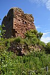 Upload another image | |||
| Glamis Road, James Hay Joiner, Former Plash Mill With Ancillary Buildings And Boundary Walls | 56°04′20″N 3°10′32″W / 56.07209°N 3.175555°W / 56.07209; -3.175555 (Glamis Road, James Hay Joiner, Former Plash Mill With Ancillary Buildings And Boundary Walls) | Category B | 46838 | Upload Photo | |||
| Harbour Road, Railway Footbridge | 56°04′08″N 3°10′29″W / 56.068782°N 3.174828°W / 56.068782; -3.174828 (Harbour Road, Railway Footbridge) | Category C(S) | 46839 | Upload Photo | |||
| 14 And 16 North Overgate, Glover's Court Including Boundary Walls | 56°04′21″N 3°10′27″W / 56.072401°N 3.174087°W / 56.072401; -3.174087 (14 And 16 North Overgate, Glover's Court Including Boundary Walls) | Category C(S) | 46853 | Upload Photo | |||
| Balmuto Bridge Over Tributary To Tiel Burn | 56°05′37″N 3°15′03″W / 56.093518°N 3.250757°W / 56.093518; -3.250757 (Balmuto Bridge Over Tributary To Tiel Burn) | Category C(S) | 46864 | Upload Photo | |||
| 1, 2 And 3 St James Place | 56°04′10″N 3°10′21″W / 56.069549°N 3.172506°W / 56.069549; -3.172506 (1, 2 And 3 St James Place) | Category C(S) | 36243 | Upload Photo | |||
| 28 - 32 (Even Nos) Nethergate And Harbour Road | 56°04′12″N 3°10′22″W / 56.069978°N 3.172792°W / 56.069978; -3.172792 (28 - 32 (Even Nos) Nethergate And Harbour Road) | Category B | 36244 | Upload Photo | |||
| 40 Nethergate, Seagate House | 56°04′11″N 3°10′21″W / 56.06981°N 3.172466°W / 56.06981; -3.172466 (40 Nethergate, Seagate House) | Category C(S) | 36247 | Upload Photo | |||
| 16 And 18 Eastgate Including Boundary Walls | 56°04′24″N 3°10′28″W / 56.073448°N 3.174504°W / 56.073448; -3.174504 (16 And 18 Eastgate Including Boundary Walls) | Category C(S) | 36266 | Upload Photo | |||
| Raith Estate, Coupie Craigs Bridge Over Dronachy Burn | 56°06′30″N 3°12′26″W / 56.108327°N 3.207259°W / 56.108327; -3.207259 (Raith Estate, Coupie Craigs Bridge Over Dronachy Burn) | Category C(S) | 9685 | Upload Photo | |||
| Spanish Cottage And Datie Mill | 56°06′28″N 3°11′18″W / 56.107765°N 3.188365°W / 56.107765; -3.188365 (Spanish Cottage And Datie Mill) | Category B | 9700 | Upload Photo | |||
| Inchkeith Island, Lighthouse And Remains Of Inchkeith Fort And Boundary Walls | 56°02′01″N 3°08′10″W / 56.033543°N 3.136219°W / 56.033543; -3.136219 (Inchkeith Island, Lighthouse And Remains Of Inchkeith Fort And Boundary Walls) | Category B | 9707 | Upload Photo | |||
| 17 Rossland Place, Rossland House | 56°04′07″N 3°10′32″W / 56.068488°N 3.175494°W / 56.068488; -3.175494 (17 Rossland Place, Rossland House) | Category C(S) | 46855 | Upload Photo | |||
| 14 Rossland Place | 56°04′06″N 3°10′33″W / 56.068358°N 3.175939°W / 56.068358; -3.175939 (14 Rossland Place) | Category C(S) | 46857 | Upload Photo | |||
| Rossland Place, War Memorial | 56°04′08″N 3°10′34″W / 56.068994°N 3.176055°W / 56.068994; -3.176055 (Rossland Place, War Memorial) | Category C(S) | 46859 | Upload Photo | |||
| 9 St Leonard's Place And South Overgate, Julian Memorial Hall Including Boundary Walls | 56°04′18″N 3°10′25″W / 56.07155°N 3.173739°W / 56.07155; -3.173739 (9 St Leonard's Place And South Overgate, Julian Memorial Hall Including Boundary Walls) | Category C(S) | 46862 | Upload Photo | |||
| Kilrie Gate, East Lodge | 56°05′26″N 3°12′47″W / 56.090631°N 3.213183°W / 56.090631; -3.213183 (Kilrie Gate, East Lodge) | Category C(S) | 46871 | Upload Photo | |||
| Nethergate, Kinghorn Parish Church Of St Leonard (Church Of Scotland) | 56°04′11″N 3°10′17″W / 56.06982°N 3.171486°W / 56.06982; -3.171486 (Nethergate, Kinghorn Parish Church Of St Leonard (Church Of Scotland)) | Category B | 36241 |  Upload another image | |||
| Nethergate, Kinghorn Old Kirk | 56°04′12″N 3°10′16″W / 56.069867°N 3.171247°W / 56.069867; -3.171247 (Nethergate, Kinghorn Old Kirk) | Category C(S) | 36242 | Upload Photo | |||
| West Balbardie Lodge | 56°05′29″N 3°14′40″W / 56.091309°N 3.244337°W / 56.091309; -3.244337 (West Balbardie Lodge) | Category C(S) | 13003 | Upload Photo | |||
| Harbour Road, Railway Viaduct | 56°04′12″N 3°10′22″W / 56.070121°N 3.172845°W / 56.070121; -3.172845 (Harbour Road, Railway Viaduct) | Category C(S) | 46840 | Upload Photo | |||
| 1 High Street | 56°04′14″N 3°10′27″W / 56.070431°N 3.174268°W / 56.070431; -3.174268 (1 High Street) | Category C(S) | 46841 | Upload Photo | |||
| 35 North Overgate | 56°04′21″N 3°10′30″W / 56.07259°N 3.174976°W / 56.07259; -3.174976 (35 North Overgate) | Category C(S) | 46852 | Upload Photo | |||
| Drinkbetween Including Boundary Walls, Railings And Gates | 56°04′59″N 3°11′09″W / 56.082964°N 3.185737°W / 56.082964; -3.185737 (Drinkbetween Including Boundary Walls, Railings And Gates) | Category C(S) | 46868 | Upload Photo | |||
| 30 North Overgate | 56°04′22″N 3°10′29″W / 56.07271°N 3.174658°W / 56.07271; -3.174658 (30 North Overgate) | Category C(S) | 36261 | Upload Photo | |||
| 38 North Overgate And Eastgate | 56°04′22″N 3°10′29″W / 56.072861°N 3.174856°W / 56.072861; -3.174856 (38 North Overgate And Eastgate) | Category B | 36264 | Upload Photo | |||
| 1 And 3 Eastgate Including Boundary Walls | 56°04′23″N 3°10′29″W / 56.072969°N 3.174795°W / 56.072969; -3.174795 (1 And 3 Eastgate Including Boundary Walls) | Category B | 36265 | Upload Photo | |||
| Balmuto Tower Including Boundary, Garden And Terrace Walls And Gatepiers | 56°05′38″N 3°15′14″W / 56.093899°N 3.253968°W / 56.093899; -3.253968 (Balmuto Tower Including Boundary, Garden And Terrace Walls And Gatepiers) | Category B | 9686 | Upload Photo | |||
| Grangehill House With Pavilions And Link Walls, Boundary Walls, Gatepiers And Gates | 56°04′02″N 3°11′29″W / 56.067141°N 3.191258°W / 56.067141; -3.191258 (Grangehill House With Pavilions And Link Walls, Boundary Walls, Gatepiers And Gates) | Category B | 9698 | Upload Photo | |||
| Burntisland Road, Kinghorn Golf Club, Clubhouse Including Boundary Walls | 56°03′59″N 3°10′45″W / 56.066439°N 3.179254°W / 56.066439; -3.179254 (Burntisland Road, Kinghorn Golf Club, Clubhouse Including Boundary Walls) | Category C(S) | 46835 | Upload Photo | |||
| Nethergate, 6 And 7 St Clair's Entry | 56°04′11″N 3°10′22″W / 56.06978°N 3.172818°W / 56.06978; -3.172818 (Nethergate, 6 And 7 St Clair's Entry) | Category C(S) | 46850 | Upload Photo | |||
| Nethergate, Kinghorn Parish Church Graveyard With Stones, Boundary Walls, Gatepiers, Gates And Railings | 56°04′11″N 3°10′16″W / 56.069724°N 3.17113°W / 56.069724; -3.17113 (Nethergate, Kinghorn Parish Church Graveyard With Stones, Boundary Walls, Gatepiers, Gates And Railings) | Category B | 46851 | Upload Photo | |||
| Pettycur Harbour | 56°03′45″N 3°10′51″W / 56.062381°N 3.180768°W / 56.062381; -3.180768 (Pettycur Harbour) | Category C(S) | 46854 |  Upload another image | |||
| Glassmount Conservatory | 56°05′01″N 3°12′48″W / 56.083577°N 3.213202°W / 56.083577; -3.213202 (Glassmount Conservatory) | Category A | 46869 | Upload Photo | |||
| Raith Estate, West Balbarton Farmhouse Including Walled Garden | 56°06′30″N 3°13′50″W / 56.108242°N 3.230476°W / 56.108242; -3.230476 (Raith Estate, West Balbarton Farmhouse Including Walled Garden) | Category C(S) | 46874 | Upload Photo | |||
| Bruce Terrace, Bowbutts Dovecot | 56°04′25″N 3°10′25″W / 56.073592°N 3.173512°W / 56.073592; -3.173512 (Bruce Terrace, Bowbutts Dovecot) | Category B | 36268 | Upload Photo | |||
| 38 Nethergate (3 St Clair's Entry) | 56°04′12″N 3°10′21″W / 56.069891°N 3.172516°W / 56.069891; -3.172516 (38 Nethergate (3 St Clair's Entry)) | Category B | 36246 | Upload Photo | |||
| Grange House Including Walled Garden, Boundary Walls And Gates | 56°05′03″N 3°10′26″W / 56.084217°N 3.173964°W / 56.084217; -3.173964 (Grange House Including Walled Garden, Boundary Walls And Gates) | Category C(S) | 9696 | Upload Photo | |||
| Glassmount Sundial | 56°05′02″N 3°12′43″W / 56.083779°N 3.211859°W / 56.083779; -3.211859 (Glassmount Sundial) | Category C(S) | 9706 | Upload Photo | |||
| 37-39 (Odd Nos) High Street | 56°04′12″N 3°10′29″W / 56.070049°N 3.174786°W / 56.070049; -3.174786 (37-39 (Odd Nos) High Street) | Category C(S) | 46843 | Upload Photo | |||
| Nethergate, 4 St Clair's Entry | 56°04′11″N 3°10′22″W / 56.069854°N 3.172644°W / 56.069854; -3.172644 (Nethergate, 4 St Clair's Entry) | Category B | 46849 | Upload Photo | |||
| 4 North Overgate Including Boundary Walls | 56°04′20″N 3°10′26″W / 56.072151°N 3.173902°W / 56.072151; -3.173902 (4 North Overgate Including Boundary Walls) | Category B | 36260 | Upload Photo | |||
| 34 North Overgate | 56°04′22″N 3°10′29″W / 56.072745°N 3.174756°W / 56.072745; -3.174756 (34 North Overgate) | Category B | 36262 | Upload Photo | |||
| Kinghorn Road, Alexander Iii Monument | 56°03′52″N 3°12′00″W / 56.064308°N 3.199892°W / 56.064308; -3.199892 (Kinghorn Road, Alexander Iii Monument) | Category B | 13639 | Upload Photo | |||
| West Balbardie Including Gatepiers | 56°05′32″N 3°14′38″W / 56.092115°N 3.243784°W / 56.092115; -3.243784 (West Balbardie Including Gatepiers) | Category C(S) | 9687 | Upload Photo | |||
| Inchkeith Island, Batteries | 56°01′47″N 3°08′02″W / 56.029729°N 3.133797°W / 56.029729; -3.133797 (Inchkeith Island, Batteries) | Category B | 9709 | Upload Photo | |||
| Inch View, Railway Tunnel No 71A | 56°03′57″N 3°10′49″W / 56.065962°N 3.1803°W / 56.065962; -3.1803 (Inch View, Railway Tunnel No 71A) | Category C(S) | 46846 | Upload Photo | |||
| 8 Rossland Place Including Boundary Walls | 56°04′07″N 3°10′34″W / 56.068635°N 3.176076°W / 56.068635; -3.176076 (8 Rossland Place Including Boundary Walls) | Category C(S) | 46856 | Upload Photo | |||
| Banchory Including Walled Garden, Boundary Walls And Gates | 56°04′55″N 3°11′24″W / 56.081971°N 3.189932°W / 56.081971; -3.189932 (Banchory Including Walled Garden, Boundary Walls And Gates) | Category C(S) | 46865 | Upload Photo | |||
| Bruce Terrace, Bowbutts House With Ancillary Building | 56°04′25″N 3°10′26″W / 56.073535°N 3.173832°W / 56.073535; -3.173832 (Bruce Terrace, Bowbutts House With Ancillary Building) | Category A | 36267 | Upload Photo | |||
| Bruce Terrace, Bowbutts Gatepiers, Gates And Enclosing Boundary Walls | 56°04′23″N 3°10′23″W / 56.073193°N 3.172922°W / 56.073193; -3.172922 (Bruce Terrace, Bowbutts Gatepiers, Gates And Enclosing Boundary Walls) | Category C(S) | 36269 | Upload Photo | |||
| Rossland Place, Public Library And Community Centre (Formerly Kinghorn Primary School) | 56°04′05″N 3°10′35″W / 56.067986°N 3.17633°W / 56.067986; -3.17633 (Rossland Place, Public Library And Community Centre (Formerly Kinghorn Primary School)) | Category B | 36250 | Upload Photo | |||
| St Leonard's Place And North Overgate, Town House Including Boundary Walls, Exercise Yard And Railings | 56°04′18″N 3°10′26″W / 56.071764°N 3.173923°W / 56.071764; -3.173923 (St Leonard's Place And North Overgate, Town House Including Boundary Walls, Exercise Yard And Railings) | Category B | 36251 |  Upload another image | |||
| 43 North Overgate | 56°04′22″N 3°10′31″W / 56.072722°N 3.175301°W / 56.072722; -3.175301 (43 North Overgate) | Category C(S) | 36255 | Upload Photo | |||
| 1 Townhead Including Boundary Walls | 56°04′22″N 3°10′32″W / 56.072747°N 3.175447°W / 56.072747; -3.175447 (1 Townhead Including Boundary Walls) | Category C(S) | 36256 | Upload Photo | |||
| Townhead, Kilcruik Cottage Including Boundary Walls | 56°04′21″N 3°10′38″W / 56.072479°N 3.177206°W / 56.072479; -3.177206 (Townhead, Kilcruik Cottage Including Boundary Walls) | Category C(S) | 36258 | Upload Photo | |||
| 2 North Overgate, Viewforth House Including Boundary Walls | 56°04′19″N 3°10′26″W / 56.072062°N 3.173787°W / 56.072062; -3.173787 (2 North Overgate, Viewforth House Including Boundary Walls) | Category B | 36259 | Upload Photo | |||
| Pitteadie Castle Including Walled Garden | 56°05′21″N 3°11′42″W / 56.089155°N 3.195024°W / 56.089155; -3.195024 (Pitteadie Castle Including Walled Garden) | Category B | 9697 | Upload Photo | |||
| Kilrie House Including Gatepiers | 56°05′42″N 3°12′52″W / 56.094959°N 3.21438°W / 56.094959; -3.21438 (Kilrie House Including Gatepiers) | Category B | 9702 | Upload Photo | |||
| Glassmount House | 56°05′02″N 3°12′46″W / 56.083751°N 3.21287°W / 56.083751; -3.21287 (Glassmount House) | Category C(S) | 9704 | Upload Photo | |||
| Inchkeith Island, Memorial To Lord Herbert Of Lea | 56°01′58″N 3°08′10″W / 56.032852°N 3.136135°W / 56.032852; -3.136135 (Inchkeith Island, Memorial To Lord Herbert Of Lea) | Category C(S) | 9708 | Upload Photo | |||
| 1 - 5 Cuinzie Neuk And Tron Gate | 56°04′14″N 3°10′27″W / 56.070622°N 3.174049°W / 56.070622; -3.174049 (1 - 5 Cuinzie Neuk And Tron Gate) | Category C(S) | 46836 | Upload Photo | |||
| 20 Eastgate | 56°04′24″N 3°10′28″W / 56.073467°N 3.17444°W / 56.073467; -3.17444 (20 Eastgate) | Category C(S) | 46837 | Upload Photo | |||
| 4 Kilcruik Road, The Manse Including Boundary Walls | 56°04′22″N 3°10′43″W / 56.072726°N 3.178563°W / 56.072726; -3.178563 (4 Kilcruik Road, The Manse Including Boundary Walls) | Category B | 46848 | Upload Photo | |||
| Banchory Farm, Grieves House With Ancillary Buildings | 56°04′54″N 3°11′18″W / 56.081601°N 3.18825°W / 56.081601; -3.18825 (Banchory Farm, Grieves House With Ancillary Buildings) | Category C(S) | 46866 | Upload Photo | |||
| Craigencalt Farm Ecology Centre, Former Mill Building, Steading, The Hermitage And Ancillary Building | 56°04′30″N 3°11′32″W / 56.075065°N 3.192306°W / 56.075065; -3.192306 (Craigencalt Farm Ecology Centre, Former Mill Building, Steading, The Hermitage And Ancillary Building) | Category C(S) | 46867 | Upload Photo | |||
| Glassmount Steading With Boundary Walls And Gatepiers | 56°05′01″N 3°12′52″W / 56.083549°N 3.21431°W / 56.083549; -3.21431 (Glassmount Steading With Boundary Walls And Gatepiers) | Category B | 46870 | Upload Photo |
Key
The scheme for classifying buildings in Scotland is:
- Category A: "buildings of national or international importance, either architectural or historic; or fine, little-altered examples of some particular period, style or building type."[1]
- Category B: "buildings of regional or more than local importance; or major examples of some particular period, style or building type, which may have been altered."[1]
- Category C: "buildings of local importance; lesser examples of any period, style, or building type, as originally constructed or moderately altered; and simple traditional buildings which group well with other listed buildings."[1]
In March 2016 there were 47,288 listed buildings in Scotland. Of these, 8% were Category A, and 50% were Category B, with the remaining 42% being Category C.[2]
See also
Notes
- ^ Sometimes known as OSGB36, the grid reference (where provided) is based on the British national grid reference system used by the Ordnance Survey.
• "Guide to National Grid". Ordnance Survey. Retrieved 12 December 2007.
• "Get-a-map". Ordnance Survey. Retrieved 17 December 2007. - ^ Historic Environment Scotland assign a unique alphanumeric identifier to each designated site in Scotland, for listed buildings this always begins with "LB", for example "LB12345".
References
- All entries, addresses and coordinates are based on data from Historic Scotland. This data falls under the Open Government Licence
- ^ a b c "What is Listing?". Historic Environment Scotland. Retrieved 29 May 2018.
- ^ Scotland's Historic Environment Audit 2016 (PDF). Historic Environment Scotland and the Built Environment Forum Scotland. pp. 15–16. Retrieved 29 May 2018.


