Le Change
You can help expand this article with text translated from the corresponding article in French. (August 2013) Click [show] for important translation instructions.
- View a machine-translated version of the French article.
- Machine translation, like DeepL or Google Translate, is a useful starting point for translations, but translators must revise errors as necessary and confirm that the translation is accurate, rather than simply copy-pasting machine-translated text into the English Wikipedia.
- Do not translate text that appears unreliable or low-quality. If possible, verify the text with references provided in the foreign-language article.
- You must provide copyright attribution in the edit summary accompanying your translation by providing an interlanguage link to the source of your translation. A model attribution edit summary is
Content in this edit is translated from the existing French Wikipedia article at [[:fr:Le Change]]; see its history for attribution. - You may also add the template
{{Translated|fr|Le Change}}to the talk page. - For more guidance, see Wikipedia:Translation.
Part of Bassillac et Auberoche in Nouvelle-Aquitaine, France
Le Change | |
|---|---|
Part of Bassillac et Auberoche | |
 | |
Location of Le Change  | |
45°11′41″N 0°53′41″E / 45.1947°N 0.8947°E / 45.1947; 0.8947 | |
| Country | France |
| Region | Nouvelle-Aquitaine |
| Department | Dordogne |
| Arrondissement | Périgueux |
| Canton | Haut-Périgord noir |
| Commune | Bassillac et Auberoche |
| Area 1 | 16.22 km2 (6.26 sq mi) |
| Population (2019)[1] | 634 |
| • Density | 39/km2 (100/sq mi) |
| Time zone | UTC+01:00 (CET) |
| • Summer (DST) | UTC+02:00 (CEST) |
| Postal code | 24640 |
| Elevation | 92–228 m (302–748 ft) (avg. 106 m or 348 ft) |
| 1 French Land Register data, which excludes lakes, ponds, glaciers > 1 km2 (0.386 sq mi or 247 acres) and river estuaries. | |
Le Change (French pronunciation: [lə ʃɑ̃ʒ]; Limousin: Lo Chamnhe) is a former commune in the Dordogne department in Nouvelle-Aquitaine in southwestern France. On 1 January 2017, it was merged into the new commune Bassillac et Auberoche.[2]
Population
|
|
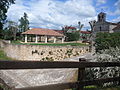
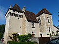
Gallery


See also
References
Wikimedia Commons has media related to Le Change.
Authority control databases | |
|---|---|
| International |
|
| National |
|
- v
- t
- e


