Langedijke
Village in Friesland, Netherlands
Langedijke Langedike (West Frisian) | |
|---|---|
Village | |
 | |
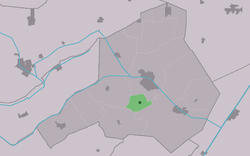 Location in Ooststellingwerf municipality | |
52°57′53″N 6°17′19″E / 52.96472°N 6.28861°E / 52.96472; 6.28861 | |
| Country |  Netherlands Netherlands |
| Province |  Friesland Friesland |
| Municipality |  Ooststellingwerf Ooststellingwerf |
| Area [1] | |
| • Total | 4.76 km2 (1.84 sq mi) |
| Elevation [2] | 5 m (16 ft) |
| Population (2021)[1] | |
| • Total | 320 |
| • Density | 67/km2 (170/sq mi) |
| Postal code | 8425[1] |
| Dialing code | 0516 |
Langedijke (West Frisian: Langedike) is a village consisting of about 290 inhabitants in the municipality of Ooststellingwerf in 2017[3] in the east of Friesland, the Netherlands.
The village was first mentioned in 1408 as Langedijc, and means "long dike".[4] The church was demolished in 1830, and only a bell tower remained. The bell dates from 1300 and is one of the oldest bells of Frieslands.[5]
In 1840, Langedijke was home to 36 people.[6]

References
- ^ a b c "Kerncijfers wijken en buurten 2021". Central Bureau of Statistics. Retrieved 1 April 2022.
- ^ "Postcodetool for 8435SB". Actueel Hoogtebestand Nederland (in Dutch). Het Waterschapshuis. Retrieved 1 April 2022.
- ^ Villages Archived 2017-09-28 at the Wayback Machine - Ooststellingwerf Municipality (in Dutch)
- ^ "Langedijke - (geografische naam)". Etymologiebank (in Dutch). Retrieved 1 April 2022.
- ^ Ronald Stenvert & Sabine Broekhoven (2000). "Oosterwolde" (in Dutch). Zwolle: Waanders. ISBN 90 400 9476 4. Retrieved 1 April 2022.
- ^ "Langedijke". Plaatsengids (in Dutch). Retrieved 1 April 2022.
Wikimedia Commons has media related to Langedijke.
- v
- t
- e
Populated places in the municipality of Ooststellingwerf
- Oosterwolde
- Appelscha
- Donkerbroek
- Elsloo
- Fochteloo
- Haule
- Haulerwijk
- Langedijke
- Makkinga
- Nijeberkoop
- Oldeberkoop
- Ravenswoud
- Waskemeer
- Aekinga
- Oude Willem (partially)
 | This Friesland location article is a stub. You can help Wikipedia by expanding it. |
- v
- t
- e


