Kambila
Commune and village in Koulikoro Region, Mali
12°47′48″N 8°6′12″W / 12.79667°N 8.10333°W / 12.79667; -8.10333 Mali
Mali (2009 census)[1]
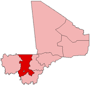
Kambila is a village and rural commune in the Cercle of Kati in the Koulikoro Region of south-western Mali. The commune has an area of 429 km2 and contains 15 villages.[2] In the 2009 census the commune had a population of 13,974.[1] The village of Kambila lies just to the east of the Route Nationale 1 (RN1) and 9 km north of Kati, the chef-lieu of the cercle.
References
- ^ a b Resultats Provisoires RGPH 2009 (Région de Koulikoro) (PDF) (in French), République de Mali: Institut National de la Statistique, archived from the original (PDF) on 2011-07-22.
- ^ Communes de la Région de Koulikoro (PDF) (in French), Ministère de l’administration territoriale et des collectivités locales, République du Mali, archived from the original (PDF) on 2012-03-09.
External links
- Plan de Sécurité Alimentaire Commune Rurale de Kambila 2008-2012 (PDF) (in French), Commissariat à la Sécurité Alimentaire, République du Mali, USAID-Mali, 2008, archived from the original (PDF) on 2012-08-14, retrieved 2012-06-10.
- v
- t
- e
 Communes and towns of Koulikoro Region
Capital: Koulikoro
- Banamba (Banamba)
- Ben Kadi (Samakele)
- Boron (Boron)
- Duguwolowula (Touba)
- Kiban (Kiban)
- Madina Sacko (Madina Sacko)
- Sebete (Sebete)
- Toubakoro (Toubakoro)

- Banko (Banko)
- Benkadi (Kotoula)
- Binko (Tingole)
- Degnekoro (Degnekoro)
- Diebé (Diebé)
- Diédougou (Belekosoba)
- Diouman (Dioumanzana)
- Dolendougou (Dandougou)
- Guegneka (Fana)
- Jekafo (Jekafo)
- Kaladougou (Diolila)
- Kemekafo (Senou)
- Kerela (Kerela)
- Kilidougou (N'Tobougou)
- Massigui (Massigui)
- Nangola (Nangola)
- Niantjila (Niantjila)
- N'Dolondougou (Mena)
- N'Garadougou (N'Gara)
- N'Golobougou (N'Golobougou)
- Tenindougou (Falako)
- Wacoro (Wacoro)
- Zan Coulibaly (Marka Coungo)
- Kati (Kati)
- Baguinéda-Camp (Baguinéda-Camp)
- Bankoumana (Bankoumana)
- Bossofala (Neguela)
- Bougoula (Bougoula)
- Daban (Daban)
- Diago (Diago)
- Dialakoroba (Dialakoroba)
- Dialakorodji (Dialakorodji)
- Diédougou (Torado)
- Dio-Gare (Dio-Gare)
- Dogodouman (Dogodouman)
- Dombila (Dombila)
- Doubabougou (Doubabougou)
- Faraba (Faraba)
- Kalabancoro (Kalabancoro)
- Kalifabougou (Kalifabougou)
- Kambila (Kambila)
- Kourouba (Kourouba)
- Mandé (Ouezzindougou)
- Moribabougou (Moribabougou)
- Mountougoula (Mountougoula)
- N'Gabacoro (N'Gabacoro-Droit)
- N'Gouraba (N'Gouraba)
- Niagadina (Niagadina)
- Nioumamakana (Nioumamakana)
- N'Tjiba (Faladié)
- Ouélessébougou (Ouélessébougou)
- Safo (Safo)
- Sanankoro Djitoumou (Sanankoro Djitoumou)
- Sanankoroba (Sanankoroba)
- Sangarébougou (Sangarébougou)
- Siby
- Sobra (Sandama)
- Tiakadougou-Dialakoro (Tiakadougou-Dialakoro)
- Tiélé (Tiélé)
- Yélékébougou (Yélékébougou)
 | This Koulikoro Region location article is a stub. You can help Wikipedia by expanding it. |
- v
- t
- e


