Jagathala
Village in Tamil Nadu, India
Jagathala Jegathala or Jakkadha | |
|---|---|
Village | |
| 11°24′16″N 76°46′58″E / 11.40444°N 76.78278°E / 11.40444; 76.78278 | |
| Country |  India India |
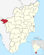
| State | Tamil Nadu |
| District | The Nilgiris |
| Population (2011) | |
| • Total | 14,383 |
| Languages | |
| • Official | Tamil |
| Time zone | UTC+5:30 (IST) |
| Vehicle registration | TN43 |
Jagathala is a panchayat town in The Nilgiris district in the Indian state of Tamil Nadu.
Demographics
As of 2011[update] India census,[1] Jegathala had a population of 14,383. Males constitute 49% of the population and females 51%. Jegathala has an average literacy rate of 79%, higher than the national average of 59.5%; male literacy is 86%, and female literacy is 73%; 9% of the population are under 6 years of age. There are about 400 household in this village.
Jegathala is one of the panchayat towns in Nilgiris, located at an altitude of 1,850 m above sea level. It is 7 km from Coonoor and 13 km from Ooty.
References
- ^ "Census of India 2011: Data from the 2011 Census, including cities, villages and towns (Provisional)". Census Commission of India. Archived from the original on 16 June 2004. Retrieved 1 November 2008.
- v
- t
- e
Nilgiris district
- Udagamandalam
- India
- Tamil Nadu
villages
- Adikaratti
- Achanakal
- Aravenu
- Aruvankadu
- Athigaratty
- Avilanji
- Bandishola
- Bearhatty
- Bellikkal
- Bikketti
- Burliar
- Chembakolli
- Cherangode
- Devala
- Devarshola
- Forest Dale
- Halatty Manithalatty
- Hubbathala
- Hullickal
- Ithalar
- Jandha
- Jegathala
- Ketti
- Kilkunda
- Kinnakorai
- Koderi
- Kotagiri
- Kundha Hosahatty
- Kuruthukuli
- Lovedale
- Manihatty
- Mango Orange
- Melur
- Mulligoor
- Naduvattam
- O' Valley
- Pandalur
- Sholur
- Sundatty
- Thambatty
- Thangadu
- Thanthanadu
- Theppakadu
- Wellington
- Yedakadu
- Yedapalli
- Yellanahalli
| Lakes | |
|---|---|
| Mountains | |
| Peaks | |
| Rivers | |
| Waterfalls |
- People
 | This article related to a location in The Nilgiris District, Tamil Nadu, India is a stub. You can help Wikipedia by expanding it. |
- v
- t
- e


