Gruinart Flats
| Designations | |
|---|---|
Ramsar Wetland | |
| Official name | Gruinart Flats, Islay |
| Designated | 14 July 1988 |
| Reference no. | 401[1] |

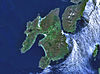
The Gruinart Flats is a low-lying landform on the western part of the isle of Islay in Scotland. The locale is an important conservation area, having been designated as an SSSI. Much of the Gruinart Flats is a marshy area operated by the Royal Society for the Protection of Birds. This vicinity is known to be an early habitation site by Mesolithic peoples.[2]
See also
- Loch Gruinart
Footnotes
References
- Hunter-gatherer landscape archaeology: the Southern Hebrides Mesolithic. 2001. ed. Steven Mithen, 684 pages
External links
Wikimedia Commons has media related to Gruinart.
55°49′5″N 6°19′55″W / 55.81806°N 6.33194°W / 55.81806; -6.33194
- v
- t
- e
Islay
- Ardbeg
- Ardilistry
- Ardtalla
- Ballygrant
- Bowmore
- Bridgend
- Bruichladdich
- Bunnahabhain
- Easter Ellister
- Kilchiaran
- Kilchoman
- Kilmeny
- Lagavulin
- Nerabus
- Port Askaig
- Port Charlotte
- Port Ellen
- Portnahaven
- Battle of Benbigrie
- Battle of Traigh Ghruinneart
- Battle of Epiphany
- Cenél nÓengusa
- Clan MacDonald of Dunnyveg
- Clark Cottage
- Dun Bhruichlinn
- Dun Guaidhre
- Dun Nosebridge
- Dunlossit House
- Dunyvaig Castle
- Finlaggan
- Islay Charter
- Islay House
- Islay LIMPET
- Islay Woollen Mill
- Kildalton Castle
- Kilarrow Parish Church
- RAF Kilchiaran
- Kildalton Cross
- Loch Gorm Castle
- Margadale
- Mulindry House
- Ramsay Hall, Port Ellen
- St John's Church, Port Ellen
 | This Scottish location article is a stub. You can help Wikipedia by expanding it. |
- v
- t
- e


