Geology of the Canary Islands


The geology of the Canary Islands is dominated by volcanoes and volcanic rock. The Canary Islands are a 450 km-long (280 mi), east-west aligned archipelago of volcanic islands in the North Atlantic Ocean, 100–500 km (60–310 mi) off the coast of Northwest Africa.[1] The islands are located on the African tectonic plate. The Canary Islands are an example of intraplate volcanism because they are located far (more than 600 km (370 mi)) from the edges of the African Plate.[2]
From east to west, the main islands are Lanzarote, Fuerteventura, Gran Canaria, Tenerife, La Gomera, La Palma, and El Hierro.[Note 1] There are also some minor islands and islets: La Graciosa, Lobos, and the Chinijo Archipelago (Alegranza, Montaña Clara, Roque del Este and Roque del Oeste). The seven main Canary Islands originated as submarine seamount volcanoes on the ocean floor, which is 1,000–4,000 m (3,000–13,000 ft) deep in the Canarian region.
Lanzarote and Fuerteventura are separated by an 11 km-wide (7 mi), 40 m-deep (130 ft) ocean strait. Both islands are parts of a volcanic ridge called the Canary Ridge. These two islands have sometimes been a single island in the past when worldwide sea level was lower than its present level.[4]
The Canary Islands, and some seamounts to the north-east, form the Canary Volcanic Province. The current long period of volcanic activity in this province started about 70 million years ago.[5] For the first 50 million years, all the volcanic eruptions in the province occurred on the ocean floor but since 20 million years ago, enough lava has accumulated on the ocean floor at several particular locations in the province to form each of the islands in turn.
Volcanic activity has occurred during the Holocene Epoch (the last 11,700 years) on all of the main islands except La Gomera.[6] The Canary Islands region is still volcanically active. The most recent volcanic eruption on land occurred in 2021[7] and the most recent underwater eruption was in 2011-12.[5]
Regional setting
Volcanic activity in the Canary Volcanic Province started about 70 Ma (million years ago), occurring at numerous seamounts and the Savage Islands, across an area of the ocean floor up to 400 km (250 mi) north of the Canary Islands. The northernmost of this group of seamounts, Lars seamount (about 380 km (240 mi) north of Lanzarote), has been dated to 68 Ma. The seamounts are progressively younger southwestwards towards Lanzarote.[8]
The Canary Islands are built upon one of the oldest regions of Earth's oceanic crust (175–147 Ma), part of the slow-moving African Plate, in the continental rise section of northwest Africa's passive continental margin.[9][10] The oceanic lithosphere is about 60 km (40 mi) thick at the central Canary Islands and about 100 km (60 mi) thick at the western islands.[11]
Two seamounts, Las Hijas (southwest of El Hierro) and El Hijo de Tenerife (about 200,000 years old, located between Gran Canaria and Tenerife) may eventually (in the next 500,000 years) form new islands by future eruptions adding more lava flows to their volcanic edifices.[12]
Growth stages

Volcanic oceanic islands, such as the Canary Islands, form in deep parts of the oceans. This type of island forms by a sequence of development stages:[13]
- submarine (seamount) stage
- shield-building stage
- declining stage (La Palma and El Hierro)
- erosion stage (La Gomera)
- rejuvenation/post-erosional stage (Fuerteventura, Lanzarote, Gran Canaria and Tenerife).[13]
The Canary Islands differ from some other volcanic oceanic islands, such as the Hawaiian Islands: for example, the Canary Islands have stratovolcanoes, compression structures and a lack of significant subsidence.[13]
The seven main Canary Islands originated as separate submarine seamount volcanoes on the floor of the Atlantic Ocean (although the distance between Lanzarote and Fuerteventura was small enough for their seamounts to overlap as they grew; the distance between Tenerife and La Gomera was also small enough for their seamounts to overlap as they grew). Each seamount, built up by the eruption of many lava flows, eventually became an island. Subaerial volcanic eruptions continued on each island. Late-stage fissure eruptions dominated on Lanzarote and Fuerteventura, resulting in relatively subdued topography with heights below 1,000 m (3,300 ft). The other islands are much more rugged and mountainous. The volcanic edifice of Tenerife, which is capped by Teide stratovolcano, rises about 7,500 m (24,600 ft) above the ocean floor (about 3,780 m (12,400 ft) underwater and 3,715 m (12,188 ft) above sea level);[Note 2] measured from the ocean floor, it is the tallest volcanic edifice on Earth, except for a few in Hawaii.[15][16][17]
The volume of volcanic rock that has built up the Canary Islands to thousands of metres above the ocean floor is about 124,600 km3 (29,900 cu mi); 96% of this lava is hidden below sea level and only 4% (4,940 km3 (1,190 cu mi)) is above sea level.[18] The western islands have more of their volume (7%) above sea level than do the eastern islands (2%).[18]
Age
From about 70 Ma to about 20 Ma, all the volcanic activity in the Canary Islands region occurred as underwater eruptions and the islands did not yet exist. Eventually, enough lava accumulated at particular locations to form each island of the Canary Islands archipelago. The age of the first underwater eruptions differs from island to island; for example, the first underwater eruptions at La Gomera were at more than 12 Ma but at La Palma they were at 4 Ma. Seamount stage rocks are not exposed on Lanzarote, Tenerife, Gran Canaria and El Hierro, which has prevented dating of the earliest underwater volcanic activity at these islands.
The age of the oldest subaerially-erupted lavas on each island decreases from east to west along the island chain: Lanzarote-Fuerteventura (20.2 Ma), Gran Canaria (14.6 Ma), Tenerife (11.9 Ma), La Gomera (9.4 Ma), La Palma (1.7 Ma) and El Hierro (1.1 Ma).[19][2]
Rock types

Volcanic rock types found on the Canary Islands are typical of oceanic islands. The volcanic rocks include alkali basalts, basanites, phonolites, trachytes, nephelinites, trachyandesites, tephrites and rhyolites.[13][6]
Outcrops of plutonic rocks (for example, syenites, gabbros and pyroxenites) that formed deep below the surface occur on Fuerteventura,[20] La Gomera and La Palma. Apart from some islands of Cape Verde (another volcanic island group in the Atlantic Ocean, about 1,400 km (900 mi) south-west of the Canary Islands), Fuerteventura is the only oceanic island known to have outcrops of carbonatite.[21]
Volcanic landforms

Examples of the following types of volcanic landforms occur in the Canary Islands: shield volcano, stratovolcano, collapse caldera, erosion caldera, cinder cone, coulee, tuff cone, tuff ring, maar, lava flow, lava flow field, dyke, volcanic plug.[24]
Origins of volcanism
Several hypotheses have been proposed to explain the volcanism of the Canary Islands.[25] Two hypotheses have received the most attention from geologists:[26]
- The volcanism is related to crustal fractures extending from the Atlas Mountains of Morocco.
- The volcanism is caused by the African Plate moving slowly over a hotspot in the Earth's mantle.
Currently, a hotspot (the Canary hotspot) is the explanation accepted by most geologists who study the Canary Islands.[27][28]
Evidence in favour of a hotspot origin for Canarian volcanism includes the age progression in the arcuate Canary Volcanic Province occurring in the same direction and at the same rate as in the neighbouring arcuate Madeira Volcanic Province (about 450 km (280 mi) farther north). This is consistent with the African Plate rotating anticlockwise at about 12 mm (0.47 in) per year.[29] Also, seismic tomography has revealed the existence of a region of hot rock extending from the surface, down through the oceanic lithosphere to a depth of at least 1,000 km (620 mi) in the upper mantle.[30]
Volcanic eruption distribution
Seventy-five confirmed volcanic eruptions have occurred in the Canary Islands in the Holocene Epoch (the last 11,700 years of Earth's geological history).[31] Sixteen of these eruptions have been during the Modern Era of European history (that is, after c.1480, which corresponds closely to the final stages of the Spanish conquest of the Canary Islands; therefore, these eruptions are also known as historical eruptions because Spanish written eyewitness reports exist).[31] In the last 500 years, volcanic eruptions have occurred, on average, every 30 to 35 years.[32] However, in the Modern Era, the repose period between infrequent eruptions at each island has been highly variable (for example, 26 to 237 years for La Palma; 1 to 212 years for Tenerife), making reliable prediction of future eruptions unlikely.[33][31]
| Island | Holocene (last 11,700 years) | Modern Era (since c. 1480) | Modern Era eruption dates | Notes | Ref. |
|---|---|---|---|---|---|
| Lanzarote | 4 | 2 | 1730–1736, 1824 | [34] | |
| Fuerteventura | 0 | 0 | —— | No specific confirmed Holocene eruptions, but they are inferred to have occurred (based on the freshness of some lavas and some volcanic landforms) | [35] |
| Gran Canaria | 11 | 0 | —— | [36] | |
| Tenerife | 42 | 5 | 1492, 1704–1705, 1706, 1798, 1909 | [37] | |
| La Gomera | 0 | 0 | —— | [32] | |
| La Palma | 14 | 8 | 1481(±11), 1585, 1646, 1677–1678, 1712, 1949, 1971, 2021 | [38] | |
| El Hierro | 4 | 1 | 2011–2012 | [39] |
Lanzarote

Volcanic activity at Lanzarote started during the Oligocene Epoch at 28 Ma.[40] For about the first 12 million years, the lava pile of a submarine seamount built up from the 2,500 m-deep (8,200 ft) ocean floor.[41] Then, in the Miocene Epoch, from 15.6 Ma to 12 Ma, the Los Ajaches subaerial shield volcano grew as an island on top of the seamount, in an area corresponding to present-day southern Lanzarote.[42] Between 10.2 Ma and 3.8 Ma, volcanic activity was focussed about 35 km (22 mi) to the northeast, forming a second shield volcanic island called Famara.[43] Between Los Ajaches and Famara volcanoes, a central volcanic edifice was also active from 6.6 to 6.1 Ma.[44] The edifices gradually merged to form a single island, Lanzarote, at about 4 Ma.[45] From 3.9 Ma to 2.7 Ma, volcanic activity paused and the island was eroded.[46] Today, although the lavas of Los Ajaches volcano are now mostly covered by calcrete,[47] the eroded remains of the two shield volcanoes are preserved in southern and northern Lanzarote respectively, with small outcrops of the central edifice occurring between them. At about 2.7 Ma, in the late Pliocene Epoch, the rejuvenation stage began. It produced much less lava than the earlier shield stage, mainly at the Montaña Roja and Montaña Bermeja volcanoes in southern Lanzarote.[46] Then, throughout the subsequent Pleistocene and Holocene epochs, the rejuvenation volcanism has continued and has been dominated by strombolian-style eruptions of lava from sets of volcanic cones aligned along numerous NE-SW fissures in the central part of Lanzarote.[48] Geologically recent examples of rejuvenation stage volcanism include eruptions at Montaña Corona (about 21,000 years ago), Timanfaya (1730–1736) and Tao/Nuevo del Fuego/Tinguatón (1824).[49][50][51]

The Timanfaya eruption (1730–1736) erupted more than one billion cubic metres (1 km3 (0.24 cu mi)) of lava, and a large volume of pyroclastic tephra, from more than 30 volcanic vents along a 14 km-long (9 mi) fissure in western Lanzarote. The lava flows cover one quarter of the island (an area of about 225 km2 (87 sq mi)) with some of the flows reaching about 50 m (160 ft) in thickness. It is the largest Modern Era eruption in the Canary Islands, and the third largest eruption of basaltic lava on Earth in historical times.[52][53][54][55][56]
Almost all the volcanic rocks of Lanzarote are basaltic.[57]
Fuerteventura

Fuerteventura is situated on Mesozoic oceanic crust, about 70 km (40 mi) from the edge of the African continental shelf and about 100 km (60 mi) from the African mainland, making it the Canarian island closest to Africa.

Due to its old age, the oceanic crust at Fuerteventura is relatively rigid and this has prevented subsidence and allowed weathering and erosion to expose deep levels of the island's geological structure.[58]
The two main rock sequences of Fuerteventura are (1) a lower, older (Cretaceous to early Miocene) sequence of sedimentary, plutonic and submarine seamount volcanic rocks with intrusive dykes, often called the "Basal Complex", which is unconformably overlain by (2) a younger sequence of Miocene, Pliocene and Quaternary subaerial volcanic rocks.
The oldest rocks of Fuerteventura are a set of mafic plutonic rocks, marine sedimentary rocks and volcanic rocks, which are intruded by igneous dykes.[59] The sedimentary rocks of the Basal Complex were deposited on the ocean floor and represent the uppermost part of the oceanic crust that was uplifted and incorporated into the volcanic edifice during volcanic activity. The Mesozoic sedimentary rocks are mostly metamorphosed, and they are steeply tilted. The tilting occurred in the mid-Cretaceous and was probably caused by the uplift of Africa.[60][61] Fuerteventura's first alkaline magmatism intruded plutonic rocks into the oceanic crust at about 70 Ma.[13] This signifies a change to a hotspot environment. A submarine seamount started to form on the ocean floor during the Eocene Epoch, at about 39 Ma.[13] The igneous rocks of the Basal Complex probably represent the seamount stage of Fuerteventura’s volcanic history, exposed due to uplift and erosion.[62]
In the early Miocene, volcanic activity transitioned from submarine to subaerial while the volcanic edifice was gradually built up above sea level. Fuerteventura has the oldest subaerial volcanic rocks of the Canary Islands, which have been dated to 20.6 Ma.[63] There were three main shield volcanoes built on the seamount base (from north to south): the Northern Edifice, the Central Edifice and the Jandia Edifice.[64][65] The central shield volcano is the oldest, built mostly from 22 to 18 Ma but with a later phase from 17.5 to 13 Ma. The southern shield volcano formed from 21 to 14 Ma. The northern shield volcano was built mainly from 17 to 12 Ma.[66] These shield volcanoes erupted mostly basaltic and trachybasaltic lava flows.[67]
In the late Miocene (from about 11.5 Ma), there was a pause in volcanic activity (the erosional stage). Minor volcanic eruptions resumed in the Pliocene, at about 5.1 Ma (the rejuvenation stage) and they continued sporadically into the Quaternary, with basaltic lava flows dominating again.[68]
The most recent volcanic eruption on Fuerteventura that has been dated occurred 134,000 years ago in the middle Pleistocene.[69] Some undated volcanic cones in northern Fuerteventura may have formed more recently.[70]
Weathering, erosion and sedimentation during the Pliocene and Quaternary formed coastal and shallow-sea sedimentary rocks that were eventually covered by younger aeolian sediments, alluvial fan deposits and palaeosols.[71]
Gran Canaria
After early Miocene submarine volcanic eruptions created a seamount, subaerial volcanic activity at Gran Canaria occurred in three phases: shield stage (middle- and late-Miocene, 14.5 to 8.5 Ma), erosional stage (late Miocene, 8.5 to 5.3 Ma) and rejuvenated stage (Pliocene to Quaternary, 5.3 Ma to present).[72]
The shield stage started with an early phase of eruptions of basaltic lava flows, from 14.5 to 14.1 Ma, which built the main subaerial shield volcanic edifice that forms three quarters of the subaerial volume of Gran Canaria.[73] At least three shield volcanoes were active during this stage of island development and their lava flows gradually merged together into a single large landform.[74] This was followed by a later phase, from 14.1 to 8.5 Ma, of explosive volcanic eruptions of differentiated felsic lavas (phonolites, trachytes and rhyolites) with many pyroclastic flows (that deposited ignimbrites). In central Gran Canaria, Tejeda caldera and a cone sheet swarm were formed in this phase.[75]

From 8.5 to 5.3 Ma, in the erosional stage, there was minimal volcanic activity. Erosion occurred along with deposition of alluvial sediments on the island and deposition of submarine turbidite sediments offshore.[76]
In the rejuvenation stage, from 5.3 Ma to present, volcanic activity has occurred in three phases. The first phase, from 5.3 to 2.7 Ma, was dominated by the formation of Roque Nublo stratovolcano in the central part of Gran Canaria. This produced lava flows, ignimbrites and debris avalanche deposits.[77] The second phase (3.5 to 1.5 Ma) had strombolian-style effusive eruptions of lava flows along a northwest-southeast trending volcanic rift.[78] The current phase, from 1.3 Ma to the present, has featured scattered phreatomagmatic and strombolian eruptions of very alkaline lavas.[79] The most recent volcanic eruption on Gran Canaria occurred about 2,000 years ago at Bandama crater, in the northeast part of the island.[80][81]

Sand dunes, with a total volume of 18 million cubic metres (24×10^6 cu yd), cover an area of 3.6 km2 (1.4 sq mi) of the Maspalomas cuspate foreland on Gran Canaria's south coast.[82] Aeolian landforms found in this dune field include barchan dunes and dune ridges (transverse dunes). The dunes are made of sand grains and pebbles. The average thickness of the dunes is 5–10 m (16–33 ft) but some dunes reach 20 m (66 ft) thick.[83] In a few areas, the underlying deltaic sediments are exposed.[84] The sand that has built the dunes has been moved about 2 or 3 km (1 or 2 mi) by water waves and wind from the sediment source area (an offshore submarine shelf at Playa del Inglés). Since the 1960s, urbanisation has affected the local winds and this has caused the gradual reduction in volume and area of the dune field because sediment erosion now exceeds sediment deposition.[85] The dunes had long been thought to have formed during the last several thousand years[86] but a 2021 study found evidence supporting a hypothesis that the dunes formed less than 300 years ago, as a consequence of a tsunami generated by the 1755 Lisbon earthquake.[87][88]
Tenerife

Tenerife's subaerial shield stage of island development started at about 11.9 Ma in the late Miocene Epoch.[89] First, a shield volcano called Tenerife central shield volcano grew as an island at what is now the central part of Tenerife. This central shield volcano was active from 11.9 to 8.9 Ma.[90] Most of this central shield volcano's lavas have been covered by younger lavas from younger volcanoes; some small patches of the central shield volcano's lavas are now preserved as the Roque del Conde massif in the centre of the island. Then, in northwestern Tenerife, a second shield volcano (Teno shield volcano) formed from 6.4 to 5.1 Ma; its remains are the Teno massif.[91] Then, from 4.9 to 3.9 Ma, a third shield volcano (Anaga shield volcano) was active in the northeastern part of Tenerife; the remains of this volcano are the Anaga massif.[92] The lavas of these three shield volcanoes gradually formed a combined volcanic edifice that accounts for 90% of Tenerife's current volume.[93]

The rejuvenation stage of Tenerife (after a long erosive gap in activity at the centre of Tenerife) started at about 4 Ma and continues to the present day. Between 4.0 and 0.2 Ma, a large stratovolcano (Las Cañadas volcano) formed, centred in the central part of Tenerife. Las Cañadas volcano covered some parts of the three older shield volcanoes.[94] This volcanic activity at the centre of Tenerife has included cycles of basaltic lavas (e.g. basanites and tephrites) alternating with significant amounts of magmatically differentiated (more felsic and more alkaline) lavas (e.g. tephri-phonolites and phonolites).[95] Central volcanic activity has been accompanied, since 3 Ma, by mostly basaltic fissure eruptions at a three-armed Y-shaped radial rift zone system that has northwest, northeast and south rift zones.[96] About 200,000 years ago, Las Cañadas volcano collapsed, forming Las Cañadas caldera. In this 16 km × 20 km (9.9 mi × 12.4 mi) caldera, two related stratovolcanoes have formed: Teide (most of its eruptions occurring before 30,000 years ago) and its younger, smaller, western, close neighbour Pico Viejo (most of its eruptions occurring between 27,000 and 14,600 years ago).[97] Both of these stratovolcanoes are still active. Together with some satellite vents, they form the Teide-Pico Viejo Volcanic Complex.[98][99][a][b] Most of Tenerife's Holocene eruptions have occurred at the radial rift zones rather than at the two stratovolcanoes.
During the Holocene Epoch, Tenerife has had 42 confirmed volcanic eruptions, which is more than any other Canary island.[100] Tenerife is currently at the point in its geological development where the effects of constructive volcanic eruption and destructive erosion are roughly balanced.[101]
La Gomera

The seamount base (also known as the Submarine Edifice) of La Gomera was built by volcanic eruptions during the Miocene Epoch. The precise age range of this submarine volcanic activity is uncertain. Dating done in the early 1970s suggested that submarine volcanic eruptions occurred from 20 Ma to 15 Ma, followed by an erosion gap of 5 million years. The reliability of these dates has been questioned; dating done in the 2000s suggests that submarine volcanic eruptions began instead at about 12 Ma.[102][103] At the end of the seamount stage, the seamount's top surface was eroded.[104][105] There are a few small areas of old lava flows that some geologists claim represent an upper part of the submarine seamount (a "Basal Complex" similar to those found on some of the other Canarian islands) but this is disputed; an alternative explanation is that the lavas in question instead represent early subaerial shield volcano eruption material that flowed off the island into the ocean.[106]

In the late Miocene, at about 11 Ma, La Gomera's shield-building stage began.[108] The oldest subaerially-erupted lavas on La Gomera have been dated to 9.4 Ma.[109] Most of the subaerial shield volcano's growth occurred from 9.4 to 8.0 Ma.[110] The shield volcano lavas are also known as the Old Edifice.[111] About 8 Ma, the northern part of the mafic alkaline shield volcano collapsed (the Garajonay landslide).[112]
From 7.5 Ma to 6.5 Ma, the Vallehermoso stratovolcano grew on top of the partially collapsed shield volcano by eruption of relatively felsic lavas (phonolites and trachytes) which covered much of the older shield volcano.[113][114][115]
In the early Pliocene, from 5.5 Ma to 4.2 Ma, basaltic lavas were erupted from highland volcanic vents; these lavas flowed over much of the island.[116] For the last 4 million years, there have been no significant volcanic eruptions on the island and La Gomera has been in the erosional stage of its development.[117][118][119][120] (The island's last volcanic eruption was a minor monogenetic eruption at Barranco del Machal, during the Early Pleistocene, about 1.94 Ma).[121] Erosion has exposed the deeper parts of the volcanic edifices, revealing volcanic plugs, dykes, cone sheets, and lower lava flows.[122]
Volcanic eruptions may resume on La Gomera in the future, but some geologists have suggested that La Gomera is already volcanically extinct.[123][124]
La Palma
La Palma's submarine seamount formed from 4 Ma to 3 Ma, in the Pliocene Epoch. The seamount stage rocks are layers of basaltic to trachytic pillow lavas with hyaloclastites and pillow breccias. The seamount's volcanic rocks have been intruded by younger mafic plutons and a mafic dyke swarm. Between 3 Ma and 1.77 Ma, the seamount rocks were uplifted, tilted and eroded. The structurally deepest rocks of the seamount have been metamorphosed to greenschist facies.[125] Small remnants of the seamount stage rocks are now exposed on La Palma as its "Basal Complex", for example in Barranco de las Angustias.[126][127][128]
La Palma's shield-building stage began at 1.77 Ma - the Garafía shield volcano grew, on top of the seamount, between 1.77 Ma and 1.20 Ma (forming the present-day northern part of La Palma), with the oldest subaerial lavas dated to 1.7 Ma. This shield volcano grew quickly to a height of about 3,000 m (9,800 ft) and a diameter of about 23 km (14 mi) but this volcano became unstable and its southern flank collapsed in a large landslide at 1.2 Ma.[129] Only a small part of Garafía shield volcano is visible now because much has been eroded away or is buried by younger lavas. After the Garafía landslide, the focus of volcanic activity moved slightly to the south, producing another shield volcano, named Taburiente volcano, on top of Garafía shield volcano's collapsed southern flank.[130]

For most of its active period, Taburiente shield volcano erupted basaltic lavas but final phases of its formation included phonolitic and trachytic lavas.[131] Together, the three successive, superimposed shield volcanoes (the seamount, Garafía and Taburiente) form the Northern Shield.[132]
A three-armed Y-shaped volcanic rift system developed at Taburiente volcano; this northern La Palma rift system had three radial arms - northwest, northeast and south - meeting at the shield volcano's summit. Gradually, most of Taburiente's volcanic activity became focused on the south rift.[133] From 810,000 to 560,000 years ago, the southern part of Taburiente shield volcano's edifice grew by volcanic eruptions at the south rift; these eruptions formed Cumbre Nueva, a 10 km-long (6 mi) north-south volcanic ridge in what is now central La Palma.[134][135][136] Cumbre Nueva had a period of particularly rapid growth from 621,000 to 566,000 years ago.[137]

Taburiente volcano grew to an estimated maximum height of about 3,000 m (9,800 ft)[138] but, about 525,000 years ago,[139] its edifice became unstable and part of its southern flank (including much of the west flank of Cumbre Nueva) collapsed laterally in a landslide with a volume of more than 200 km3 (48 cu mi),[140] resulting in the formation of a large crater named "Caldera de Taburiente"; it is an erosion caldera formed by mass wasting, not a collapse caldera formed by volcanic eruption. The Caldera de Taburiente is a topographic depression; from the time of the landslide until the present day, it has been enlarged by erosion and is now 15 km (9.3 mi) long, 6 km (3.7 mi) wide and 1.5 km (0.93 mi) deep.[141][142][143][144] Also after the landslide, Cumbre Nueva grew rapidly again until about 490,000 years ago.[145] A small stratovolcano, named Bejenado volcano, started forming on the floor of the Caldera de Taburiente about 523,000 years ago; it erupted lavas until about 491,000 years ago.[146] Eruptions of lava occurred at Taburiente volcano until about 400,000 years ago.[147][148][149] Volcanic activity then appears to have paused for the next 275,000 years.[150]
About 125,000 years ago,[151] the focus of volcanic activity moved south again, with eruptions of mostly mafic alkaline lavas gradually forming Cumbre Vieja, a 20 km-long (12 mi) ridge-shaped elevated rift zone volcano that has grown until the present day at southern La Palma's north-south volcanic rift zone. Cumbre Vieja reaches 1,949 m (6,394 ft) in height and it dominates the geology of the southern half of the island.[Note 3][153][154][155] From 125,000 to 20,000 years ago, volcanic eruptions occurred on all arms of southern La Palma's triple-armed volcanic rift system. Between 20,000 and 7,000 years ago, volcanic activity declined on the northwest arm and stopped completely on the northeast arm.[156]

During the Modern Era, eight confirmed eruptions have occurred at Cumbre Vieja, making La Palma the most volcanically active of the Canary Islands and accounting for half of all the volcanic eruptions in the Canary Islands during this c. 540 year timespan.[157][158] These Modern Era eruptions have mostly been of the strombolian type, forming cinder cones; magmas have been predominantly mafic in composition but some more felsic phonolites have also been produced.[159] Cumbre Vieja is still volcanically active; its three most recent eruptions are Nambroque (1949), Teneguía (1971) and Tajogaite (2021).[160] Geologically recent volcanic eruptions have also occurred along the submarine section of the north-south rift zone that extends about 20 km (12 mi) beyond the southern tip of the island.[161]
Day et al. (1999)[162] suggested that the west flank of Cumbre Vieja is in the initial stages of instability. Modelling by Ward and Day (2001, 2005)[163][164] led them to suggest that if a large landslide of Cumbre Vieja's volcanic rocks were to occur in the next few thousand years, it could displace a large volume of ocean water that would cause widespread tsunami damage along Atlantic Ocean coastlines. This suggestion has been opposed by some geologists who assess southern La Palma's volcanic rift zone to be stable and any generated tsunami would be much smaller than the modelled size, suggesting that Cumbre Vieja's collapse and damage scenarios would be less severe than Ward, Day and some popular science television documentaries have claimed.[165][166] (See also: Cumbre Vieja tsunami hazard and Megatsunami).
El Hierro
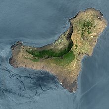
El Hierro is the youngest and smallest of the seven main Canary Islands.[167] El Hierro is in its shield-building stage.[168]
During the Early Pleistocene, a submarine seamount grew upwards from the ocean floor, almost to sea level, on top of Cretaceous-Pliocene oceanic sediments.[169][170]

Then, at 1.2 Ma, Tiñor shield volcano began to form on top of the seamount.[171] Tiñor volcano's first subaerial lava was erupted at 1.12 Ma.[172] Tiñor grew by erupting lavas across what is now the eastern half of El Hierro until about 882,000 years ago; the eruptions were mostly of effusive basaltic lava but there was also an explosive, xenolith-rich last eruptive phase (the Ventejís volcanics).[173] Instability in the edifice of Tiñor volcano resulted in the Tiñor lateral collapse landslide at about 882,000 years ago when much of the volcano's northwest flank slid downwards and onto the ocean floor.[174][175] This left a curved bay where the volcano's flank had been.
About 545,000 years ago,[176][177] El Hierro's second subaerial shield volcano, named El Golfo volcano (also known as the El Golfo-Las Playas Edifice),[178][c] started erupting. Its summit was slightly to the west of Tiñor volcano. Lavas from El Golfo volcano filled the bay that had been formed by the Tiñor landslide. El Golfo volcano's later lava flows covered the remains of Tiñor volcano. At its maximum development, El Golfo volcano was about 2,000 m (6,600 ft) high, about 20 km (12 mi) in diameter, with a surface area slightly larger than present-day El Hierro and about twice the area that Tiñor volcano had covered.[179][180] El Golfo volcano grew by erupting lava from a Y-shaped rift system with west-north-west, north-north-east and south-south-east arms; most of the eruptions occurred on the west-north-west and north-north-east arms.[181] Late-stage eruptions were of more differentiated lavas. El Golfo volcano gave El Hierro a roughly circular shape at this time.[182] Eruptions occurred at El Golfo volcano until about 176,000 years ago.[183]
The volcanic edifices of El Hierro were affected by at least two other large lateral collapse landslides of uncertain age:[184] (1) the El Julán lateral collapse, in which much of the southwest flank of El Golfo volcano slid downwards and onto the ocean floor, occurred at least 158,000 years ago;[185] (2) at least 145,000 years ago, the Las Playas lateral collapse occurred on the southeast flank of El Golfo volcano. At about the same time, slumping nearby did not result in complete downward slumping of El Golfo volcano's southeast flank into the ocean. Instead, a large detached block of rock moved about 30 m (98 ft) down a fault plane (the now inactive San Andrés fault) in what has been described as an "aborted" lateral collapse.[186][187]
El Hierro's third, and current, major phase of volcanic activity is rift volcanism; it started about 158,000 years ago.[188][189] This rift volcanism occurs at a Y-shaped volcanic rift zone system with west-north-west, north-north-east and south-south-east arms that meet at the centre of the island; all of the three rift arms have been very volcanically active.[190][191] About 200 monogenetic cinder cones occur along the ridge crests of the three rift zones (the highest density of such cones in the Canary Islands).[192] Rift phase lavas cover most of the island, not only forming the ridges along each rift zone but also partially infilling the landslide bays. The rift zones extend outwards as submarine volcanic ridges on the ocean floor; for example, the south-south-east rift zone extends underwater to at least 40 km (25 mi) south of the island.[193]

Instability in the edifice of El Golfo volcano resulted in El Hierro's youngest and largest landslide, the El Golfo lateral collapse landslide, when a large part (with a volume of 180 km3 (43 cu mi)) of the volcano's northern flank slid downwards off the island and onto the ocean floor; individual blocks of moved material, up to 1,200 m (3,900 ft) across, have slid as much as 65 km (40 mi) from their original positions.[194][195] This landslide formed the curved 14 km-wide (8.7 mi) El Golfo bay and a curved landslide scar depression, where the volcano's flank had been; the bay still forms the curved northwest coast of El Hierro.[196] The El Golfo landslide scarp is preserved today as a 26 km-long (16 mi) cliff with a maximum height of 1,400 m (4,600 ft); the cliff is roughly parallel to the coast but about 2–4 km (1.2–2.5 mi) inland, except at each end, where the cliff meets the coast. The age of the El Golfo lateral collapse landslide is poorly constrained; it occurred sometime between 133,000 and 13,000 years ago. Evidence found on land favours the older end of this age range; evidence on the ocean floor favours a young age. Carracedo et al. (1999)[197] have suggested that the conflicting evidence from land and ocean floor can be reconciled if there were two landslides instead of a single event: first, a collapse of the subaerial part of the El Golfo volcanic edifice at 133,000 years ago, then a submarine landslide at 13,000 years ago.[198][199]

It has been estimated that the large landslides on El Hierro removed more than two-thirds of the total volume of lava erupted subaerially by the two shield volcanoes and the rift cinder cones of the island.[200] This removal of lava has hampered efforts to estimate El Hierro's magma production and eruption rates.[201]
The most recent volcanic eruption on land at El Hierro occurred 2,500 years ago. Its source was a small vent located on the north-north-east rift.[202]
In 2011, a period of seismic unrest (associated with underground movements of molten magma) was followed by El Hierro's most recent volcanic eruption, which occurred underwater on the volcanic rift about 2 km (1.2 mi) south of the southern tip of the island.[203] From October 2011 to March 2012, lava erupted from a submarine volcanic vent, which was later named Tagoro.[204][205] Initially, this volcanic edifice was at a depth of 350 m (1,150 ft) but, by the end on the eruption, the edifice had grown to 88 m (289 ft) below sea level.[206]
Earthquakes
The seismicity of the Canary Islands is low. Earthquakes that occur on or near the Canary Islands are linked to volcanism and tectonism: scenarios include underground magma movement in dykes or magma chambers, normal faulting and reverse faulting.[207] On the Modified Mercalli Scale (an earthquake intensity scale ranging from I for "not felt" to XII for "extreme"), most earthquakes in the region have had an intensity of VI or less. The Timanfaya eruptions on Lanzarote in 1730, however, were accompanied by earthquakes with intensities of up to X on the same scale.[208] Earthquakes of intensity VII have occurred on La Palma (1677, 1920), on Gran Canaria (1913), and on Fuerteventua (1915, 1917).[209]
From 1 January 1975 to 31 December 2023, 168 earthquakes of magnitude 2.5 or larger, with epicentres on or close to the Canary Islands, were recorded; the largest of these earthquakes had a moment magnitude of 5.4 and an intensity of VII with its epicentre on the ocean floor about 28 km (17 mi) west of El Hierro in 2013.[210]
In 2004, an earthquake swarm occurred on Tenerife, which raised concern that a volcanic eruption may have been about to occur but no such eruption followed the swarm.[211][212]
Earthquake swarms, due to the underground movement of molten magma, were detected before and during the volcanic eruptions of 2011–2012 and 2021. In the week before the 2021 eruption on La Palma, a swarm of more than 22,000 earthquakes occurred, with mbLg magnitudes up to about 3.5. The hypocentres of successive earthquakes migrated upwards as magma rose slowly to the surface.[213][214][215] During the eruption, larger earthquakes were detected, for example an earthquake of mbLg magnitude 4.3 occurred 35 km (22 mi) below the surface.[216]
At least four tsunamis, triggered by distant earthquakes, have hit the coasts of the Canary Islands in the Modern Era. They occurred in 1755 (1755 Lisbon earthquake), 1761 (1761 Lisbon earthquake), 1941 (1941 Gloria Fault earthquake) and 1969.[217]
See also
- Canary Islands Seamount Province
- Geology of Cape Verde
- Geology of Madeira
- Geology of Morocco
- Longshore drift – Sediment moved by the longshore current
- Pico do Fogo – Mountain peak in Cape Verde
Further reading
- Carracedo, Juan Carlos; Day, Simon (2002). The Canary Islands (Classic Geology in Europe). Terra Books. ISBN 978-1903544075.
- Carracedo, Juan Carlos; Troll, Valentin R. (2016). The Geology of the Canary Islands. Amsterdam: Elsevier. ISBN 978-0-12-809663-5.
Notes
- ^ Since 2018, La Graciosa has been officially designated "la octava isla canaria habitada"[3] (the eighth inhabited island of the Canary Islands), in effect the eighth "main island". This is only a political and social designation. La Graciosa continues to be a geologically minor island of the Canary Islands, associated with its much larger neighbour Lanzarote.
- ^ The summit of Teide is 3,715 m above sea level. The volcanic cone of Teide rises 1,525 m above the floor of Las Cañadas caldera. At Teide, the volcanic edifice of Tenerife comprises Teide stratovolcano cone on top of the remains of Las Cañadas stratovolcano on top of the remains of the central shield volcano on top of the remains of the seamount.[14] Tenerife's volcanic edifice has a total height of 7,500 m (half of which is below sea level).
- ^ Cumbre Vieja means Old Summit; Cumbre Nueva means New Summit. The Old and New adjectives refer to dates of forestation. Geologically, however, Cumbre Nueva is older than Cumbre Vieja.[152]
- ^ Teide and Pico Viejo are referred to in various ways: for example, Teide stratocone and Pico Viejo stratocone, Teide edifice and Pico Viejo edifice, Teide stratovolcano and Pico Viejo stratovolcano, Teide-Pico Viejo stratovolcano, Teide volcano and Pico Viejo volcano, Teide-Pico Viejo Volcanic Complex.
- ^ Montaña Blanca, on the south-east flank of Teide, is sometimes included as a third volcano in the Teide-Pico Viejo Volcanic Complex.
- ^ El Golfo shield volcano on El Hierro should not to be confused with El Golfo tuff cone volcano on Lanzarote.
References
- ^ Schmincke, H.U. and Sumita, M. (1998) Volcanic Evolution of Gran Canaria reconstructed from Apron Sediments: Synthesis of VICAP Project Drilling in Weaver, P.P.E., Schmincke, H.U., Firth, J.V., and Duffield, W. (editors) (1998) Proceedings of the Ocean Drilling Program, Scientific Results, volume 157
- ^ a b Carracedo, Juan Carlos; Troll, Valentin R. (2021), "North-East Atlantic Islands: The Macaronesian Archipelagos", in Alderton, David; Elias, Scott A. (eds.), Encyclopedia of Geology (Second Edition), Oxford: Academic Press, pp. 674–699, doi:10.1016/b978-0-08-102908-4.00027-8, ISBN 978-0-08-102909-1, S2CID 226588940, retrieved 2021-03-16
- ^ "El Senado reconoce a La Graciosa como la octava isla canaria habitada". El País (in Spanish). 26 June 2018. Retrieved 4 December 2019.
- ^ Carracedo, J.C. and Troll, V.R. (2016) The Geology of the Canary Islands, Amsterdam, Elsevier, ISBN 978-0-12-809663-5, page 532
- ^ a b Carracedo, J.C.; Troll, V.R.; Zaczek, K.; Rodríguez-González, A.; Soler, V.; Deegan, F.M. (2015) The 2011–2012 submarine eruption off El Hierro, Canary Islands: New lessons in oceanic island growth and volcanic crisis management, Earth-Science Reviews, volume 150, pages 168–200, doi:10.1016/j.earscirev.2015.06.007
- ^ a b Tanguy, J-C. and Scarth, A. (2001) “Volcanoes of Europe”, Harpenden, Terra Publishing, ISBN 1-903544-03-3, page 101
- ^ "Lava shoots up from volcano on La Palma in Spanish Canary Islands". Reuters. 2021-09-19. Retrieved 2021-09-19.
- ^ Carracedo, J.C. and Troll, V.R. (2016) "The Geology of the Canary Islands", Amsterdam, Elsevier, ISBN 978-0-12-809663-5, page 9
- ^ Lang, N.P., Lang, K.T., Camodeca, B.M. (2012) "A geology-focused virtual field trip to Tenerife, Spain", Geological Society of America Special Paper 492, pages 323-334, doi:10.1130/2012.2492(23)
- ^ Vera, J.A. (editor) (2004) "Geologia de Espana", Madrid, SGE-IGME (in Spanish) page 637
- ^ Schmincke, H.U. and Sumita, M. (1998) "Volcanic Evolution of Gran Canaria reconstructed from Apron Sediments: Synthesis of VICAP Project Drilling" in Weaver, P.P.E., Schmincke, H.-U., Firth, J.V., and Duffield, W. (editors) (1998) "Proceedings of the Ocean Drilling Program, Scientific Results", volume 157.
- ^ Carracedo, J.C. and Troll, V.R. (2016) "The Geology of the Canary Islands", Amsterdam, Elsevier, ISBN 978-0-12-809663-5, pages 9-11
- ^ a b c d e f Viñuela, J.M. (2007). "The Canary Islands Hot Spot" (PDF). www.mantleplumes.org. Archived (PDF) from the original on 18 August 2019. Retrieved 30 November 2019.
- ^ Carracedo, J.C. and Troll, V.R. (2016) The Geology of the Canary Islands, Amsterdam, Elsevier, ISBN 978-0-12-809663-5, page 229
- ^ Hoernle, K. and Carracedo, J.C. Canary Islands, Geology in Gillespie, R. and Clague, D. (editors) (2009) Encyclopedia of Islands, page 134
- ^ Martínez-García, E. Spain in Moores, E.M. and Fairbridge, R. (editors) (1997) Encyclopedia of European and Asian Regional Geology, London, Chapman and Hall, ISBN 0-412740-400, page 680
- ^ How big are the Hawaiian volcanoes? ; United States Geological Survey; Frequently Asked Questions - Natural Hazards; https://web.archive.org/web/20220205034730/https://www.usgs.gov/faqs/how-big-are-hawaiian-volcanoes ; Retrieved 1 August 2024
- ^ a b Paris, R. (2002) "Rythmes de noconstruction et de destruction des édifices volcaniques de point chaud : I'exemple des lIes Canaries (Espagne)", Université Paris 1 Panthéon Sorbonne - Universidad de Las Palmas - Laboratoire de Géographie Physique CNRS, Doctoral Thesis, page 15, table 1 (in French)
- ^ Carracedo, J.C and Troll, V.R. (editors) (2013) “Teide Volcano:Geology and Eruptions of a Highly Differentiated Oceanic Stratovolcano”, Berlin, Springer-Verlag, ISBN 978-3-642-25892-3, Page 24
- ^ Hoernle, K. and Carracedo, J.C. Canary Islands, Geology in Gillespie, R. and Clague, D. (editors) (2009) Encyclopedia of Islands, page 140
- ^ Bell, K.; Tilton, G.R. (2002). "Probing The Mantle: The Story From Carbonatites". Eos. 83 (25): 273–280. Bibcode:2002EOSTr..83..273B. doi:10.1029/2002EO000190.
- ^ Carracedo, J.C. and Troll, V.R. (2016) "The Geology of the Canary Islands"’, Amsterdam, Elsevier, ISBN:978-0-12-809663-5, pages 224-225
- ^ IGME "Mapa Geológico Continuo de España a escala 1/50.000", ["Continuous Geological Map of Spain scale 1/50000"], https://hub.arcgis.com/maps/IGME::mapa-geol%C3%B3gico-continuo-de-espa%C3%B1a-a-escala-1-50-000-continuous-geological-map-of-spain-scale-1-50-000/explore?location=28.210836%2C-17.275109%2C14.87 Retrieved 15 August 2024
- ^ Tanguy, J-C. and Scarth, A. (2001) Volcanoes of Europe. Harpenden, Terra Publishing, ISBN 1-903544-03-3, page 100
- ^ Vonlanthen, P.; Kunze, K.; Burlini, L.; Grobety, B. (2006). "Seismic properties of the upper mantle beneath Lanzarote (Canary Islands): Model predictions based on texture measurements by EBSD" (PDF). Tectonophysics. 428 (1–4): 65–85. Bibcode:2006Tectp.428...65V. doi:10.1016/j.tecto.2006.09.005.
- ^ Carracedo, J.C. and Troll, V.R. (editors) (2013) "Teide Volcano: Geology and Eruptions of a Highly Differentiated Oceanic Stratovolcano", page 25
- ^ Yepes, J.A. (2007). "The Canary Islands Topobathymetric Relief Map - Aspect Of The Sea Bed And Geology" (PDF). Spanish Institute of Oceanography (IEO). Retrieved 25 July 2018.
- ^ Weis, F.A.; Skogby, H.; Troll, V.R.; Deegan, F.M.; Dahren, B. (2015). "Magmatic water contents determined through clinopyroxene: Examples from the Western Canary Islands, Spain". Geochemistry, Geophysics, Geosystems. 16 (7): 2127–2146. Bibcode:2015GGG....16.2127W. doi:10.1002/2015GC005800. hdl:10553/72171. S2CID 128390629.
- ^ Hoernle, K. and Carracedo, J-C. "Canary Islands, Geology" in Gillespie, R. and Clague, D. (editors) (2009) "Encyclopedia of Islands", page 142
- ^ Carracedo, J.C. and Troll, V.R. (2016) "The Geology of the Canary Islands", Amsterdam, Elsevier, ISBN 978-0-12-809663-5, pages 15-16
- ^ a b c Spain Volcanoes – Smithsonian Institution Global Volcanism Program, retrieved 26 November 2023; https://volcano.si.edu/volcanolist_countries.cfm?country=Spain
- ^ a b Tanguy, J-C. and Scarth, A. (2001) "Volcanoes of Europe", Harpenden, Terra Publishing, ISBN 1-903544-03-3, page 101
- ^ Hoernle, K. and Carracedo, J.C. "Canary Islands, Geology" in Gillespie, R. and Clague, D. (editors) (2009) "Encyclopedia of Islands", page 135
- ^ Lanzarote - Eruption history ; Smithsonian Institution Global Volcanism Program, retrieved 08 Nov 2023; https://volcano.si.edu/volcano.cfm?vn=383060
- ^ Fuerteventura - Eruption history ; Smithsonian Institution Global Volcanism Program, retrieved 08 Nov 2023; https://volcano.si.edu/volcano.cfm?vn=383050
- ^ Gran Canaria - Eruption history ; Smithsonian Institution Global Volcanism Program, retrieved 08 Nov 2023; https://volcano.si.edu/volcano.cfm?vn=383040
- ^ Tenerife - Eruption history ; Smithsonian Institution Global Volcanism Program, retrieved 08 Nov 2023; https://volcano.si.edu/volcano.cfm?vn=383030
- ^ La Palma - Eruption history ; Smithsonian Institution Global Volcanism Program, retrieved 08 Nov 2023; https://volcano.si.edu/volcano.cfm?vn=383010
- ^ Hierro - Eruption history ; Smithsonian Institution Global Volcanism Program, retrieved 08 Nov 2023; https://volcano.si.edu/volcano.cfm?vn=383020
- ^ Hansen Machin, A. and Perez Torrado, F. (2005) "The Island and it's Territory: Volcanism in Lanzarote", Sixth International Conference on Geomorphology, Field Trip Guide C-1, page 6
- ^ Becerril, L. et al. (2017) "Assessing qualitative long-term volcanic hazards at Lanzarote Island (Canary Islands)", Nat. Hazards Earth Syst. Sci., volume 17, pages 1145–1157, doi=10.5194/nhess-17-1145-2017
- ^ Coello et al. (1992) "Evolution of the eastern volcanic ridge of the Canary Islands based on new K-Ar data", Journal of Volcanology and Geothermal Research, volume 53, pages 251-274
- ^ Hansen Machin, A. and Perez Torrado, F. (2005) "The Island and it's Territory: Volcanism in Lanzarote", Sixth International Conference on Geomorphology, Field Trip Guide C-1, page 7
- ^ Instituto Geológico y Minero de España (IGME) Cartográfica de Canarias (GRAFCAN) (2015) "Descripción de las Unidades Geológicas de Lanzarote" for "Mapa Geológico de Canarias", Instituto Geológico y Minero de España; Madrid, Spain: 2015. Gobierno de Canarias, CARTOGRAF, FEDER, Programa MAC 2007–2013, 1992–1994, page 2
- ^ Hansen Machin, A. and Perez Torrado, F. (2005) "The Island and it's Territory: Volcanism in Lanzarote", Sixth International Conference on Geomorphology, Field Trip Guide C-1, page 8
- ^ a b Instituto Geológico y Minero de España (IGME) Cartográfica de Canarias (GRAFCAN) (2015) "Descripción de las Unidades Geológicas de Lanzarote" for "Mapa Geológico de Canarias", Instituto Geológico y Minero de España; Madrid, Spain: 2015. Gobierno de Canarias, CARTOGRAF, FEDER, Programa MAC 2007–2013, 1992–1994, page 3
- ^ Carracedo, J.C. and Day, S. (2002) "Canary Islands", Harpenden, Terra Publishing, ISBN 1-903544-07-6, page 58
- ^ Instituto Geológico y Minero de España (IGME) Cartográfica de Canarias (GRAFCAN) (2015) "Descripción de las Unidades Geológicas de Lanzarote" for "Mapa Geológico de Canarias", Instituto Geológico y Minero de España; Madrid, Spain: 2015. Gobierno de Canarias, CARTOGRAF, FEDER, Programa MAC 2007–2013, 1992–1994, pages 3 and 4
- ^ Carracedo, J.C. and Day, S. (2002) “Canary Islands”, Harpenden, Terra Publishing, ISBN 1-903544-07-6, pages 1–11, 57
- ^ Hoernle, K. and Carracedo, J-C. “Canary Islands, Geology” in Gillespie, R. and Clague, D. (editors) (2009) “Encyclopedia of Islands”, page 140
- ^ Lanzarote and Chinijo Archipelago Geopark http://www.geoparquelanzarote.org/geologia/
- ^ Carracedo, J.C. and Troll, V.R. (2016) "The Geology of the Canary Islands", Amsterdam, Elsevier, ISBN 978-0-12-809663-5, page 486
- ^ Hoernle, K. and Carracedo, J-C. "Canary Islands, Geology" in Gillespie, R. and Clague, D. (editors) (2009) "Encyclopedia of Islands", page 140
- ^ Carracedo J.C. and Perez Torrado, F.J. "Cenozoic Volcanism in the Canary Islands: Canarian geochronology, stratigraphy and evolution: an overview" in Gibbons, W. and Moreno, T. (editors) (2002) "Geology of Spain", London, The Geological Society, ISBN 1-86239-110-6, page 463
- ^ Schmincke, H.U. and Sumita, M. (1998) "Volcanic Evolution of Gran Canaria reconstructed from Apron Sediments: Synthesis of VICAP Project Drilling" in Weaver, P.P.E., Schmincke, H.-U., Firth, J.V., and Duffield, W. (editors) (1998) "Proceedings of the Ocean Drilling Program, Scientific Results", volume 157
- ^ Padilla, G. et al. (2010) "Diffuse CO2 Emission from Timanfaya Volcano, Lanzarote, Canary Islands, Spain", Cities on Volcanoes - Conference 6 - Abstracts
- ^ Mitchell-Thomé, Raoul C. (1976) "Geology of the Middle Atlantic Islands", Berlin, Gebrueder Borntraeger, ISBN 3-443-11012-6, pages 170 and 174
- ^ Carracedo, J.C. and Troll, V.R. (2016) The Geology of the Canary Islands, Amsterdam, Elsevier, ISBN 978-0-12-809663-5, page 19
- ^ Carracedo, J.C. and Troll, V.R. (2016) The Geology of the Canary Islands, Amsterdam, Elsevier, ISBN 978-0-12-809663-5, page 532
- ^ Carracedo, J.C. and Day, S. (2002) "Canary Islands", Harpenden, Terra Publishing, ISBN 1-903544-07-6, pages 24–25
- ^ Carracedo, J.C. and Troll, V.R. (2016) The Geology of the Canary Islands, Amsterdam, Elsevier, ISBN 978-0-12-809663-5, page 533–534
- ^ Carracedo, J.C. and Troll, V.R. (2016) The Geology of the Canary Islands, Amsterdam, Elsevier, ISBN 978-0-12-809663-5, page 533
- ^ Hoernle, K. A. and Tilton, G. R. (1991) "Sr-Nd-Pb isotope data for Fuerteventura (Canary Islands) basal complex and subaerial volcanics: applications to magma genesis and evolution", Schweiz. Mineral. Petrogr. Mitt., volume 71, pages 3–18
- ^ Ancochea, E. "Canary Islands: Evolution of volcanic activity" in Vera, J.A. (editor) (2004) "Geología de España", Madrid, SGE-IGME (in Spanish), pages 637–642
- ^ Hoernle, K. and Carracedo, J.C. Canary Islands, Geology in Gillespie, R. and Clague, D. (editors) (2009) Encyclopedia of Islands, page 140
- ^ Balogh, K.; Ahijado, A.; Casillas, R.; Fernandez, C. (1999) "Contributions to the chronology of the Basal Complex of Fuerteventura, Canary Islands", Journal of Volcanology and Geothermal Research, volume 90, pages 81–101
- ^ Hoernle, K. and Carracedo, J.C. Canary Islands, Geology in Gillespie, R. and Clague, D. (editors) (2009) Encyclopedia of Islands, page 140
- ^ Casillas, R. and Ahijado, A. "Cenozoic Volcanism in the Canary Islands: Fuerteventura" in Gibbons, W. and Moreno, T. (editors) (2002) "Geology of Spain", London, The Geological Society, ISBN 1-86239-110-6, page 442
- ^ Hoernle, K. and Carracedo, J.C. Canary Islands, Geology in Gillespie, R. and Clague, D. (editors) (2009) Encyclopedia of Islands, page 140
- ^ Hoernle, K. and Carracedo, J.C. Canary Islands, Geology in Gillespie, R. and Clague, D. (editors) (2009) Encyclopedia of Islands, page 140
- ^ Casillas, R. and Ahijado, A. "Cenozoic Volcanism in the Canary Islands: Fuerteventura" in Gibbons, W. and Moreno, T. (editors) (2002) "Geology of Spain", London, The Geological Society, ISBN 1-86239-110-6, page 444
- ^ Schneider, J-L. et al. (2004) "Sedimentary signatures of the entrance of coarse-grained volcaniclastic flows into the sea: the example of the breccia units of the Las Palmas Detritic Formation (Mio–Pliocene, Gran Canaria, Eastern Atlantic, Spain)", Journal of Volcanology and Geothermal Research, volume 138, pages 295–323
- ^ Schneider, J-L. et al. (2004) "Sedimentary signatures of the entrance of coarse-grained volcaniclastic flows into the sea: the example of the breccia units of the Las Palmas Detritic Formation (Mio–Pliocene, Gran Canaria, Eastern Atlantic, Spain)", Journal of Volcanology and Geothermal Research, volume 138, pages 295–323
- ^ Schmincke, H-U (2004) "Volcanism", Berlin, Springer-Verlag, ISBN 3-540-43650-2, page 90.
- ^ Schneider, J-L. et al. (2004) "Sedimentary signatures of the entrance of coarse-grained volcaniclastic flows into the sea: the example of the breccia units of the Las Palmas Detritic Formation (Mio–Pliocene, Gran Canaria, Eastern Atlantic, Spain)", Journal of Volcanology and Geothermal Research, volume 138, pages 295–323
- ^ Schneider, J-L. et al. (2004) "Sedimentary signatures of the entrance of coarse-grained volcaniclastic flows into the sea: the example of the breccia units of the Las Palmas Detritic Formation (Mio–Pliocene, Gran Canaria, Eastern Atlantic, Spain)", Journal of Volcanology and Geothermal Research, volume 138, pages 295–323
- ^ Schneider, J-L. et al. (2004) "Sedimentary signatures of the entrance of coarse-grained volcaniclastic flows into the sea: the example of the breccia units of the Las Palmas Detritic Formation (Mio–Pliocene, Gran Canaria, Eastern Atlantic, Spain)", Journal of Volcanology and Geothermal Research, volume 138, pages 295–323
- ^ Schneider, J-L. et al. (2004) "Sedimentary signatures of the entrance of coarse-grained volcaniclastic flows into the sea: the example of the breccia units of the Las Palmas Detritic Formation (Mio–Pliocene, Gran Canaria, Eastern Atlantic, Spain)", Journal of Volcanology and Geothermal Research, volume 138, pages 295–323
- ^ Schneider, J-L. et al. (2004) "Sedimentary signatures of the entrance of coarse-grained volcaniclastic flows into the sea: the example of the breccia units of the Las Palmas Detritic Formation (Mio–Pliocene, Gran Canaria, Eastern Atlantic, Spain)", Journal of Volcanology and Geothermal Research, volume 138, pages 295–323
- ^ Hoernle, K. and Carracedo, J.C. Canary Islands, Geology in Gillespie, R. and Clague, D. (editors) (2009) Encyclopedia of Islands, pages 139–140
- ^ Gran Canaria - Eruption history ; Smithsonian Institution Global Volcanism Program, retrieved 08 Nov 2023; https://volcano.si.edu/volcano.cfm?vn=383040
- ^ Fontán-Bouzas, Á. et al. (2019) "Multiannual Shore Morphodynamics of a Cuspate Foreland: Maspalomas (Gran Canaria, Canary Islands)", J. Mar. Sci. Eng., volume 7, issue 11, page 416, doi=10.3390/jmse7110416
- ^ IGME Carta geologica, (1989 map and 1990 memoir) Magna 50k (2nd Series), 1:25000, Sheet 1114-III (Maspalomas) http://info.igme.es/cartografiadigital/datos/magna50/pdfs/d11_G50/Magna50_11143.pdf and http://info.igme.es/cartografiadigital/datos/magna50/memorias/MMagna1114III.pdf pages 51 and 52
- ^ Dunas cuaternarias de Maspalomas (in Spanish), Inventario Español de Lugares de Interés Geológico, IGME, https://info.igme.es/ielig/LIGInfo.aspx?codigo=IC3012 , retrieved 15 February 2024
- ^ Smith, A.B.; Jackson, D.W.T.; Cooper, J.A.G.; Hernández-Calvento, L. (2017) "Quantifying the Role of Urbanization on Airflow Perturbations and Dunefield Evolution", Earth's Future, volume 5, issue 5, doi=10.1002/2016EF000524
- ^ IGME Carta geologica, (1989 map and 1990 memoir) Magna 50k (2nd Series), 1:25000, Sheet 1114-III (Maspalomas) http://info.igme.es/cartografiadigital/datos/magna50/pdfs/d11_G50/Magna50_11143.pdf and http://info.igme.es/cartografiadigital/datos/magna50/memorias/MMagna1114III.pdf
- ^ "Environmental restoration of the Maspalomas dune system (MASDUNAS Project)" Plataforma sobre Adaptación al Cambio Climático en España https://adaptecca.es/en/casos-practicos/environmental-restoration-maspalomas-dune-system-masdunas-project#:~:text=There%20is%20no%20mention%20of,and%20the%20ecosystem%20of%20La ; retrieved 7 March 2024)
- ^ La Provincia - Diario de Las Palmas (12 October 2021) "Un tsunami, en el origen de las dunas de Maspalomas", https://www.laprovincia.es/gran-canaria/2021/10/12/tsunami-origen-dunas-maspalomas-58318280.html ; (in Spanish), retrieved 7 March 2024
- ^ Guillou, H., Carracedo, J.C., Paris, R., and Perez Torrado, F.J. (2004) “Implications for the early shield-stage evolution of Tenerife from K/Ar ages and magnetic stratigraphy”, Earth and Planetary Science Letters, volume 222, pages 599–614, doi:10.1016/j.epsl.2004.03.012
- ^ Guillou, H., Carracedo, J.C., Paris, R., and Perez Torrado, F.J. (2004) “Implications for the early shield-stage evolution of Tenerife from K/Ar ages and magnetic stratigraphy”, Earth and Planetary Science Letters, volume 222, pages 599–614, doi:10.1016/j.epsl.2004.03.012
- ^ Guillou, H., Carracedo, J.C., Paris, R., and Perez Torrado, F.J. (2004) “Implications for the early shield-stage evolution of Tenerife from K/Ar ages and magnetic stratigraphy”, Earth and Planetary Science Letters, volume 222, pages 599–614, doi:10.1016/j.epsl.2004.03.012
- ^ Guillou, H., Carracedo, J.C., Paris, R., and Perez Torrado, F.J.(2004) “Implications for the early shield-stage evolution of Tenerife from K/Ar ages and magnetic stratigraphy”, Earth and Planetary Science Letters, volume 222, pages 599–614, doi:10.1016/j.epsl.2004.03.012
- ^ Carracedo, J.C. and Troll, V.R. (editors) (2013) "Teide Volcano: Geology and Eruptions of a Highly Differentiated Oceanic Stratovolcano", page 32
- ^ Andujar, Joan and Scaillet (2012) ‘’Experimental Constraints on Parameters Controlling the Difference in the Eruptive Dynamics of Phonolitic Magmas: the Case of Tenerife (Canary Islands)’’, Journal of Petrology, volume 53, number 9, pages 1777-1806, doi:10.1093/petrology/egs033
- ^ Carracedo, J.C. and Troll, V.R. (editors) (2013) "Teide Volcano: Geology and Eruptions of a Highly Differentiated Oceanic Stratovolcano", page 84
- ^ Carracedo, J.C. and Troll, V.R. (editors) (2013) "Teide Volcano: Geology and Eruptions of a Highly Differentiated Oceanic Stratovolcano", page 33
- ^ Carracedo, J.C. (2008) “Outstanding geological values: the basis of Mt Teide’s World Heritage nomination”, Geology Today, Volume 23, Number 3, pages 104–111
- ^ Andujar, Joan and Scaillet (2012) ‘’Experimental Constraints on Parameters Controlling the Difference in the Eruptive Dynamics of Phonolitic Magmas: the Case of Tenerife (Canary Islands)’’, Journal of Petrology, volume 53, number 9, pages 1777-1806, doi:10.1093/petrology/egs033
- ^ Ablay et al. (1998) ‘’Basanite–Phonolite Lineages of the Teide–Pico Viejo Volcanic Complex, Tenerife, Canary Islands’’, Journal of Petrology, volume 39, number 5, pages 905–936
- ^ Spain Volcanoes – Holocene Eruptions, Smithsonian Institution Global Volcanism Program, retrieved 13 July 2024; https://volcano.si.edu/volcanolist_countries.cfm?country=Spain
- ^ Carracedo, J.C. and Troll, V.R. (editors) (2013) "Teide Volcano: Geology and Eruptions of a Highly Differentiated Oceanic Stratovolcano", page 31
- ^ Ancochea, E.; Hernán, F.; Huertas, M.J.; Brändle, J.L.; Herrera, R. (2006) "A new chronostratigraphical and evolutionary model for La Gomera: Implications for the overall evolution of the Canarian Archipelago", Journal of Volcanology and Geothermal Research, volume 157, pages 271–293, doi:10.1016/j.jvolgeores.2006.04.001
- ^ Carracedo, J.C. and Troll, V.R. (2016) "The Geology of the Canary Islands", Amsterdam, Elsevier, ISBN 978-0-12-809663-5, pages 185-187
- ^ Ancochea, E.; Hernán, F.; Huertas, M.J.; Brändle, J.L.; Herrera, R. (2006) "A new chronostratigraphical and evolutionary model for La Gomera: Implications for the overall evolution of the Canarian Archipelago", Journal of Volcanology and Geothermal Research, volume 157, pages 271–293, doi:10.1016/j.jvolgeores.2006.04.001
- ^ Vera, J.A. (editor) (2004) "Geología de España", Madrid, SGE-IGME (in Spanish), pages 637-642
- ^ Carracedo, J.C. and Troll, V.R. (2016) "The Geology of the Canary Islands", Amsterdam, Elsevier, ISBN 978-0-12-809663-5, page 189
- ^ Carracedo, J.C. and Troll, V.R. (2016) "The Geology of the Canary Islands"’, Amsterdam, Elsevier, ISBN 978-0-12-809663-5, page 211
- ^ Carracedo, J.C. and Troll, V.R. (2016) "The Geology of the Canary Islands", Amsterdam, Elsevier, ISBN 978-0-12-809663-5, pages 9-13, 190
- ^ Guillou, H.; Carracedo, J.C.; Paris, R.; Pérez Torrado, F.J. (2004) "Implications for the early shield-stage evolution of Tenerife from K/Ar ages and magnetic stratigraphy", Earth and Planetary Science Letters, volume 222, pages 599–614, doi:10.1016/j.epsl.2004.03.012
- ^ Guillou, H.; Carracedo, J.C.; Pérez Torrado, F.J. (2005) "Volcanic and morphological evolution of La Gomera (Canary Islands), based on new K-Ar ages and magnetic stratigraphy: Implications for oceanic island evolution", Journal of the Geological Society, volume 162, issue 3, pages 501-512
- ^ Ancochea, E.; Hernán, F.; Huertas, M.J.; Brändle, J.L.; Herrera, R. (2006) "A new chronostratigraphical and evolutionary model for La Gomera: Implications for the overall evolution of the Canarian Archipelago", Journal of Volcanology and Geothermal Research, volume 157, pages 271–293, doi:10.1016/j.jvolgeores.2006.04.001
- ^ Carracedo, J.C. and Troll, V.R. (2016) "The Geology of the Canary Islands", Amsterdam, Elsevier, ISBN 978-0-12-809663-5, pages 190-193
- ^ Hoernle, K. and Carracedo, J.C. "Canary Islands, Geology" in Gillespie, R. and Clague, D. (editors) (2009) "Encyclopedia of Islands", page 136
- ^ Ancochea, E.; Hernán, F.; Huertas, M.J.; Brändle, J.L.; Herrera, R. (2006) "A new chronostratigraphical and evolutionary model for La Gomera: Implications for the overall evolution of the Canarian Archipelago", Journal of Volcanology and Geothermal Research, volume 157, pages 271–293, doi:10.1016/j.jvolgeores.2006.04.001
- ^ Carracedo, J.C. and Troll, V.R. (2016) "The Geology of the Canary Islands", Amsterdam, Elsevier, ISBN 978-0-12-809663-5, page 192
- ^ Carracedo, J.C. and Troll, V.R. (2016) "The Geology of the Canary Islands"’, Amsterdam, Elsevier, ISBN 978-0-12-809663-5, page 193
- ^ Hoernle, K. and Carracedo, J.C. "Canary Islands, Geology" in Gillespie, R. and Clague, D. (editors) (2009) "Encyclopedia of Islands", page 136
- ^ Anguita, F. and Hernán, F. (2000) "The Canary Islands origin: a unifying model", Journal of Volcanology and Geothermal Research, volume 103, pages 1-26
- ^ Acosta, J. et al. (2003) "Geologic evolution of the Canarian Islands of Lanzarote, Fuerteventura, Gran Canaria and La Gomera and comparison of landslides at these islands with those at Tenerife, La Palma and El Hierro", Marine Geophysical Researches, volume 24, issue 1–2, pages 1–40, doi=10.1007/s11001-004-1513-3
- ^ Carracedo, J.C. and Troll, V.R. (2016) "The Geology of the Canary Islands", Amsterdam, Elsevier, ISBN 978-0-12-809663-5, page 194
- ^ Carracedo, J.C. and Troll, V.R. (2016) "The Geology of the Canary Islands", Amsterdam, Elsevier, ISBN 978-0-12-809663-5, page 194
- ^ Ancochea, E.; Hernán, F.; Huertas, M.J.; Brändle, J.L.; Herrera, R. (2006) "A new chronostratigraphical and evolutionary model for La Gomera: Implications for the overall evolution of the Canarian Archipelago", Journal of Volcanology and Geothermal Research, volume 157, pages 271–293, doi:10.1016/j.jvolgeores.2006.04.001
- ^ Carracedo, J.C; Pérez Torrado, F.J.; Meco, J. "La Gea: Análisis de una isla en estado post-erosivo de desarrollo", chapter in Octavio Rodríguez Delgado (editor) (2005) "Patrimonio natural de la isla de Fuerteventura", Centro Cultura Popular Canaria, ISBN 84-7926-391-1, pages 27-44 (in Spanish)
- ^ Carracedo, J.C. and Troll, V.R. (2016) "The Geology of the Canary Islands"’, Amsterdam, Elsevier, ISBN 978-0-12-809663-5, page 183
- ^ Carracedo, J.C. and Day, S. (2002) "Canary Islands", Harpenden, Terra Publishing, ISBN 1-903544-07-6, page 198
- ^ Demeny, A. et al. "Plume-related stable isotope compositions and fluid–rock interaction processes in the Basal Complex of La Palma, Canary Islands, Spain" In: Coltorti, M. and Grégoire, M. (editors) (2008) "Metasomatism in Oceanic and Continental Lithospheric Mantle". Geological Society of London Special Publication 293, pages 155–175, ISSN 0305-8719, doi:10.1144/SP293.8
- ^ Hoernle, K. and Carracedo, J.C. "Canary Islands, Geology" in Gillespie, R. and Clague, D. (editors) (2009) "Encyclopedia of Islands", page 136.
- ^ Day J.M.D., et al. (2010) "Evidence for distinct proportions of subducted oceanic crust and lithosphere in HIMU-type mantle beneath El Hierro and La Palma, Canary Islands". Geochimica Cosmochimica Acta, doi:10.1016/j.gca.2010.08.021
- ^ Carracedo, J.C. and Day, S. (2002) "Canary Islands", Harpenden, Terra Publishing, ISBN 1-903544-07-6, page 200
- ^ Hoernle, K. and Carracedo, J.C. "Canary Islands, Geology" in Gillespie, R. and Clague, D. (editors) (2009) "Encyclopedia of Islands", page 136.
- ^ Carracedo, J.C., Badiola, E.R, Guillou, H., de la Nuez, J. and Pérez Torrado, F.J. (2001) "Geology and Volcanology of La Palma and El Hierro, Western Canaries", Estudios Geologicos, volume 57, pages 175–273
- ^ Carracedo, J.C. and Day, S. (2002) "Canary Islands", Harpenden, Terra Publishing, ISBN 1-903544-07-6, pages 193–206
- ^ Carracedo, J.C., Badiola, E.R, Guillou, H., de la Nuez, J. and Pérez Torrado, F.J. (2001) "Geology and Volcanology of La Palma and El Hierro, Western Canaries", Estudios Geologicos, volume 57, pages 175–273
- ^ García-Romero, E., Vegas, J., Baldonedo, J.L. and Marfil, R. (2005) "Clay minerals as alteration products in basaltic volcaniclastic deposits of La Palma (Canary Islands, Spain)", Sedimentary Geology, volume 174, pages 237–253, doi:10.1016/j.sedgeo.2004.12.007
- ^ Day, S.J; Carracedo, J.C; Guillou, H.; Gravestock, P. (1999) "Recent structural evolution of the Cumbre Vieja volcano, La Palma, Canary Islands: volcanic rift zone reconfiguration as a precursor to volcano flank instability?", Journal of Volcanology and Geothermal Research, volume 94, pages 135-167
- ^ Carracedo, J.C. and Troll, V.R. (2016) "The Geology of the Canary Islands", Amsterdam, Elsevier, ISBN 978-0-12-809663-5, pages 106, 107, 116
- ^ Groom, S.; Barfod, D.N.; Millar, I.; Downes, H. (2023) "The Cumbre Nueva collapse (La Palma, Canary Islands): New age determinations and evidence of an isotopic excursion", Journal of Volcanology and Geothermal Research, volume 433, (January 2023), article 107708, DOI=10.1016/j.jvolgeores.2022.107708
- ^ Hoernle, K. and Carracedo, J.C. "Canary Islands, Geology" in Gillespie, R. and Clague, D. (editors) (2009) "Encyclopedia of Islands", page 136.
- ^ Groom, S.; Barfod, D.N.; Millar, I.; Downes, H. (2023) "The Cumbre Nueva collapse (La Palma, Canary Islands): New age determinations and evidence of an isotopic excursion", Journal of Volcanology and Geothermal Research, volume 433, (January 2023), article 107708 DOI=10.1016/j.jvolgeores.2022.107708
- ^ Carracedo, J.C; Day, S J.; Guillou, H.; Pérez Torrado, F.J. (1999) "Giant Quaternary landslides in the evolution of La Palma and El Hierro", Journal of Volcanology and Geothermal Research, volume 94, pages 169-190
- ^ Demeny, A. et al. "Plume-related stable isotope compositions and fluid–rock interaction processes in the Basal Complex of La Palma, Canary Islands, Spain" In: Coltorti, M. and Grégoire, M. (editors) (2008) "Metasomatism in Oceanic and Continental Lithospheric Mantle". Geological Society of London Special Publication 293, pages 155–175, ISSN 0305-8719, doi:10.1144/SP293.8
- ^ Hoernle, K. and Carracedo, J.C. "Canary Islands, Geology" in Gillespie, R. and Clague, D. (editors) (2009) "Encyclopedia of Islands", page 136.
- ^ Isaac Newton Group of Telescopes "The Geology of La Palma", https://www.ing.iac.es/PR/lapalma/geology.html Retrieved on 26 May 2002.
- ^ Carracedo, J.C. "Structural Collapses in the Canary Islands", Chapter 24 in Guttiérez, F. and Guttiérez, M. (editors) (2014) "Landscapes and Landforms of Spain", Dordrecht, Springer Science+Business Media, page 295
- ^ Groom, S.; Barfod, D.N.; Millar, I.; Downes, H. (2023) "The Cumbre Nueva collapse (La Palma, Canary Islands): New age determinations and evidence of an isotopic excursion", Journal of Volcanology and Geothermal Research, volume 433, (January 2023), article 107708, DOI=10.1016/j.jvolgeores.2022.107708
- ^ Groom, S.; Barfod, D.N.; Millar, I.; Downes, H. (2023) "The Cumbre Nueva collapse (La Palma, Canary Islands): New age determinations and evidence of an isotopic excursion", Journal of Volcanology and Geothermal Research, volume 433, (January 2023), article 107708, DOI=10.1016/j.jvolgeores.2022.107708
- ^ Demeny, A. et al. "Plume-related stable isotope compositions and fluid–rock interaction processes in the Basal Complex of La Palma, Canary Islands, Spain" In: Coltorti, M. and Grégoire, M. (editors) (2008) "Metasomatism in Oceanic and Continental Lithospheric Mantle". Geological Society of London Special Publication 293, pages 155–175, ISSN 0305-8719, doi:10.1144/SP293.8
- ^ Hoernle, K. and Carracedo, J.C. "Canary Islands, Geology" in Gillespie, R. and Clague, D. (editors) (2009) "Encyclopedia of Islands", page 136.
- ^ Carracedo, J.C. and Troll, V.R. (2016) "The Geology of the Canary Islands", Amsterdam, Elsevier, ISBN 978-0-12-809663-5, page 115
- ^ Carracedo, J.C. and Troll, V.R. (2016) "The Geology of the Canary Islands", Amsterdam, Elsevier, ISBN 978-0-12-809663-5, page 104
- ^ Carracedo, J.C. "Structural Collapses in the Canary Islands", Chapter 24 in Guttiérez, F. and Guttiérez, M. (editors) (2014) "Landscapes and Landforms of Spain", Dordrecht, Springer Science+Business Media, page 302
- ^ Carracedo, J.C. and Troll, V.R. (2016) "The Geology of the Canary Islands", Amsterdam, Elsevier, ISBN 978-0-12-809663-5, page 120
- ^ Demeny, A. et al. "Plume-related stable isotope compositions and fluid–rock interaction processes in the Basal Complex of La Palma, Canary Islands, Spain" In: Coltorti, M. and Grégoire, M. (editors) (2008) "Metasomatism in Oceanic and Continental Lithospheric Mantle". Geological Society of London Special Publication 293, pages 155–175, ISSN 0305-8719, doi:10.1144/SP293.8
- ^ Schmincke, H-U. (2004) "Volcanism", Berlin, Springer-Verlag, ISBN 3-540- 43650-2, page 147.
- ^ Hoernle, K. and Carracedo, J.C. "Canary Islands, Geology" in Gillespie, R. and Clague, D. (editors) (2009) "Encyclopedia of Islands", page 136.
- ^ Day, S.J; Carracedo, J.C; Guillou, H.; Gravestock, P. (1999) "Recent structural evolution of the Cumbre Vieja volcano, La Palma, Canary Islands: volcanic rift zone reconfiguration as a precursor to volcano flank instability?", Journal of Volcanology and Geothermal Research, volume 94, pages 135-167
- ^ Spain Volcanoes – Smithsonian Institution Global Volcanism Program, https://volcano.si.edu/volcanolist_countries.cfm?country=Spain ; retrieved 15 July 2024
- ^ Praegel, N.-O. and Holm, P.M. (2006) "Lithospheric contributions to high-MgO basanites from the Cumbre Vieja Volcano, La Palma, Canary Islands and evidence for temporal variation in plume influence", Journal of Volcanology and Geothermal Research, volume 149, pages 213– 239, doi:10.1016/j.jvolgeores.2005.07.019
- ^ Hoernle, K. and Carracedo, J.C. "Canary Islands, Geology" in Gillespie, R. and Clague, D. (editors) (2009) "Encyclopedia of Islands", page 136.
- ^ La Palma - Eruption history ; Smithsonian Institution Global Volcanism Program ; https://volcano.si.edu/volcano.cfm?vn=383010 ; retrieved 8 November 2023.
- ^ Carracedo, J.C. and Troll, V.R. (2016) "The Geology of the Canary Islands", Amsterdam, Elsevier, ISBN 978-0-12-809663-5, page 107
- ^ Day, S.J; Carracedo, J.C; Guillou, H.; Gravestock, P. (1999) "Recent structural evolution of the Cumbre Vieja volcano, La Palma, Canary Islands: volcanic rift zone reconfiguration as a precursor to volcano flank instability?", Journal of Volcanology and Geothermal Research, volume 94, pages 135-167
- ^ Ward, S.N; Day, S.J. (2001) "Cumbre Vieja Volcano: potential collapse and tsunami at La Palma, Canary Islands", Geophysical Research Letters, 28-17, pages 3397-3400
- ^ Ward, S.N; Day, S. (2005) "Tsunami Thoughts", Recorder - Canadian Society of Exploration Geophysics, volume 300, pages 38-44
- ^ BBC2 TV (12 October 2000) "Mega-tsunami:Wave of Destruction", Horizon, transcript, https://www.bbc.co.uk/science/horizon/2000/mega_tsunami_transcript.shtml ; retrieved 28 July 2024
- ^ Carracedo, J.C. "Structural Collapses in the Canary Islands", Chapter 24 in Guttiérez, F. and Guttiérez, M. (editors) (2014) "Landscapes and Landforms of Spain", Dordrecht, Springer Science+Business Media, pages 302-303
- ^ Carracedo, J.C.; Troll, V.R.; Zaczek, K.; Rodríguez-González, A.; Soler, V.; Deegan, F.M. (2015) "The 2011–2012 submarine eruption off El Hierro, Canary Islands: New lessons in oceanic island growth and volcanic crisis management", Earth-Science Reviews, volume 150, pages 168–200, DOI=10.1016/j.earscirev.2015.06.007
- ^ Carracedo, J.C. and Troll, V.R. (2016) "The Geology of the Canary Islands", Amsterdam, Elsevier, ISBN:978-0-12-809663-5, page 44
- ^ Hernández Ramos, W.; Ortega, V.; Przeor, M.; Pérez, N.M.; Hernández, P.A. "Volcanology of Recent Oceanic Active Island" in Dóniz-Páez, J.; Pérez, N.M. (editors) (2023) "El Hierro Island Global Geopark", DOI=10.1007/978-3-031-07289-5_2 , ISBN 978-3-031-07288-8 , Springer, page 25
- ^ Carracedo, J.C. and Troll, V.R. (2016) "The Geology of the Canary Islands", Amsterdam, Elsevier, ISBN:978-0-12-809663-5, page 65
- ^ Lopez, C. et al. (2012) "Monitoring the volcanic unrest of El Hierro (Canary Islands) before the onset of the 2011–2012 submarine eruption", Geophysical Research Letters, volume 39, L13303, doi:10.1029/2012GL051846
- ^ Hernández Ramos, W.; Ortega, V.; Przeor, M.; Pérez, N.M.; Hernández, P.A. "Volcanology of Recent Oceanic Active Island" in Dóniz-Páez, J.; Pérez, N.M. (editors) (2023) "El Hierro Island Global Geopark", DOI=10.1007/978-3-031-07289-5_2 , ISBN 978-3-031-07288-8 , Springer, pages 25 and 26
- ^ Carracedo, J.C.; Badiola, E.R.; Guillou, H.; de la Nuez, J.; Pérez Torrado, F.J. (2001) "Geology and Volcanology of La Palma and El Hierro, Western Canaries", Estudios Geologicos, volume 57, pages 175–273
- ^ Carracedo, J.C.; Badiola, E.R.; Guillou, H.; de la Nuez, J.; Pérez Torrado, F.J. (2001) "Geology and Volcanology of La Palma and El Hierro, Western Canaries", Estudios Geologicos, volume 57, pages 175–273
- ^ Montesinos, F.G.; Arnoso, J.; Benavent, M.; Vieira, R. (2006) "The crustal structure of El Hierro (Canary Islands) from 3-D gravity inversion", Journal of Volcanology and Geothermal Research, volume 150, pages 283–299
- ^ Aulinas, M.; Domínguez, D.; Rodríguez-González, A.; Carmona, H.; Fernández-Turiel, J.L.; Pérez-Torrado, F.J.; Carracedo, J.C.; Arienzo, I; D’Antonio, M. (2019) "The Holocene volcanism at El Hierro: insights from petrology and geochemistry", Geogaceta, volume 65, pages 35-38
- ^ Becerril, L.; Galve, J.P.; Morales, J.M.; Romero, C.; Sánchez, N; Martí, J.; Galindo, I. (2016) "Volcano-structure of El Hierro (Canary Islands)", Journal of Maps, volume 12, number S1, pages 43–52, doi=10.1080/17445647.2016.1157767
- ^ Becerril, L.; Galindo, I.; Martí, J.; Gudmundsson, A. (2015) "Three-armed rifts or masked radial pattern of eruptive fissures? The intriguing case of El Hierro volcano (Canary Islands)", Tectonophysics, volumes 647–648, pages 33-47, DOI=10.1016/j.tecto.2015.02.006
- ^ Carracedo, J.C.; Pérez Torrado, F.J.; Rodríguez Badiola, E. "Cenozoic Volcanism in the Canary Islands: El Hierro" in Gibbons, W. and Moreno, T. (editors) (2002) "Geology of Spain", London, The Geological Society, ISBN=1-86239-110-6, pages 455-458
- ^ Carracedo, J.C.; Badiola, E.R.; Guillou, H.; de la Nuez, J.; Pérez Torrado, F.J. (2001) "Geology and Volcanology of La Palma and El Hierro, Western Canaries", Estudios Geologicos, volume 57, pages 175–273
- ^ Carracedo, J.C.; Badiola, E.R.; Guillou, H.; de la Nuez, J.; Pérez Torrado, F.J. (2001) "Geology and Volcanology of La Palma and El Hierro, Western Canaries", Estudios Geologicos, volume 57, pages 175–273
- ^ Carracedo, J.C.; Badiola, E.R.; Guillou, H.; de la Nuez, J.; Pérez Torrado, F.J. (2001) "Geology and Volcanology of La Palma and El Hierro, Western Canaries", Estudios Geologicos, volume 57, pages 175–273
- ^ Carracedo, J.C. and Day, S. (2002) "Canary Islands", Harpenden, Terra Publishing, ISBN=1-903544-07-6, page 244
- ^ Carracedo, J.C. and Troll, V.R. (2016) "The Geology of the Canary Islands", Amsterdam, Elsevier, ISBN:978-0-12-809663-5, pages 57-58
- ^ Hoernle, K. and Carracedo, J.C. "Canary Islands, Geology" in Gillespie, R. and Clague, D. (editors) (2009) "Encyclopedia of Islands", page 136.
- ^ Carracedo, J.C. and Troll, V.R. (2016) "The Geology of the Canary Islands", Amsterdam, Elsevier, ISBN:978-0-12-809663-5, pages 70-75.
- ^ Becerril, L.; Galve, J.P.; Morales, J.M.; Romero, C.; Sánchez, N; Martí, J.; Galindo, I. (2016) "Volcano-structure of El Hierro (Canary Islands)", Journal of Maps, volume 12, number S1, pages 43–52, doi=10.1080/17445647.2016.1157767
- ^ Aulinas, M.; Domínguez, D.; Rodríguez-González, A.; Carmona, H.; Fernández-Turiel, J.L.; Pérez-Torrado, F.J.; Carracedo, J.C.; Arienzo, I; D’Antonio, M. (2019) "The Holocene volcanism at El Hierro: insights from petrology and geochemistry", Geogaceta, volume 65, pages 35-38
- ^ Becerril, L.; Galve, J.P.; Morales, J.M.; Romero, C.; Sánchez, N; Martí, J.; Galindo, I. (2016) "Volcano-structure of El Hierro (Canary Islands)", Journal of Maps, volume 12, number S1, pages 43–52, doi=10.1080/17445647.2016.1157767
- ^ Carracedo, J.C. and Troll, V.R. (2016) "The Geology of the Canary Islands", Amsterdam, Elsevier, ISBN:978-0-12-809663-5, page 48.
- ^ Carracedo, J.C.; Badiola, E.R.; Guillou, H.; de la Nuez, J.; Pérez Torrado, F.J. (2001) "Geology and Volcanology of La Palma and El Hierro, Western Canaries", Estudios Geologicos, volume 57, pages 175–273
- ^ Becerril, L.; Galve, J.P.; Morales, J.M.; Romero, C.; Sánchez, N; Martí, J.; Galindo, I. (2016) "Volcano-structure of El Hierro (Canary Islands)", Journal of Maps, volume 12, number S1, pages 43–52, doi=10.1080/17445647.2016.1157767
- ^ Carracedo, J. C.; Troll, V.R.; Zaczek, K.; Rodríguez-González, A.; Soler, V.; Deegan, F. M. (2015) "The 2011–2012 submarine eruption off El Hierro, Canary Islands: New lessons in oceanic island growth and volcanic crisis management", Earth-Science Reviews, volume 150, pages 168–200, doi:10.1016/j.earscirev.2015.06.007
- ^ Carracedo, J.C.; Badiola, E.R.; Guillou, H.; de la Nuez, J.; Pérez Torrado, F.J. (2001) "Geology and Volcanology of La Palma and El Hierro, Western Canaries", Estudios Geologicos, volume 57, pages 175–273
- ^ Carracedo, J.C. and Troll, V.R. (2016) "The Geology of the Canary Islands", Amsterdam, Elsevier, ISBN:978-0-12-809663-5, pages 54, 57, 58.
- ^ Carracedo, J.C. and Troll, V.R. (2016) "The Geology of the Canary Islands", Amsterdam, Elsevier, ISBN:978-0-12-809663-5, page 57.
- ^ Carracedo, J.C; Day, S.J.; Guillou, H.; Pérez Torrado, F.J. (1999) "Giant Quaternary landslides in the evolution of La Palma and El Hierro, Canary Islands", Journal of Volcanology and Geothermal Research, volume 94, pages 169-190, doi=10.1016/S0377-0273(99)00102-X
- ^ Carracedo, J.C. and Troll, V.R. (2016) "The Geology of the Canary Islands", Amsterdam, Elsevier, ISBN:978-0-12-809663-5, page 57-58.
- ^ Montesinos, F.G.; Arnoso, J.; Benavent, M.; Vieira, R. (2006) "The crustal structure of El Hierro (Canary Islands) from 3-D gravity inversion", Journal of Volcanology and Geothermal Research, volume 150, pages 283–299
- ^ Carracedo, J.C. and Day, S. (2002) "Canary Islands", Harpenden, Terra Publishing, ISBN 1-903544-07-6, page 247
- ^ Carracedo, J.C. and Day, S. (2002) "Canary Islands", Harpenden, Terra Publishing, ISBN 1-903544-07-6, page 247
- ^ Hoernle, K. and Carracedo, J.C. "Canary Islands, Geology" in Gillespie, R. and Clague, D. (editors) (2009) "Encyclopedia of Islands", page 136.
- ^ Lopez, C. et al. (2012) "Monitoring the volcanic unrest of El Hierro (Canary Islands) before the onset of the 2011–2012 submarine eruption", Geophysical Research Letters, volume 39, L13303, doi:10.1029/2012GL051846
- ^ Carracedo, J.C.; Troll, V.R.; Zaczek, K.; Rodríguez-González, A.; Soler, V.; Deegan, F.M. (2015) "The 2011–2012 submarine eruption off El Hierro, Canary Islands: New lessons in oceanic island growth and volcanic crisis management", Earth-Science Reviews, volume 150, pages 168–200, DOI=10.1016/j.earscirev.2015.06.007
- ^ "El volcán submarino de El Hierro, bautizado oficialmente como "Tagoro"". La Vanguardia. 30 May 2016. https://www.lavanguardia.com/local/canarias/20160530/402148484233/el-volcan-submarino-de-el-hierro-bautizado-oficialmente-como-tagoro.html
- ^ Carracedo, J.C. and Troll, V.R. (2016) "The Geology of the Canary Islands", Amsterdam, Elsevier, ISBN:978-0-12-809663-5, page 66.
- ^ Carracedo, J.C. and Troll, V.R. (editors) (2016) The Geology of the Canary Islands, Amsterdam, Elsevier, ISBN 978-0-12-809663-5, page 252
- ^ González de Vallejoa, L.I.; Tsigé, M.; Cabrera, L. (2005). "Paleoliquefaction features on Tenerife (Canary Islands) in Holocene sand deposits" (PDF). Engineering Geology. 76 (3–4): 179–190. Bibcode:2005EngGe..76..179G. doi:10.1016/j.enggeo.2004.07.006.
- ^ Gonzalez de Vallejo, L.I; et al.(2003) "Paleoearthquake evidence in Tenerife (Canary Islands) and possible seismotectonic sources", Marine Geophysical Researches, volume 24; pages 149–160, DOI=10.1007/s11001-004-5883-3
- ^ Earthquakes of the Canary Islands 1975–2023 – USGS Earthquake Catalog retrieved on 3 February 2024.
- ^ Domínguez Cerdeña, I.; del Fresno, C.; Rivera, L. (2011) "New insight on the increasing seismicity during Tenerife's 2004 volcanic reactivation", Journal of Volcanology and Geothermal Research, volume 206, issues 1-2, pages 15-29, doi=10.1016/j.jvolgeores.2011.06.005
- ^ Carracedo, J.C.; Troll, V.R.; Zaczek, K.; Rodríguez-González, A.; Soler, V.; Deegan, F.M. (2015) "The 2011–2012 submarine eruption off El Hierro, Canary Islands: New lessons in oceanic island growth and volcanic crisis management", Earth-Science Reviews, volume 150, pages 168–200, DOI=10.1016/j.earscirev.2015.06.007
- ^ Suarez, Borja (2021-09-19). "Lava shoots up from volcano on La Palma in Spain's Canary Islands". Reuters. Archived from the original on 22 September 2021. Retrieved 19 September 2021.
- ^ "La Palma Update: The intensity of earthquakes has increased". Canarian Weekly. 19 September 2021. Archived from the original on 23 September 2021. Retrieved 20 September 2021.
- ^ "Noticias e informe mensual de vigilancia volcánica" (in Spanish). Instituto Geográfico Nacional. 2 October 2021.
- ^ "La Palma registra un terremoto de 4,3: el más intenso desde el inicio de la actividad volcánica". rtve.es (in Spanish). 7 October 2021. Retrieved 11 October 2021.
- ^ Galindo, I.; Romero, C.; Martín-González, E.; Vegas, J.; Sánchez, N. (2021). "A Review on Historical Tsunamis in the Canary Islands: Implications for Tsunami Risk Reduction". Geosciences. 11 (5) 222: 222. Bibcode:2021Geosc..11..222G. doi:10.3390/geosciences11050222.
External links
Wikimedia Commons has media related to Geology of the Canary Islands.
- MAGNA 50k (2nd series) – Geological map of Spain, scale 1:50,000. Published by IGME, Madrid. Retrieved 2024-04-24.
- v
- t
- e
- Algeria
- Angola
- Benin
- Botswana
- Burkina Faso
- Burundi
- Cameroon
- Cape Verde
- Central African Republic
- Chad
- Comoros
- Democratic Republic of the Congo
- Republic of the Congo
- Djibouti
- Egypt
- Equatorial Guinea
- Eritrea
- Eswatini
- Ethiopia
- Gabon
- The Gambia
- Ghana
- Guinea
- Guinea-Bissau
- Ivory Coast
- Kenya
- Lesotho
- Liberia
- Libya
- Madagascar
- Malawi
- Mali
- Mauritania
- Mauritius
- Morocco
- Mozambique
- Namibia
- Niger
- Nigeria
- Rwanda
- São Tomé and Príncipe
- Senegal
- Seychelles
- Sierra Leone
- Somalia
- South Africa
- South Sudan
- Sudan
- Tanzania
- Togo
- Tunisia
- Uganda
- Zambia
- Zimbabwe
States with limited
recognition
recognition
Dependencies and
other territories
other territories
- Canary Islands / Ceuta / Melilla (Spain)
- Madeira (Portugal)
- Mayotte / Réunion (France)
- Saint Helena / Ascension Island / Tristan da Cunha (United Kingdom)


