Freeling, South Australia
Town in South Australia
34°27′0″S 138°48′0″E / 34.45000°S 138.80000°E / -34.45000; 138.80000| Mean max temp | Mean min temp | Annual rainfall |
| 48.6 °C 119 °F | -3.4 °C 26 °F | 449 mm 17.7 in |
| Localities around Freeling: | ||
| Morn Hill | Linwood | Fords |
| Templers | Freeling | Nain |
| Roseworthy | Shea-Oak Log | Daveyston |
Freeling is a small town in South Australia, about 60 km north of Adelaide. It neighbours the Barossa Valley wine region. At the 2021 census, Freeling had a population of 2,688.[2]
Description
Freeling is in the Light Regional Council, the state electoral district of Schubert and the federal Division of Barker.
History
The township of Freeling was surveyed in March 1860 by Robert Stephenson. It was named after Major-General Sir Arthur Henry Freeling, Surveyor-General of South Australia from 1849 to 1861.[3] Freeling was a stopping place on the Gawler to Kapunda railway, which opened in 1860 but is no longer used. The Freeling Hotel was founded in 1863, the Railway Hotel in 1867 and the St Petri Lutheran Church (now a private home) in 1871. By 1866, Freeling's population numbered approximately 60.
Local economy
The main source of income for the town is its extensive farming land, where mainly cereal crops are grown. It is regarded as some of the best farming land in Australia, with the University of Adelaide's Roseworthy Campus, (Roseworthy, South Australia) situated nearby. The long-term rainfall average for Freeling is 475mm/Yr, this enables wheat crops of up to 5-6T/Ha to be grown as well as large tonnages of cereal hay, with thousands of acres of hay being harvested each year. A factory making farming implement blades and parts, has also been situated at Freeling for many years.[4]
A major tourist attraction for the town and surrounding area is a popular Australian Drama television series, McLeod's Daughters. The town had many sets used on the show, including the Gungellan Hotel (previously the Railway Hotel), truckstop and showgrounds.
Gallery
-
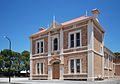 Institute
 -
 Post office
 -
 Public library
 -
 Uniting Church
 -
 War Memorial


References
- ^ Australian Bureau of Statistics (27 June 2017). "Freeling". 2016 Census QuickStats. Retrieved 2 January 2018.

- ^ "2021 5372, SA, Census All persons QuickStats | Australian Bureau of Statistics". www.abs.gov.au. Retrieved 21 July 2023.
- ^ Biography of Arthur Freeling in Australian Dictionary of Biography online, accessed 5 October 2007.
- ^ "About Us: AgPoint". AgPoint Australia. Retrieved 29 June 2015.
External links
Wikimedia Commons has media related to Freeling, South Australia.
- Light Regional Council page on Freeling
Further reading
- Kuhlmann, Thelma & Bockmann, Owen. Horses, Harrows and Haystacks: Freeling Through the Years 1860-1980. Adelaide: Freeling Women's Agricultural Bureau, 1981. ISBN 0-9595629-4-X
- v
- t
- e
Towns and localities of the Light Regional Council
- Allendale North
- Bagot Well
- Bethel
- Buchfelde
- Daveyston
- Ebenezer
- Fords
- Freeling
- Gawler Belt
- Gawler River
- Gomersal
- Greenock
- Hamilton
- Hamley Bridge
- Hansborough
- Hewett
- Kangaroo Flat
- Kapunda
- Kingsford
- Koonunga
- Linwood
- Lyndoch
- Magdala
- Marananga
- Moppa
- Morn Hill
- Nain
- Nuriootpa
- Pinkerton Plains
- Reeves Plains
- Rosedale
- Roseworthy
- Rowland Flat
- Seppeltsfield
- Shea-Oak Log
- St Johns
- St Kitts
- Stockwell
- Stone Well
- Tanunda
- Templers
- Truro
- Ward Belt
- Wasleys
- Woolsheds
- Light River
- Gawler River
- Barossa Valley
- Central Adelaide Plains


