Fort Simpson Airport
Airport in the Northwest Territories, Canada

CYS
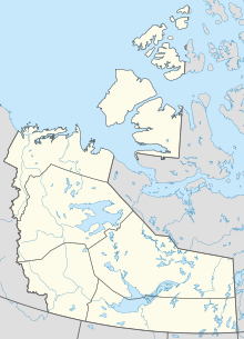
Location in the Northwest Territories
Show map of Northwest Territories
CYS
CYS (Canada)
Show map of Canada| Direction | Length | Surface | |
|---|---|---|---|
| ft | m | ||
| 14/32 | 6,000 | 1,829 | Asphalt |
| Aircraft movements | 2,373 |
|---|
Sources: Canada Flight Supplement[1]
Environment Canada[2]
Movements from Statistics Canada.[3]
Environment Canada[2]
Movements from Statistics Canada.[3]
Fort Simpson Airport (IATA: YFS, ICAO: CYFS) is located 7.4 nautical miles (13.7 km; 8.5 mi) east southeast of Fort Simpson, Northwest Territories, Canada.
Airlines and destinations
| Airlines | Destinations |
|---|---|
| Air Tindi | Yellowknife[4] |
| Canadian North | Hay River, Yellowknife[5] |
Accidents and incidents
- On 26 June 1994, Douglas C-47A C-FROD of Buffalo Airways crashed on approach due to fuel exhaustion. The aircraft was on a cargo flight from Trout Lake Airport.[6] There were two crews on board at that time. There were no fatalities but the aircraft was written off.
See also
References
- ^ Canada Flight Supplement. Effective 0901Z 16 July 2020 to 0901Z 10 September 2020.
- ^ Synoptic/Metstat Station Information Archived December 1, 2011, at the Wayback Machine
- ^ Total aircraft movements by class of operation
- ^ "Air Tindi Flight Schedule" (PDF). Archived from the original (PDF) on 2013-05-18. Retrieved 2013-05-18.
- ^ Full network schedule
- ^ "C-FROD Accident description". Aviation Safety Network. Retrieved 25 June 2010.
External links
- Past three hours METARs, SPECI and current TAFs for Fort Simpson Airport from Nav Canada as available.
- v
- t
- e
- A–B
- C–D
- E–G
- H–K
- L–M
- N–Q
- R–S
- T–Z
- CA
- CB
- CC
- CD
- CE
- CF
- CG
- CH
- CI
- CJ
- CK
- CL
- CM
- CN
- CO
- CP
- CQ
- CR
- CS
- CT
- CU
- CV
- CW
- CX
- CY
- CZ
 Category
 Portal


