Churup
Mountain in Peru


Churup
Peru
Churup[2][3][4] or Tsurup[1] (possibly from Ancash Quechua) is a mountain in the Cordillera Blanca in the Andes of Peru, about 5,495 metres (18,028 ft) high.[4][1] It is situated in the Ancash Region, Huaraz Province, Independencia District, north-east of Huaraz.[2][5] Churup is situated south of the mountain Ranrapalca, between the Rima Rima in the north-west and Collapaco and Huamashraju in the south-east, at the entrance to the Quilcayhuanca valley. Lake Churup lies at the foot of the mountain.[4]
Gallery
-
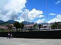 Ranrapalca (in the distance), Rima Rima, Churup (middle, left), Collapaco and Huamashraju as seen from Huaraz
 -
 Churup Lake at the foot of the mountain
 -
 The mountains Rima Rima and Churup as seen from Huaraz


References
- ^ a b c Neate, Jill (1994). "Peru". Mountaineering in the Andes (PDF). RGS-IBG Expedition Advisory Centre. p. 13. ISBN 0-907649-64-5. Archived from the original (PDF) on 2016-03-04.
- ^ a b "Nevado Churup". mincetur. Archived from the original on August 22, 2014. Retrieved August 21, 2014.
- ^ Díaz, Felipe (2008–2009). Carta Turística. Cordilleras Blanca, Negra, Huayhuash y Callejón de Huaylas.
- ^ a b c Alpenvereinskarte 0/3b. Cordillera Blanca Süd (Peru). 1:100 000. Oesterreichischer Alpenverein. 2005. ISBN 3-937530-05-3.
- ^ escale.minedu.gob.pe - UGEL map of the Huaraz Province (Ancash Region) showing Churup labelled "Nevado Huamanrripa"
- v
- t
- e


