Cerro Pelado
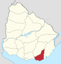
Suburb of Maldonado in Maldonado Department, Uruguay
34°53′0″S 54°59′0″W / 34.88333°S 54.98333°W / -34.88333; -54.98333 Uruguay
 (2011)
20000
Cerro Pelado is a fast-growing population centre, or neighborhood, in the Maldonado Department of southeastern Uruguay. It is one of the northern suburbs of Maldonado, along with Villa Delia and La Sonrisa. In the 2011 census, it was the 6th biggest populated centre of the department. According to some reports, there are about 12000 inhabitants in the area of influence of this neighborhood.[1]
Population
In 2011 Cerro Pelado had a population of 8,177.[2]
| Year | Population |
|---|---|
| 1985 | 130 |
| 1996 | 2,407 |
| 2004 | 6,385 |
| 2011 | 8,177 |
Source: Instituto Nacional de Estadística de Uruguay[3]
References
- ^ "El populoso barrio Cerro Pelado contará con cajero automático del BROU". maldonadonoticias.com. 2013-03-06. Archived from the original on 2013-11-14. Retrieved 2024-06-10.
- ^ "Censos 2011 Cuadros Maldonado". INE. 2012. Archived from the original on 10 October 2012. Retrieved 25 August 2012.
- ^ "1963–1996 Statistics / C". Instituto Nacional de Estadística de Uruguay. 2004. Archived from the original (DOC) on 15 June 2013. Retrieved 27 June 2011.
External links
- INE map of Maldonado, Villa Delia, La Sonrisa, Cerro Pelado, Los Aromos and Pinares-Las Delicias
- v
- t
- e
 Maldonado Department of Uruguay
Capital:  Maldonado
 Maldonado
- Aiguá
- Garzón
- Maldonado
- Pan de Azúcar
- Piriápolis
- Punta del Este
- San Carlos
- Solís Grande
villages
- Aiguá
- Balneario Buenos Aires
- Barrio Hipódromo
- Barrio Los Aromos
- Cerro Pelado
- El Tesoro
- Garzón
- Gerona
- Gregorio Aznárez
- José Ignacio
- La Sonrisa
- Maldonado
- Pan de Azúcar
- Pinares – Las Delicias
- Piriápolis
- Playa Grande
- Punta Ballena
- Punta del Este
- San Carlos
- San Rafael - El Placer
- Villa Delia
 | This article about a place in Maldonado Department is a stub. You can help Wikipedia by expanding it. |
- v
- t
- e


