Burlington, Iowa micropolitan area
Micropolitan Statistical Area in the United States
Burlington Micropolitan Area | ||
|---|---|---|
Micropolitan Statistical Area | ||
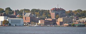 Downtown Burlington from Mississippi River | ||
 Map of Burlington–Fort Madison, IA–IL CSA
| ||
| Country |  United States United States | |
| State |  Iowa Iowa Illinois Illinois | |
| Principal cities | Burlington West Burlington Fort Madison Keokuk | |
| Time zone | UTC−6 (CST) | |
| • Summer (DST) | UTC−5 (CDT) | |
The Burlington, IA−IL Micropolitan Statistical Area, as defined by the United States Census Bureau, is an area consisting of two counties−one in southeast Iowa and the other in West Central Illinois, anchored by the city of Burlington, Iowa.
As of the 2000 census, the μSA had a population of 50,564 (though a July 1, 2009 estimate placed the population at 48,412).[1]
Counties
Communities
- Places with more than 20,000 inhabitants
- Burlington, Iowa (Principal city)
- Places with 1,000 to 10,000 inhabitants
- Places with 500 to 1,000 inhabitants
- Places with less than 500 inhabitants
- Unincorporated places
Townships
Des Moines County
- Benton Township
- Burlington Township
- Concordia Township
- Danville Township
- Flint River Township
- Franklin Township
- Huron Township
- Jackson Township
- Pleasant Grove Township
- Tama Township
- Union Township
- Washington Township
- Yellow Springs Township
Henderson County
- Bald Bluff Township
- Biggsville Township
- Carman Township
- Gladstone Township
- Lomax Township
- Media Township
- Oquawka Township
- Raritan Township
- Rozetta Township
- Stronghurst Township
- Terre Haute Township
Demographics
As of the census[2] of 2000, there were 50,564 people, 20,635 households, and 13,911 families residing within the μSA. The racial makeup of the μSA was 94.47% White, 3.03% African American, 0.22% Native American, 0.51% Asian, 0.04% Pacific Islander, 0.60% from other races, and 1.12% from two or more races. Hispanic or Latino of any race were 1.61% of the population.
The median income for a household in the μSA was $36,598, and the median income for a family was $43,745. Males had a median income of $33,060 versus $21,815 for females. The per capita income for the μSA was $18,579.
See also
References
- ^ "Table 1. Annual Estimates of the Population of Metropolitan and Micropolitan Statistical Areas: April 1, 2000 to July 1, 2009 (CBSA-EST2009-01)". 2009 Population Estimates. United States Census Bureau, Population Division. 2010-03-23. Archived from the original (CSV) on 2010-06-15. Retrieved 2010-03-24.
- ^ "U.S. Census website". United States Census Bureau. Retrieved 2008-01-31.
- v
- t
- e
Des Moines (capital)
- Archaeology
- Area codes
- Attorney General
- Auditor of State
- Capitol
- Climate change
- Code
- Congressional districts
- Crime
- Delegations
- Elections
- Environment
- Flag
- Governor
- Gun laws
- History
- Index
- Legislature
- LGBT rights
- Museums
- People
- Political parties
- Seal
- Secretary of Agriculture
- Secretary of State
- State Parks
- Supreme Court
- Symbols
- Treasurer of State
- Adair
- Adams
- Allamakee
- Appanoose
- Audubon
- Benton
- Black Hawk
- Boone
- Bremer
- Buchanan
- Buena Vista
- Butler
- Calhoun
- Carroll
- Cass
- Cedar
- Cerro Gordo
- Cherokee
- Chickasaw
- Clarke
- Clay
- Clayton
- Clinton
- Crawford
- Dallas
- Davis
- Decatur
- Delaware
- Des Moines
- Dickinson
- Dubuque
- Emmet
- Fayette
- Floyd
- Franklin
- Fremont
- Greene
- Grundy
- Guthrie
- Hamilton
- Hancock
- Hardin
- Harrison
- Henry
- Howard
- Humboldt
- Ida
- Iowa
- Jackson
- Jasper
- Jefferson
- Johnson
- Jones
- Keokuk
- Kossuth
- Lee
- Linn
- Louisa
- Lucas
- Lyon
- Madison
- Mahaska
- Marion
- Marshall
- Mills
- Mitchell
- Monona
- Monroe
- Montgomery
- Muscatine
- O'Brien
- Osceola
- Page
- Palo Alto
- Plymouth
- Pocahontas
- Polk
- Pottawattamie
- Poweshiek
- Ringgold
- Sac
- Scott
- Shelby
- Sioux
- Story
- Tama
- Taylor
- Union
- Van Buren
- Wapello
- Warren
- Washington
- Wayne
- Webster
- Winnebago
- Winneshiek
- Woodbury
- Worth
- Wright
 Iowa portal
40°49′N 91°07′W / 40.817°N 91.117°W / 40.817; -91.117


