Altıntaş District
District of Kütahya Province, Turkey
District in Kütahya, Turkey
39°04′N 30°07′E / 39.067°N 30.117°E / 39.067; 30.117 (2022)
Altıntaş District is a district of the Kütahya Province of Turkey. Its seat is the town of Altıntaş.[1] Its area is 941 km2,[2] and its population is 15,018 (2022).[3]
Composition
There is one municipality in Altıntaş District:[1]
There are 35 villages in Altıntaş District:[4]
- Akçaköy
- Alibey
- Alıncık
- Altıntaş
- Aydınlar
- Aykırıkçı
- Beşkarış
- Çakırsaz
- Çayırbaşı
- Erenköy
- Eymir
- Gecek
- Genişler
- Gökçeler
- Işıklar
- Karaağaç
- Kuyucak
- Mecidiye
- Murathanlar
- Osmaniye
- Oysu
- Pınarcık
- Pusan
- Sadıkkırı
- Şanlıyurt
- Saraycık
- Sevdiğin
- Üçhüyük
- Yalnızsaray
- Yapılcan
- Yayla
- Yenikaraağaç
- Yeşilyurt
- Yolçatı
- Zafertepeçalköy
References
- ^ a b İlçe Belediyesi, Turkey Civil Administration Departments Inventory. Retrieved 22 May 2023.
- ^ "İl ve İlçe Yüz ölçümleri". General Directorate of Mapping. Retrieved 22 May 2023.
- ^ "Address-based population registration system (ADNKS) results dated 31 December 2022, Favorite Reports" (XLS). TÜİK. Retrieved 22 May 2023.
- ^ Köy, Turkey Civil Administration Departments Inventory. Retrieved 22 May 2023.
- v
- t
- e
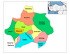
Altıntaş District in Kütahya Province of Turkey

| Istanbul | |
|---|---|
| West Marmara | |
| Aegean | |
| East Marmara | |
| West Anatolia | |
| Mediterranean | |
| Central Anatolia | |
| West Black Sea | |
| East Black Sea | |
| Northeast Anatolia | |
| Central East Anatolia | |
| Southeast Anatolia | |
Metropolitan municipalities are bolded.
 | This article about an Aegean Region of Turkey location is a stub. You can help Wikipedia by expanding it. |
- v
- t
- e


