İlisu
Municipality in Qakh, Azerbaijan
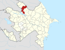
41°28′06″N 47°03′24″E / 41.46833°N 47.05667°E / 41.46833; 47.05667 Azerbaijan
 (2009)
İlisu is a village and municipality in the Qakh District of Azerbaijan. It has a population of 1,370. It was the capital of the Elisu Sultanate. The postal code is AZ 3417.
Reserve
Ilisu State Nature Reserve was established on February 20, 1987, by decree number 57, with an area of 9345 ha. It is located on the south side of the Greater Caucasus (Gakh), between Zagatala and Ismayilli Reserve, at an altitude of 700–2100 metres. The area was expanded by the decree of the Cabinet of Ministers of the Azerbaijan Republic dated March 31. Now its area is 17381.6 ha.[1]
See also
- Jinli Castle
Gallery


References
Wikimedia Commons has media related to İlisu.
- ^ "QAX RAYON Icra Hakimiyyəti". www.qax-ih.gov.az. Retrieved 2018-07-14.
- İlisu at GEOnet Names Server
- v
- t
- e
Qakh District
Capital: Qax
- Ağçay
- Ağyazı
- Almalı
- Amanlı
- Armudlu
- Aşağı Malax
- Bağtala
- Bashmalakh
- Baydarlı
- Böyük Alatəmir
- Cəlayir
- Çinarlı
- Çüdüllü
- Dəymədağlı
- Əli Bayramlı
- Əlibəyli
- Əmbərçay
- Əmircan
- Fıstıqlı
- Güllük
- İbaxlı
- İlisu
- İngiloy Kötüklü
- Keşqutan
- Kiçik Alatəmir
- Küdürlü
- Ləkit
- Ləkit Kötüklü
- Ləkit Malax
- Lələli
- Lələpaşa
- Malax
- Marsan
- Meşəbaş
- Oncallı
- Qapıçay
- Qarabaldır
- Qaradolaq
- Qarameşə
- Qaratala
- Qaşqaçay
- Qax İngiloy
- Qaxbaş
- Qaxmuğal
- Qaysarlı
- Qazmalar
- Qımır
- Qımırlı
- Qındırğa
- Qıpçaq
- Qorağan
- Qum
- Sarıbaş
- Şıxlar
- Şotavar
- Suskənd
- Tanqıt
- Tasmalı
- Turaclı
- Üzümlükənd
- Uzuntala
- Xələftala
- Yeni İlisu
- Zərnə
- Zəyəm
 | This Qakh District location article is a stub. You can help Wikipedia by expanding it. |
- v
- t
- e


