Name des Ramsar-Gebiets Bild Region Karte Lage Ramsar-Nr. Fläche [ha] Ausweisungsdatum Anmerkungen Apsley Marshes Tasmania Liste der Ramsar-Gebiete in Australien (Australien)
41° 58′ 59″ S , 148° 12′ 0″ O -41.983055555556 148.2 255 880 16. Nov. 1982 An der Mündung des Apsley Rivers gelegenes Marschland Ashmore Reef Commonwealth Marine Reserve External Territory of Ashmore and Cartier Islands Liste der Ramsar-Gebiete in Australien (Australien)
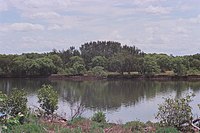
12° 13′ 59″ S , 123° 7′ 0″ O -12.233055555556 123.11666666667 1220 58.300 21. Okt. 2002 Banrock Station Wetland Complex South Australia Liste der Ramsar-Gebiete in Australien (Australien)
34° 10′ 59″ S , 140° 19′ 59″ O -34.183055555556 140.33305555556 1221 1375 21. Okt. 2002 Barmah Forest South Australia Liste der Ramsar-Gebiete in Australien (Australien)
35° 55′ 0″ S , 145° 7′ 59″ O -35.916666666667 145.13305555556 262 28.515 15. Dez. 1982 Becher Point Wetlands Western Australia Liste der Ramsar-Gebiete in Australien (Australien)
32° 22′ 0″ S , 115° 43′ 59″ O -32.366666666667 115.73305555556 1048 708 5. Jan. 2001 Blue Lake New South Wales Liste der Ramsar-Gebiete in Australien (Australien)
36° 24′ 0″ S , 148° 19′ 0″ O -36.4 148.31666666667 800 338 17. März 1996 Bool and Hacks Lagoons South Australia Liste der Ramsar-Gebiete in Australien (Australien)
37° 7′ 59″ S , 140° 40′ 59″ O -37.133055555556 140.68305555556 322 3.200 1. Nov. 1985 Bowling Green Bay Queensland Liste der Ramsar-Gebiete in Australien (Australien)
19° 27′ 0″ S , 147° 15′ 0″ O -19.45 147.25 632 35.500 22. Okt. 1993 Cape Barren Island,east coast lagoons Tasmania Liste der Ramsar-Gebiete in Australien (Australien)
40° 22′ 42″ S , 148° 24′ 5″ O -40.378333333333 148.40138888889 256 4.473 16. Nov. 1982 Cobourg Peninsula Northern Territory Liste der Ramsar-Gebiete in Australien (Australien)
11° 25′ 0″ S , 132° 15′ 0″ O -11.416666666667 132.25 1 220.700 8. Mai 1974 Coongie Lakes South Australia Liste der Ramsar-Gebiete in Australien (Australien)
27° 34′ 33″ S , 139° 56′ 26″ O -27.575833333333 139.94055555556 376 2.178.952 15. Juni 1987 Coral Sea Reserves Coral Sea Islands Territory Liste der Ramsar-Gebiete in Australien (Australien)
16° 52′ 13″ S , 149° 49′ 14″ O -16.870277777778 149.82055555556 1222 1.728.920 21. Okt. 2002 Corner Inlet Victoria Liste der Ramsar-Gebiete in Australien (Australien)
38° 45′ 0″ S , 146° 31′ 59″ O -38.75 146.53305555556 261 67.186 15. Dez. 1982 Currawinya Lakes Queensland Liste der Ramsar-Gebiete in Australien (Australien)
28° 47′ 35″ S , 144° 33′ 9″ O -28.793055555556 144.5525 791 151.300 11. März 1996 Edithvale-Seaford Wetlands Victoria Liste der Ramsar-Gebiete in Australien (Australien)
38° 4′ 0″ S , 145° 7′ 0″ O -38.066666666667 145.11666666667 1096 261 29. Aug. 2001 Eighty Mile Beach Western Australia Liste der Ramsar-Gebiete in Australien (Australien)
19° 28′ 59″ S , 120° 34′ 59″ O -19.483055555556 120.58305555556 480 125.000 7. Juni 1990 Elizabeth and Middleton Reefs Marine National Nature Reserve Australia’s East Marine Region Liste der Ramsar-Gebiete in Australien (Pazifischer Ozean)
29° 27′ 0″ S , 159° 7′ 0″ O -29.45 159.11666666667 1223 187.726 21. Okt. 2002 Fivebough and Tuckerbil Swamps New South Wales Liste der Ramsar-Gebiete in Australien (Australien)
34° 30′ 0″ S , 146° 22′ 59″ O -34.5 146.38305555556 1224 689 21. Okt. 2002 Flood Plain Lower Ringarooma River Tasmania Liste der Ramsar-Gebiete in Australien (Australien)
40° 54′ 0″ S , 147° 55′ 59″ O -40.9 147.93305555556 257 3519 16. Nov. 1982 Forrestdale and Thomsons Lakes Western Australia Liste der Ramsar-Gebiete in Australien (Australien)
32° 9′ 0″ S , 115° 52′ 0″ O -32.15 115.86666666667 481 754 7. Juni 1990 Ginini Flats Subalpine Bog Complex Australian Capital Territory Liste der Ramsar-Gebiete in Australien (Australien)
35° 31′ 29″ S , 148° 46′ 53″ O -35.524722222222 148.78138888889 793 350 1. März 1996 Gippsland Lakes Victoria Liste der Ramsar-Gebiete in Australien (Australien)
38° 0′ 0″ S , 147° 36′ 0″ O -38 147.6 269 60.015 15. Dez. 1982 Glenelg Estuary and Discovery Bay Ramsar Site Shire of Glenelg, Victoria Liste der Ramsar-Gebiete in Australien (Australien)
38° 0′ 0″ S , 147° 36′ 0″ O -38 147.6 2.344 22.289 28. Feb. 2018 Great Sandy Strait Queensland Liste der Ramsar-Gebiete in Australien (Australien)
25° 28′ 0″ S , 152° 54′ 0″ O -25.466666666667 152.9 992 93.160 14. Juni 1999 Gunbower Forest Victoria Liste der Ramsar-Gebiete in Australien (Australien)
35° 49′ 0″ S , 144° 19′ 0″ O -35.816666666667 144.31666666667 263 19.931 15. Dez. 1982 Gwydir Wetlands Gingham and Lower Gwydir Watercourses New South Wales Liste der Ramsar-Gebiete in Australien (Australien)
29° 18′ 0″ S , 149° 13′ 59″ O -29.3 149.23305555556 993 823 14. Juni 1999 Hattah-Kulkyne Lakes Victoria Liste der Ramsar-Gebiete in Australien (Australien)
34° 40′ 59″ S , 142° 25′ 59″ O -34.683055555556 142.43305555556 264 955 15. Dez. 1982 Hosnie's Spring Christmas Island Liste der Ramsar-Gebiete in Australien (Pazifischer Ozean)
10° 28′ 0″ S , 105° 40′ 59″ O -10.466666666667 105.68305555556 512 202 11. Dez. 1990 Hunter Estuary Wetlands New South Wales Liste der Ramsar-Gebiete in Australien (Australien)
32° 51′ 0″ S , 151° 46′ 0″ O -32.85 151.76666666667 287 3.388 21. Feb. 1984 Interlaken Lakeside Reserve Tasmania Liste der Ramsar-Gebiete in Australien (Australien)
42° 9′ 0″ S , 147° 10′ 0″ O -42.15 147.16666666667 259 517 16. Nov. 1982 Jocks Lagoon Tasmania Liste der Ramsar-Gebiete in Australien (Australien)
41° 20′ 41″ S , 148° 18′ 29″ O -41.344722222222 148.30805555556 258 19 16. Nov. 1982 Kakadu National Park Northern Territory Liste der Ramsar-Gebiete in Australien (Australien)
12° 40′ 0″ S , 132° 45′ 0″ O -12.666666666667 132.75 204 1.979.766 6. Dez. 1980 Kerang Wetlands Victoria Liste der Ramsar-Gebiete in Australien (Australien)
35° 39′ 39″ S , 143° 52′ 16″ O -35.660833333333 143.87111111111 265 9.784 15. Dez. 1982 Lake Albacutya Victoria Liste der Ramsar-Gebiete in Australien (Australien)
35° 46′ 0″ S , 141° 58′ 0″ O -35.766666666667 141.96666666667 270 5.731 15. Dez. 1982 Lake Gore Western Australia Liste der Ramsar-Gebiete in Australien (Australien)
33° 46′ 59″ S , 121° 28′ 59″ O -33.783055555556 121.48305555556 1.049 4.017 5. Jan. 2001 Lake Pinaroo New South Wales Liste der Ramsar-Gebiete in Australien (Australien)
29° 6′ 0″ S , 141° 13′ 0″ O -29.1 141.21666666667 799 719 17. März 1996 Lakes Argyle and Kununurra Western Australia Liste der Ramsar-Gebiete in Australien (Australien)
16° 19′ 59″ S , 128° 39′ 0″ O -16.333055555556 128.65 478 150.000 7. Juni 1990 Lake Warden system Western Australia Liste der Ramsar-Gebiete in Australien (Australien)
33° 48′ 0″ S , 121° 55′ 59″ O -33.8 121.93305555556 485 2.300 7. Juni 1990 Lavinia Nature Reserve Tasmania Liste der Ramsar-Gebiete in Australien (Australien)
39° 45′ 0″ S , 144° 4′ 59″ O -39.75 144.08305555556 253 7.034 16. Nov. 1982 Little Llangothlin Nature Reserve New South Wales Liste der Ramsar-Gebiete in Australien (Australien)
30° 5′ 11″ S , 151° 46′ 54″ O -30.086388888889 151.78166666667 798 257,6 17. März 1996 Little Waterhouse Lake Tasmania Liste der Ramsar-Gebiete in Australien (Australien)
40° 52′ 30″ S , 147° 36′ 39″ O -40.875 147.61083333333 260 56 16. Nov. 1982 Logan Lagoon Tasmania Liste der Ramsar-Gebiete in Australien (Australien)
40° 10′ 0″ S , 148° 16′ 59″ O -40.166666666667 148.28305555556 252 2.257 16. Nov. 1982 Macquarie Marshes New South Wales Liste der Ramsar-Gebiete in Australien (Australien)
30° 45′ 0″ S , 147° 33′ 0″ O -30.75 147.55 337 19.850 1. Aug. 1986 Moreton Bay Queensland Liste der Ramsar-Gebiete in Australien (Australien)
27° 19′ 59″ S , 153° 10′ 0″ O -27.333055555556 153.16666666667 631 113.314 22. Okt. 1993 Moulting Lagoon Tasmania Liste der Ramsar-Gebiete in Australien (Australien)
42° 1′ 59″ S , 148° 10′ 59″ O -42.033055555556 148.18305555556 251 4.507 16. Nov. 1982 Muir-Byenup System Western Australia Liste der Ramsar-Gebiete in Australien (Australien)
34° 28′ 59″ S , 116° 43′ 0″ O -34.483055555556 116.71666666667 1.050 10.631 5. Jan. 2001 Myall Lakes New South Wales Liste der Ramsar-Gebiete in Australien (Australien)
32° 30′ 0″ S , 152° 16′ 59″ O -32.5 152.28305555556 994 44.612 14. Juni 1999 Narran Lake Nature Reserve New South Wales Liste der Ramsar-Gebiete in Australien (Australien)
29° 43′ 0″ S , 147° 25′ 59″ O -29.716666666667 147.43305555556 995 8.447 14. Juni 1999 NSW Central Murray State Forests New South Wales Liste der Ramsar-Gebiete in Australien (Australien)
35° 39′ 0″ S , 144° 39′ 0″ O -35.65 144.65 1.291 83.992 20. Mai 2003 Ord River Floodplain Western Australia Liste der Ramsar-Gebiete in Australien (Australien)
15° 31′ 13″ S , 128° 19′ 48″ O -15.520277777778 128.33 477 140.766 7. Juni 1990 Paroo River Wetlands New South Wales Liste der Ramsar-Gebiete in Australien (Australien)
30° 19′ 59″ S , 143° 51′ 0″ O -30.333055555556 143.85 1.716 138.304 13. Sep. 2007 Peel-Yalgorup system Western Australia Liste der Ramsar-Gebiete in Australien (Australien)
32° 49′ 0″ S , 115° 42′ 0″ O -32.816666666667 115.7 482 26.530 7. Juni 1990 Piccaninnie Ponds Karst Wetlands South Australia Liste der Ramsar-Gebiete in Australien (Australien)
38° 3′ 0″ S , 140° 55′ 59″ O -38.05 140.93305555556 2.136 862 21. Dez. 2012 Pittwater-Orielton Lagoon Tasmania Liste der Ramsar-Gebiete in Australien (Australien)
42° 46′ 59″ S , 147° 30′ 0″ O -42.783055555556 147.5 254 3.334 16. Nov. 1982 Port Phillip Bay & Bellarine Peninsula Victoria Liste der Ramsar-Gebiete in Australien (Australien)
38° 4′ 0″ S , 144° 36′ 0″ O -38.066666666667 144.6 266 22.897 15. Dez. 1982 Pulu Keeling National Park Cocos (Keeling) Islands Liste der Ramsar-Gebiete in Australien (Indischer Ozean)
11° 49′ 0″ S , 96° 49′ 0″ O -11.816666666667 96.816666666667 797 2.603 17. März 1996 Riverland South Australia Liste der Ramsar-Gebiete in Australien (Australien)
34° 1′ 59″ S , 140° 51′ 0″ O -34.033055555556 140.85 377 30.640 23. Sep. 1987 Roebuck Bay Western Australia Liste der Ramsar-Gebiete in Australien (Australien)
18° 7′ 0″ S , 122° 16′ 0″ O -18.116666666667 122.26666666667 479 55.000 7. Juni 1990 Shoalwater and Corio Bays Area Livingston Shire, Queensland Liste der Ramsar-Gebiete in Australien (Australien)
22° 33′ 56″ S , 150° 29′ 41″ O -22.565555555556 150.49472222222 792 202.023 1. März 1996 The Coorong, Lake Alexandrina & Albert Wetland South Australia Liste der Ramsar-Gebiete in Australien (Australien)
35° 18′ 0″ S , 138° 43′ 59″ O -35.3 138.73305555556 321 142.530 11. Jan. 1985 The Dales, Christmas Island Christmas Island Territory Liste der Ramsar-Gebiete in Australien (Pazifischer Ozean)
10° 28′ 59″ S , 105° 34′ 0″ O -10.483055555556 105.56666666667 1.225 580 21. Okt. 2002 Toolibin Lake Western Australia Liste der Ramsar-Gebiete in Australien (Australien)
32° 55′ 0″ S , 117° 36′ 29″ O -32.916666666667 117.60805555556 483 497 7. Juni 1990 Towra Point New South Wales Liste der Ramsar-Gebiete in Australien (Australien)
34° 0′ 0″ S , 151° 10′ 0″ O -34 151.16666666667 286 604 21. Feb. 1984 Vasse-Wonnerup System Western Australia Liste der Ramsar-Gebiete in Australien (Australien)
33° 38′ 6″ S , 115° 25′ 1″ O -33.635 115.41694444444 484 1.109 7. Juni 1990 Western District Lakes Victoria Liste der Ramsar-Gebiete in Australien (Australien)
38° 10′ 0″ S , 143° 31′ 0″ O -38.166666666667 143.51666666667 268 32.898 15. Dez. 1982 Western Port Victoria Liste der Ramsar-Gebiete in Australien (Australien)
38° 22′ 0″ S , 145° 16′ 59″ O -38.366666666667 145.28305555556 267 59.297 15. Dez. 1982