Liste der Kategorie-A-Bauwerke in Dumfries and Galloway
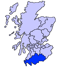
Die Liste der Kategorie-A-Gebäude in Dumfries and Galloway umfasst sämtliche in der Kategorie A eingetragenen Baudenkmäler in der schottischen Council Area Dumfries and Galloway. Die Einstufung wird anhand der Kriterien von Historic Scotland vorgenommen, wobei in die höchste Kategorie A Bauwerke von nationaler oder internationaler Bedeutung einsortiert sind. In Dumfries and Galloway sind derzeit 213 Bauwerke in der Kategorie A gelistet.
| Name | Lage | Typ | Eintrag | Bild |
|---|---|---|---|---|
| Rusco Tower | nahe Gatehouse of Fleet 54° 55′ 6,1″ N, 4° 12′ 37,7″ W54.918361111111-4.2104722222222 | Tower House | 3299 | 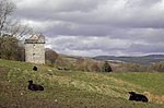 |
| Ardwall House | nahe Gatehouse of Fleet 54° 52′ 2″ N, 4° 12′ 43,5″ W54.867222222222-4.2120833333333 | Villa | 3302 | |
| Friedhof der Anwoth Old Church | nahe Gatehouse of Fleet 54° 52′ 49,7″ N, 4° 12′ 38,2″ W54.880472222222-4.2106111111111 | Friedhof | 3309 | 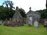 |
| Barscobe Castle | nahe Balmaclellan 55° 6′ 7,3″ N, 4° 6′ 7,7″ W55.102027777778-4.1021388888889 | Wohngebäude | 3310 |  |
| Ironmacannie Mill | nahe Balmaclellan 55° 3′ 16,3″ N, 4° 5′ 16,5″ W55.054527777778-4.0879166666667 | Mühle | 3315 | |
| Ken Bridge | nahe New Galloway 55° 4′ 51,4″ N, 4° 7′ 51,9″ W55.080944444444-4.1310833333333 | Brücke | 3316 | 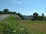 |
| Millhouse Bridge | Millhousebridge 55° 9′ 21,3″ N, 3° 24′ 23,5″ W55.155916666667-3.4065277777778 | Brücke | 3324 | |
| Old Tollbar Cottage | nahe Johnstonebridge 55° 11′ 51″ N, 3° 24′ 31,2″ W55.1975-3.4086666666667 | Zollhaus | 3327 |  |
| Stallungen von Jardine Hall | nahe Templand 55° 10′ 36,1″ N, 3° 24′ 49,4″ W55.176694444444-3.4137222222222 | Stallungen | 3340 | |
| Gärten von Jardine Hall | nahe Templand 55° 10′ 36,6″ N, 3° 24′ 56,4″ W55.176833333333-3.4156666666667 | Gärten | 3341 | |
| Buittle Bridge | nahe Dalbeattie 54° 55′ 36″ N, 3° 50′ 20″ W54.926666666667-3.8388888888889 | Brücke | 3364 |  |
| Buittle Old Church | nahe Dalbeattie 54° 55′ 8,2″ N, 3° 51′ 41,6″ W54.918944444444-3.8615555555556 | Kirchenruine | 3365 |  |
| Rammerscales House | nahe Hightae 55° 5′ 5,1″ N, 3° 26′ 22,8″ W55.08475-3.4396666666667 | Herrenhaus | 3378 |  |
| Corseyard Farm | nahe Borgue 54° 48′ 43,6″ N, 4° 11′ 38,3″ W54.812111111111-4.1939722222222 | Bauernhof | 3381 |  |
| Borgue Old House | Borgue 54° 48′ 36,1″ N, 4° 7′ 40,2″ W54.810027777778-4.1278333333333 | Wohngebäude | 3393 |  |
| Hensol House | nahe Crossmichael 55° 0′ 19,2″ N, 4° 4′ 20,4″ W55.005333333333-4.0723333333333 | Villa | 3415 | 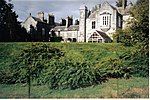 |
| Sonnenuhr von Hensol House | nahe Crossmichael 55° 0′ 18,5″ N, 4° 4′ 18,8″ W55.005138888889-4.0718888888889 | Sonnenuhr | 3416 | |
| Shillahill Bridge | nahe Lockerbie 55° 6′ 45,4″ N, 3° 24′ 9,9″ W55.112611111111-3.40275 | Brücke | 3453 |  |
| Friedhof der Dalton Old Parish Church | Dalton 55° 3′ 8,6″ N, 3° 23′ 16,8″ W55.052388888889-3.388 | Friedhof | 3455 | 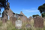 |
| Denbie House | nahe Dalton 55° 2′ 35,2″ N, 3° 23′ 33,8″ W55.043111111111-3.3927222222222 | Villa | 3469 | |
| Taubenturm von Denbie House | nahe Dalton 55° 2′ 38,6″ N, 3° 23′ 45,4″ W55.044055555556-3.3959444444444 | Taubenturm | 3470 | |
| Bonshaw Tower | Kirtlebridge 55° 2′ 14,4″ N, 3° 11′ 12″ W55.037333333333-3.1866666666667 | Tower House | 3489 |  |
| Brydekirk Bridge | Brydekirk 55° 1′ 21,7″ N, 3° 16′ 26,5″ W55.022694444444-3.2740277777778 | Brücke | 3494 |  |
| Gilnockie Bridge | nahe Canonbie 55° 5′ 39″ N, 2° 57′ 49,7″ W55.094166666667-2.9638055555556 | Brücke | 3504 |  |
| Byreburnfoot Bridge | nahe Canonbie 55° 5′ 32,6″ N, 2° 57′ 25″ W55.092388888889-2.9569444444444 | Brücke | 3520 | |
| Gilnockie Tower | nahe Canonbie 55° 5′ 51,9″ N, 2° 58′ 10,6″ W55.09775-2.9696111111111 | Tower House | 3527 |  |
| Scheune der Priorslynn Farm | Canonbie 55° 4′ 23,8″ N, 2° 57′ 4,2″ W55.073277777778-2.9511666666667 | Scheune | 3531 | |
| Riddings Junction Viaduct | nahe Canonbie 55° 4′ 16,6″ N, 2° 55′ 27,6″ W55.071277777778-2.9243333333333 | Brücke | 3533 |  |
| Tarrasfoot Tile Works | nahe Langholm 55° 7′ 8,7″ N, 2° 58′ 22,6″ W55.119083333333-2.9729444444444 | Ziegelei | 3535 | |
| Hoddom Castle | nahe Brydekirk 55° 2′ 39,6″ N, 3° 19′ 22,2″ W55.044333333333-3.3228333333333 | Burg | 3558 |  |
| Repentance Tower | nahe Brydekirk 55° 2′ 15″ N, 3° 19′ 25,4″ W55.0375-3.3237222222222 | Tower House | 3570 |  |
| Kinmount House | nahe Cummertrees 55° 0′ 19,2″ N, 3° 20′ 44,5″ W55.005333333333-3.3456944444444 | Herrenhaus | 3582 | 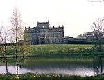 |
| Earlstoun Castle | nahe St John’s Town of Dalry 55° 7′ 52,2″ N, 4° 10′ 39,3″ W55.131166666667-4.1775833333333 | Tower House | 3624 | |
| Grennan Mill | nahe St John’s Town of Dalry 55° 5′ 55,5″ N, 4° 7′ 39,5″ W55.09875-4.1276388888889 | Mühle | 3625 | |
| Crossmichael Parish Church | Crossmichael 54° 58′ 52,2″ N, 3° 59′ 11″ W54.981166666667-3.9863888888889 | Kirche | 3698 |  |
| Gordon Memorial | Crossmichael 54° 58′ 52,2″ N, 3° 59′ 10,1″ W54.981166666667-3.9861388888889 | Denkmal | 3699 | |
| Glenlochar Bridge | Glenlochar 54° 57′ 32,7″ N, 3° 58′ 54″ W54.959083333333-3.9816666666667 | Brücke | 3706 | |
| Greenlaw House | nahe Castle Douglas 54° 57′ 31,6″ N, 3° 56′ 50,7″ W54.958777777778-3.9474166666667 | Villa | 3708 | |
| Southwick Home Farm | nahe Southerness 54° 53′ 42,9″ N, 3° 39′ 33,6″ W54.89525-3.6593333333333 | Bauernhof | 3723 | 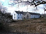 |
| Stapleton Tower | nahe Annan 55° 0′ 30,5″ N, 3° 11′ 53,1″ W55.008472222222-3.1980833333333 | Tower House | 3782 | 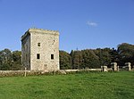 |
| Dornock House | Dornock 54° 58′ 58,9″ N, 3° 12′ 7″ W54.983027777778-3.2019444444444 | Bauernhof | 3792 | |
| Crichton Royal Hospital | Dumfries 55° 3′ 12,2″ N, 3° 35′ 47,1″ W55.053388888889-3.5964166666667 | Krankenhaus | 3839 | 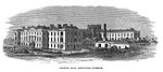 |
| Durisdeer Parish Church | Durisdeer 55° 18′ 56″ N, 3° 44′ 39,5″ W55.315555555556-3.7443055555556 | Kirche | 3856 |  |
| Drumlanrig Castle | nahe Thornhill 55° 16′ 25,1″ N, 3° 48′ 32,1″ W55.273638888889-3.8089166666667 | Schloss | 3886 | 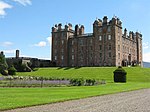 |
| Wallacehall Academy | Closeburn 55° 12′ 49,3″ N, 3° 43′ 35,8″ W55.213694444444-3.7266111111111 | Schule | 3953 | |
| Auldgirth Bridge | Auldgirth 55° 9′ 34,2″ N, 3° 42′ 35,3″ W55.1595-3.7098055555556 | Brücke | 3966 |  |
| Dalgonar Bridge | nahe Dunscore 55° 8′ 16,4″ N, 3° 47′ 21,7″ W55.137888888889-3.7893611111111 | Brücke | 4227 | |
| Dunscore Parish Church | Dunscore 55° 8′ 25,3″ N, 3° 46′ 46,2″ W55.140361111111-3.7795 | Kirche | 4230 | 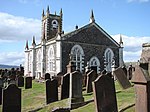 |
| Ellisland Farm | nahe Auldgirth 55° 8′ 14,6″ N, 3° 40′ 48,6″ W55.137388888889-3.6801666666667 | Bauernhof | 4232 |  |
| Crichton Farm | Dumfries 55° 2′ 52,1″ N, 3° 35′ 33,4″ W55.047805555556-3.5926111111111 | Bauernhof | 6693 | |
| Crichton Memorial Church | Dumfries 55° 3′ 3,5″ N, 3° 35′ 37,7″ W55.050972222222-3.5938055555556 | Kirche | 6695 |  |
| Hills Tower | nahe Lochfoot 55° 2′ 11,5″ N, 3° 42′ 13,3″ W55.036527777778-3.7036944444444 | Tower House | 9715 |  |
| Duchess Bridge | Langholm 55° 9′ 26,1″ N, 3° 0′ 44,6″ W55.15725-3.0123888888889 | Brücke | 9734 | 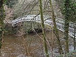 |
| Scheune von Knocknalling House | nahe St John’s Town of Dalry 55° 8′ 17″ N, 4° 12′ 11,9″ W55.138055555556-4.2033055555556 | Scheune | 9746 | |
| Milnholm Farmhouse | nahe Langholm 55° 10′ 32,3″ N, 3° 0′ 50,6″ W55.175638888889-3.0140555555556 | Bauernhaus | 9763 | |
| Skipper’s Bridge | nahe Langholm 55° 8′ 27,3″ N, 2° 59′ 19,5″ W55.140916666667-2.98875 | Brücke | 9764 |  |
| Mossknowe House | nahe Kirkpatrick-Fleming 55° 1′ 1,7″ N, 3° 7′ 33″ W55.017138888889-3.1258333333333 | Herrenhaus | 9799 | |
| Springkell House | nahe Eaglesfield 55° 3′ 55,8″ N, 3° 10′ 4,8″ W55.0655-3.168 | Herrenhaus | 9805 | |
| Stallungen von Wyseby House | Kirtlebridge 55° 2′ 27,7″ N, 3° 11′ 21,5″ W55.041027777778-3.1893055555556 | Stallungen | 9808 | |
| Grabstätte der Grahams of Mossknowe | Kirkpatrick-Fleming 55° 1′ 12,3″ N, 3° 7′ 59,9″ W55.020083333333-3.1333055555556 | Grabstätte | 9813 |  |
| Douglas Mausoleum | nahe Castle Douglas 54° 55′ 20,4″ N, 3° 56′ 17,7″ W54.922333333333-3.93825 | Mausoleum | 9835 |  |
| Gelston Castle | nahe Gelston 54° 54′ 17,1″ N, 3° 54′ 31,3″ W54.90475-3.9086944444444 | Herrenhaus | 9836 | 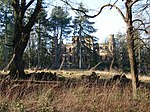 |
| Old Bridge of Dee | Bridge of Dee 54° 55′ 5,7″ N, 3° 58′ 34,5″ W54.91825-3.97625 | Brücke | 9838 |  |
| Craigielands House | Beattock 55° 17′ 58,4″ N, 3° 27′ 22,9″ W55.299555555556-3.4563611111111 | Villa | 9842 | |
| Cally Palace Hotel | nahe Gatehouse of Fleet 54° 52′ 10,5″ N, 4° 10′ 59,9″ W54.869583333333-4.1833055555556 | Hotel | 9854 |  |
| Friedhof der Girthon Old Kirk | Girthon 54° 51′ 20,6″ N, 4° 10′ 25,5″ W54.855722222222-4.17375 | Friedhof | 9859 | 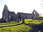 |
| Raehills House | nahe Johnstonebridge 55° 14′ 3,5″ N, 3° 28′ 25,5″ W55.234305555556-3.47375 | Herrenhaus | 9898 |  |
| The Old Brig Inn | Beattock 55° 18′ 39,3″ N, 3° 27′ 17,5″ W55.310916666667-3.4548611111111 | Hotel | 9908 |  |
| Hutton and Corrie Parish Church | Boreland 55° 12′ 17,3″ N, 3° 18′ 18″ W55.204805555556-3.305 | Kirche | 9911 |  |
| Corsewall Lighthouse | Corsewall Point 55° 0′ 25,5″ N, 5° 9′ 33,9″ W55.007083333333-5.1594166666667 | Leuchtturm | 9923 | 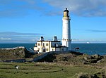 |
| Kinnel Bridge | nahe Templand 55° 9′ 3,7″ N, 3° 25′ 49,4″ W55.151027777778-3.4303888888889 | Brücke | 9950 | 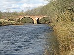 |
| Spedlins Tower | nahe Templand 55° 10′ 26,3″ N, 3° 25′ 5,6″ W55.173972222222-3.4182222222222 | Tower House | 9965 |  |
| Elshieshields Tower | nahe Templand 55° 9′ 3″ N, 3° 27′ 45,4″ W55.150833333333-3.4626111111111 | Tower House | 9970 | |
| Stallungen von Halleaths | nahe Lochmaben 55° 7′ 37,3″ N, 3° 25′ 1,4″ W55.127027777778-3.4170555555556 | Stallungen | 9971 | |
| Hoddom Bridge | nahe Brydekirk 55° 2′ 30,6″ N, 3° 18′ 37,7″ W55.041833333333-3.3104722222222 | Brücke | 10026 | 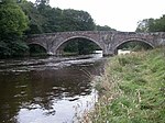 |
| Windmühle von Shortrigg | nahe Ecclefechan 55° 3′ 24,1″ N, 3° 18′ 51,5″ W55.056694444444-3.3143055555556 | Windmühle | 10041 | |
| Geburtshaus von Thomas Carlyle | Ecclefechan 55° 3′ 32,9″ N, 3° 15′ 51,3″ W55.059138888889-3.26425 | Wohngebäude | 10065 |  |
| Kirkcowan Parish Church | Kirkcowan 54° 54′ 55″ N, 4° 36′ 39,1″ W54.915277777778-4.6108611111111 | Kirche | 10066 |  |
| Craichlaw House | nahe Kirkcowan 54° 54′ 56,6″ N, 4° 38′ 38,6″ W54.915722222222-4.6440555555556 | Herrenhaus | 10076 |  |
| Barholm Castle | nahe Carsluith 54° 50′ 58,2″ N, 4° 18′ 19,7″ W54.8495-4.3054722222222 | Tower House | 10093 | 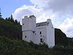 |
| Carsluith Castle | nahe Carsluith 54° 51′ 33,9″ N, 4° 20′ 48″ W54.859416666667-4.3466666666667 | Tower House | 10104 | 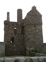 |
| Torzufahrt zu Baldoon Castle | nahe Bladnoch 54° 51′ 9,3″ N, 4° 27′ 13,1″ W54.852583333333-4.4536388888889 | Tor | 10109 |  |
| Old Place of Monreith | nahe Port William 54° 45′ 21,2″ N, 4° 31′ 1,5″ W54.755888888889-4.5170833333333 | Tower House | 10123 |  |
| Ravenstone Castle | nahe Sorbie 54° 46′ 2,3″ N, 4° 28′ 26,8″ W54.767305555556-4.4741111111111 | Tower House | 10133 |  |
| Glasserton Parish Church | nahe Whithorn 54° 42′ 46,5″ N, 4° 27′ 8,3″ W54.712916666667-4.4523055555556 | Kirche | 10137 | 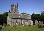 |
| Craigcaffie Tower | nahe Stranraer 54° 56′ 6,5″ N, 4° 59′ 6,4″ W54.935138888889-4.9851111111111 | Tower House | 10164 |  |
| Lochryan House | Cairnryan 54° 58′ 33,2″ N, 5° 1′ 35,5″ W54.975888888889-5.0265277777778 | Herrenhaus | 10168 |  |
| Lochinch Castle | nahe Castle Kennedy 54° 54′ 52,9″ N, 4° 57′ 22″ W54.914694444444-4.9561111111111 | Herrenhaus | 10179 |  |
| Old Bridge of Urr Mill | Old Bridge of Urr 54° 59′ 19,8″ N, 3° 54′ 49,5″ W54.988833333333-3.91375 | Mühle | 10191 |  |
| Fourmerkland Tower | nahe Dumfries 55° 6′ 32,9″ N, 3° 42′ 44,7″ W55.109138888889-3.7124166666667 | Tower House | 10204 |  |
| West Galloberry Farm | nahe Kirkton 55° 7′ 37,7″ N, 3° 37′ 34,1″ W55.127138888889-3.6261388888889 | Bauernhof | 10218 | |
| Stallungen von Blackwood House | nahe Auldgirth 55° 9′ 54,9″ N, 3° 43′ 3,3″ W55.16525-3.7175833333333 | Stallungen | 10244 | |
| Capenoch House | nahe Penpont 55° 13′ 30,4″ N, 3° 49′ 11,2″ W55.225111111111-3.8197777777778 | Herrenhaus | 10247 | |
| Kilneiss House | Moniaive 55° 11′ 53,4″ N, 3° 55′ 41,8″ W55.198166666667-3.9282777777778 | Villa | 10298 | |
| Carnsalloch House | nahe Kirkton 55° 6′ 22,8″ N, 3° 36′ 52,5″ W55.106333333333-3.6145833333333 | Herrenhaus | 10300 | |
| Carnsalloch Chapel at the Mount | nahe Kirkton 55° 6′ 44,4″ N, 3° 36′ 31,9″ W55.112333333333-3.6088611111111 | Kirche | 10301 | |
| Stallungen von Carnsalloch House | nahe Kirkton 55° 6′ 26,1″ N, 3° 36′ 39,9″ W55.10725-3.6110833333333 | Stallungen | 10303 | |
| Glenluiart House | nahe Moniaive 55° 11′ 47,5″ N, 3° 56′ 34,7″ W55.196527777778-3.9429722222222 | Villa | 10307 | 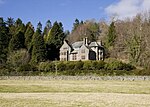 |
| Glencairn Parish Church | nahe Moniaive 55° 11′ 38,8″ N, 3° 52′ 20,7″ W55.194111111111-3.8724166666667 | Kirche | 10312 |  |
| Craigdarroch House | nahe Moniaive 55° 11′ 46,4″ N, 3° 58′ 43,3″ W55.196222222222-3.9786944444444 | Herrenhaus | 10340 | 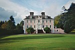 |
| Ross Mains | nahe Templand 55° 11′ 0,3″ N, 3° 28′ 1,7″ W55.183416666667-3.4671388888889 | Bauernhaus | 10353 | |
| John Paul Jones’ Cottage | nahe Southerness 54° 53′ 55,6″ N, 3° 34′ 48,7″ W54.898777777778-3.5801944444444 | Wohngebäude | 10397 |  |
| Arbigland House | nahe Southerness 54° 54′ 4,8″ N, 3° 34′ 37″ W54.901333333333-3.5769444444444 | Herrenhaus | 10398 | |
| Southerness Lighthouse | Southerness 54° 52′ 22,2″ N, 3° 35′ 42″ W54.872833333333-3.595 | Leuchtturm | 10415 |  |
| Shennanton House | nahe Kirkcowan 54° 56′ 44,6″ N, 4° 35′ 34,6″ W54.945722222222-4.5929444444444 | Villa | 13106 | |
| Kirkdale Bridge | nahe Carsluith 54° 51′ 2,4″ N, 4° 18′ 39,4″ W54.850666666667-4.3109444444444 | Brücke | 13137 | |
| Kirkdale House | nahe Carsluith 54° 51′ 8,2″ N, 4° 18′ 53,5″ W54.852277777778-4.3148611111111 | Villa | 13138 |  |
| Kirkdale Kirk | nahe Carsluith 54° 51′ 32,7″ N, 4° 19′ 10,1″ W54.859083333333-4.3194722222222 | Kirchenruine | 13139 |  |
| Stallungen von Kirkdale House | nahe Carsluith 54° 51′ 17,9″ N, 4° 19′ 4,6″ W54.854972222222-4.3179444444444 | Stallungen | 13140 | |
| Lochnaw Castle | nahe Leswalt 54° 55′ 10,8″ N, 5° 8′ 8,7″ W54.919666666667-5.13575 | Herrenhaus | 13498 |  |
| Gärten von Lochnaw Castle | nahe Leswalt 54° 55′ 17,8″ N, 5° 8′ 26,8″ W54.921611111111-5.1407777777778 | Gärten | 13505 | |
| Logan House | nahe Port Logan 54° 44′ 39,4″ N, 4° 57′ 31,7″ W54.744277777778-4.9588055555556 | Herrenhaus | 13564 | 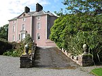 |
| Logan Windmill | nahe Ardwell 54° 45′ 12,9″ N, 4° 55′ 49,1″ W54.753583333333-4.9303055555556 | Windmühle | 13570 |  |
| Mull of Galloway Lighthouse | Mull of Galloway 54° 38′ 5,9″ N, 4° 51′ 26,6″ W54.634972222222-4.8573888888889 | Leuchtturm | 13578 |  |
| Old Parish Church of Kirkmaiden | nahe Drummore 54° 41′ 32,4″ N, 4° 54′ 40,8″ W54.692333333333-4.9113333333333 | Kirche | 13581 |  |
| Kirkmadrine Church | nahe Sandhead 54° 47′ 36,8″ N, 4° 59′ 15,9″ W54.793555555556-4.98775 | Kirche | 16739 |  |
| Portpatrick Old Parish Church | Portpatrick 54° 50′ 33,7″ N, 5° 6′ 59,7″ W54.842694444444-5.1165833333333 | Kirchenruine | 16743 |  |
| Isle Castle | Isle of Whithorn 54° 42′ 4,8″ N, 4° 21′ 56,7″ W54.701333333333-4.36575 | Tower House | 16751 | 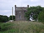 |
| Castle of Park | nahe Glenluce 54° 52′ 33,5″ N, 4° 49′ 31,9″ W54.875972222222-4.8255277777778 | Tower House | 16761 |  |
| Haugh Bridge | Haugh of Urr 54° 58′ 26,5″ N, 3° 52′ 4,2″ W54.974027777778-3.8678333333333 | Brücke | 16807 |  |
| Scheune der Archbank Farm | nahe Moffat 55° 20′ 49,5″ N, 3° 26′ 7,3″ W55.347083333333-3.4353611111111 | Scheune | 16847 | |
| Granton House | nahe Moffat 55° 22′ 28,1″ N, 3° 27′ 43,2″ W55.374472222222-3.462 | Villa | 16858 | |
| Heatheryhaugh | Moffat 55° 20′ 30,8″ N, 3° 25′ 56,8″ W55.341888888889-3.4324444444444 | Villa | 16861 | |
| Cruggleton Church | nahe Garlieston 54° 45′ 25,6″ N, 4° 22′ 0,1″ W54.757111111111-4.3666944444444 | Kirche | 16875 |  |
| Galloway House | nahe Garlieston 54° 46′ 45,4″ N, 4° 22′ 1,9″ W54.779277777778-4.3671944444444 | Herrenhaus | 16876 |  |
| Castlemilk | nahe Kettleholm 55° 5′ 3,6″ N, 3° 20′ 2,7″ W55.084333333333-3.3340833333333 | Herrenhaus | 16888 | |
| Brücke von Castlemilk | nahe Kettleholm 55° 4′ 57,1″ N, 3° 19′ 56,4″ W55.082527777778-3.3323333333333 | Brücke | 16890 | |
| Johnstone Mausoleum | Bentpath 55° 12′ 9,4″ N, 3° 4′ 52,3″ W55.202611111111-3.0811944444444 | Mausoleum | 16921 |  |
| Bentpath Bridge | Bentpath 55° 12′ 6,1″ N, 3° 4′ 59,3″ W55.201694444444-3.0831388888889 | Brücke | 16939 |  |
| Barwhinnock House | nahe Twynholm 54° 52′ 17,6″ N, 4° 5′ 40,6″ W54.871555555556-4.0946111111111 | Villa | 16989 | |
| Cumstoun House | nahe Kirkcudbright 54° 51′ 26″ N, 4° 3′ 10,2″ W54.857222222222-4.0528333333333 | Herrenhaus | 16993 | |
| Cumloden House | nahe Minnigaff 54° 58′ 43,2″ N, 4° 28′ 27,5″ W54.978666666667-4.4743055555556 | Villa | 17052 |  |
| Dundrennan Abbey | Dundrennan 54° 48′ 24,5″ N, 3° 56′ 50″ W54.806805555556-3.9472222222222 | Klosterruine | 17072 |  |
| Tor von Corsock House | nahe Corsock 55° 3′ 39,8″ N, 3° 56′ 24,8″ W55.061055555556-3.9402222222222 | Tor | 17094 |  |
| Argrennan House | nahe Tongland 54° 54′ 3″ N, 4° 0′ 22″ W54.900833333333-4.0061111111111 | Herrenhaus | 17114 | 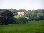 |
| Old Tongland Bridge | Tongland 54° 51′ 38,5″ N, 4° 1′ 53,7″ W54.860694444444-4.0315833333333 | Brücke | 17123 | |
| Tongland Bridge | Tongland 54° 51′ 28,1″ N, 4° 2′ 20,8″ W54.857805555556-4.0391111111111 | Brücke | 17125 | 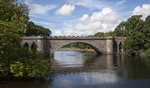 |
| Wasserkraftwerk Tongland | Tongland 54° 51′ 35″ N, 4° 2′ 3,6″ W54.859722222222-4.0343333333333 | Kraftwerk | 17126 |  |
| Torthorwald Cruck Cottage | Torthorwald 55° 5′ 28,6″ N, 3° 31′ 1,4″ W55.091277777778-3.5170555555556 | Wohngebäude | 17157 |  |
| Miners’ Library | Wanlockhead 55° 23′ 52,4″ N, 3° 46′ 46,9″ W55.397888888889-3.7796944444444 | Bücherei | 17192 |  |
| Goldielea Viaduct | nahe Cargenbridge 55° 2′ 43,3″ N, 3° 40′ 32,6″ W55.045361111111-3.6757222222222 | Brücke | 17201 |  |
| Kirkconnel House | nahe New Abbey 54° 59′ 47″ N, 3° 35′ 46″ W54.996388888889-3.5961111111111 | Herrenhaus | 17204 | |
| Stallungen von Terregles House | Terregles 55° 4′ 54,3″ N, 3° 40′ 31,2″ W55.08175-3.6753333333333 | Stallungen | 17208 | |
| Tynron Parish Church | Tynron 55° 13′ 0,5″ N, 3° 52′ 42,1″ W55.216805555556-3.8783611111111 | Kirche | 17222 | 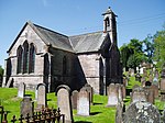 |
| Amisfield Tower | nahe Amisfield 55° 8′ 17,8″ N, 3° 34′ 57,5″ W55.138277777778-3.5826388888889 | Tower House | 17233 | 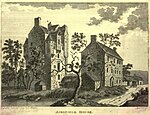 |
| Tinwald House | nahe Tinwald 55° 6′ 26,2″ N, 3° 32′ 30,2″ W55.107277777778-3.5417222222222 | Herrenhaus | 17238 |  |
| Cottages von Tinwald House | nahe Tinwald 55° 6′ 24,3″ N, 3° 32′ 29,4″ W55.10675-3.5415 | Wohngebäude | 17239 | |
| Gutshof von Tinwald House | nahe Tinwald 55° 6′ 27,3″ N, 3° 32′ 33,5″ W55.107583333333-3.5426388888889 | Stallungen | 17240 | |
| Comlongon Castle | nahe Clarencefield 55° 0′ 23,4″ N, 3° 26′ 26,8″ W55.0065-3.4407777777778 | Tower House | 17245 |  |
| Ruthwell Museum | Ruthwell 54° 59′ 34,6″ N, 3° 24′ 19,2″ W54.992944444444-3.4053333333333 | Museum | 17249 | 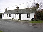 |
| Nith Bridge | nahe Thornhill 55° 14′ 26,1″ N, 3° 46′ 38,7″ W55.240583333333-3.7774166666667 | Brücke | 17286 |  |
| Gärtnerhaus von Drumlanrig Castle | nahe Thornhill 55° 15′ 53,1″ N, 3° 47′ 57,4″ W55.26475-3.7992777777778 | Wohngebäude | 17297 | |
| Sweetheart Abbey | New Abbey 54° 58′ 48,9″ N, 3° 37′ 7,8″ W54.98025-3.6188333333333 | Klosterruine | 17304 |  |
| New Abbey Mill | New Abbey 54° 58′ 48″ N, 3° 37′ 23,2″ W54.98-3.6231111111111 | Mühle | 17323 |  |
| Thornhill Cross | Thornhill 55° 14′ 26,6″ N, 3° 45′ 53,7″ W55.240722222222-3.7649166666667 | Marktkreuz | 17337 |  |
| The Old House | New Abbey 54° 58′ 47,1″ N, 3° 37′ 25,1″ W54.97975-3.6236388888889 | Wohngebäude | 17346 | |
| Henry Duncan Monument | Mouswald 55° 1′ 47,3″ N, 3° 27′ 12,6″ W55.029805555556-3.4535 | Denkmal | 17388 | |
| Sorbie Tower | nahe Sorbie 54° 47′ 38,8″ N, 4° 24′ 39,6″ W54.794111111111-4.411 | Tower House | 19181 |  |
| All Saints Episcopal Church | nahe Newton Stewart 54° 58′ 32,7″ N, 4° 31′ 28,4″ W54.97575-4.5245555555556 | Kirche | 19190 |  |
| Tonderghie House | nahe Isle of Whithorn 54° 41′ 31,1″ N, 4° 25′ 0,4″ W54.691972222222-4.4167777777778 | Villa | 19248 |  |
| Gutshof von Tonderghie House | nahe Isle of Whithorn 54° 41′ 21,4″ N, 4° 25′ 6,4″ W54.689277777778-4.4184444444444 | Bauernhof | 19249 | |
| Heron Monument | Minnigaff 54° 58′ 6,1″ N, 4° 29′ 7,8″ W54.968361111111-4.4855 | Grabstätte | 19313 | |
| Monreith House | nahe Port William 54° 45′ 13,3″ N, 4° 33′ 22,9″ W54.753694444444-4.5563611111111 | Herrenhaus | 19561 | 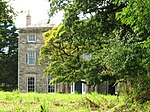 |
| Old Place of Mochrum | nahe Kirkcowan 54° 51′ 10,5″ N, 4° 38′ 13,8″ W54.852916666667-4.6371666666667 | Tower House | 19570 | 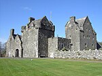 |
| Annan Bridge | Annan 54° 59′ 14,2″ N, 3° 15′ 56,9″ W54.987277777778-3.2658055555556 | Brücke | 21061 | 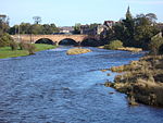 |
| 27–29 Bank Street | Annan 54° 59′ 10,2″ N, 3° 15′ 43,6″ W54.986166666667-3.2621111111111 | Wohn- und Geschäftsgebäude | 21066 | |
| 5–9 High Street | Annan 54° 59′ 12,6″ N, 3° 15′ 53,6″ W54.986833333333-3.2648888888889 | Wohngebäude | 21086 | 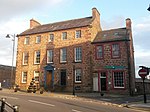 |
| Annan Old Parish Church | Annan 54° 59′ 15,1″ N, 3° 15′ 29,8″ W54.987527777778-3.2582777777778 | Kirche | 21106 |  |
| Viehmarkthalle von Castle Douglas | Castle Douglas 54° 56′ 32,8″ N, 3° 55′ 28,6″ W54.942444444444-3.9246111111111 | Markthalle | 22976 | 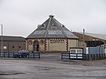 |
| Lincluden Collegiate Church | Dumfries 55° 5′ 6″ N, 3° 37′ 14,7″ W55.085-3.62075 | Kirchenruine | 26075 |  |
| 5–11 Bank Street | Dumfries 55° 4′ 4,2″ N, 3° 36′ 44,7″ W55.067833333333-3.6124166666667 | Wohn- und Geschäftsgebäude | 26083 | |
| Alte Methodistische Kirche | Dumfries 55° 4′ 13,2″ N, 3° 36′ 48,5″ W55.070333333333-3.6134722222222 | Kirche | 26102 | 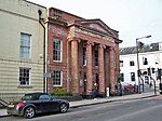 |
| Robert Burns’ House | Dumfries 55° 3′ 57,9″ N, 3° 36′ 29,1″ W55.066083333333-3.6080833333333 | Wohngebäude | 26115 | 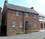 |
| 25–37 Castle Street | Dumfries 55° 4′ 14″ N, 3° 36′ 49,5″ W55.070555555556-3.61375 | Wohngebäude | 26118 | |
| 41–47 Castle Street | Dumfries 55° 4′ 16,6″ N, 3° 36′ 53″ W55.071277777778-3.6147222222222 | Wohngebäude | 26120 | |
| 14–24 Castle Street | Dumfries 55° 4′ 14,2″ N, 3° 36′ 47,5″ W55.070611111111-3.6131944444444 | Wohngebäude | 26122 | |
| 26–30 Castle Street | Dumfries 55° 4′ 17″ N, 3° 36′ 51,4″ W55.071388888889-3.6142777777778 | Wohngebäude | 26123 | |
| Greyfriars Church | Dumfries 55° 4′ 13,5″ N, 3° 36′ 45,4″ W55.070416666667-3.6126111111111 | Kirche | 26126 |  |
| Dumfries Museum | Dumfries 55° 3′ 55,1″ N, 3° 36′ 52,8″ W55.065305555556-3.6146666666667 | Museum | 26135 |  |
| Queensberry Column | Dumfries 55° 4′ 8,9″ N, 3° 36′ 39″ W55.069138888889-3.6108333333333 | Denkmal | 26173 |  |
| Midsteeple | Dumfries 55° 4′ 7,7″ N, 3° 36′ 38,8″ W55.068805555556-3.6107777777778 | Rathaus | 26215 |  |
| The Globe Inn | Dumfries 55° 4′ 3,2″ N, 3° 36′ 34,6″ W55.067555555556-3.6096111111111 | Gasthaus | 26230 |  |
| Trades Hall | Dumfries 55° 4′ 8,4″ N, 3° 36′ 38,1″ W55.069-3.6105833333333 | Versammlungsgebäude | 26234 | |
| 29 Irish Street | Dumfries 55° 3′ 58,8″ N, 3° 36′ 38,8″ W55.066333333333-3.6107777777778 | Villa | 26240 | 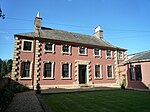 |
| 24 Nith Place | Dumfries 55° 3′ 59,5″ N, 3° 36′ 33,5″ W55.066527777778-3.6093055555556 | Villa | 26305 | |
| St Michael’s Church | Dumfries 55° 3′ 54,4″ N, 3° 36′ 22,6″ W55.065111111111-3.6062777777778 | Kirche | 26335 | 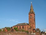 |
| Friedhof der St Michael’s Church | Dumfries 55° 3′ 54,4″ N, 3° 36′ 20,5″ W55.065111111111-3.6056944444444 | Friedhof | 26336 | |
| Burns’ Mausoleum | Dumfries 55° 3′ 54,3″ N, 3° 36′ 17,7″ W55.065083333333-3.6049166666667 | Mausoleum | 26337 |  |
| Devorgilla Bridge | Dumfries 55° 4′ 5,4″ N, 3° 36′ 58,4″ W55.068166666667-3.6162222222222 | Brücke | 26354 |  |
| MacLellan’s Castle | Kirkcudbright 54° 50′ 13,4″ N, 4° 3′ 11,3″ W54.837055555556-4.0531388888889 | Tower House | 36484 |  |
| Blair House | Kirkcudbright 54° 50′ 13,3″ N, 4° 3′ 15,2″ W54.837027777778-4.0542222222222 | Villa | 36529 | |
| Broughton House | Kirkcudbright 54° 50′ 12,6″ N, 4° 3′ 15,7″ W54.836833333333-4.0543611111111 | Villa | 36530 |  |
| Tolbooth von Kirkcudbright | Kirkcudbright 54° 50′ 7,6″ N, 4° 3′ 20,5″ W54.835444444444-4.0556944444444 | Rathaus | 36542 |  |
| 66–70 High Street | Kirkcudbright 54° 50′ 7,3″ N, 4° 3′ 19,4″ W54.835361111111-4.0553888888889 | Wohngebäude | 36545 | |
| 74 High Street | Kirkcudbright 54° 50′ 7″ N, 4° 3′ 18,4″ W54.835277777778-4.0551111111111 | Wohngebäude | 36546 | |
| Langholm Parish Church | Langholm 55° 9′ 1,1″ N, 3° 0′ 12,1″ W55.150305555556-3.0033611111111 | Kirche | 37137 | 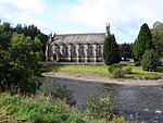 |
| Lochmaben Parish Church | Lochmaben 55° 7′ 34,9″ N, 3° 26′ 19,1″ W55.126361111111-3.4386388888889 | Kirche | 37539 |  |
| Tolbooth von Lochmaben | Lochmaben 55° 7′ 44,5″ N, 3° 26′ 29,2″ W55.129027777778-3.4414444444444 | Rathaus | 37541 |  |
| Rathaus von Lockerbie | Lockerbie 55° 7′ 17,9″ N, 3° 21′ 17″ W55.121638888889-3.3547222222222 | Rathaus | 37579 |  |
| St Andrew’s Parish Church | Moffat 55° 19′ 53,9″ N, 3° 26′ 40,7″ W55.331638888889-3.4446388888889 | Kirche | 37881 | 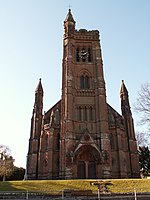 |
| Moffat House Hotel | Moffat 55° 20′ 1,9″ N, 3° 26′ 45,5″ W55.333861111111-3.4459722222222 | Hotel | 37928 |  |
| Sidmount Cottage | Moffat 55° 20′ 8″ N, 3° 26′ 11,6″ W55.335555555556-3.4365555555556 | Villa | 37935 | |
| Penninghame Parish Church | Newton Stewart 54° 57′ 28,5″ N, 4° 29′ 6,7″ W54.957916666667-4.4851944444444 | Kirche | 38663 |  |
| Cree Bridge | Newton Stewart 54° 57′ 36,6″ N, 4° 28′ 56,4″ W54.960166666667-4.4823333333333 | Brücke | 38667 | 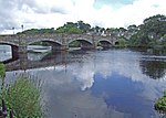 |
| Douglas House | Newton Stewart 54° 58′ 0,4″ N, 4° 29′ 14,4″ W54.966777777778-4.4873333333333 | Villa | 38672 | |
| Tolbooth von Sanquhar | Sanquhar 55° 22′ 4,7″ N, 3° 55′ 30,2″ W55.367972222222-3.9250555555556 | Rathaus | 40540 |  |
| Stranraer Museum | Stranraer 54° 54′ 16″ N, 5° 1′ 41,8″ W54.904444444444-5.0282777777778 | Museum | 41745 | 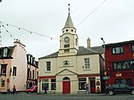 |
| Stranraer Castle | Stranraer 54° 54′ 15,8″ N, 5° 1′ 33,6″ W54.904388888889-5.026 | Tower House | 41765 |  |
| Torweg zu Whithorn Priory | Whithorn 54° 43′ 59,3″ N, 4° 24′ 56,9″ W54.733138888889-4.4158055555556 | Wohngebäude | 42195 |  |
| 55–57 George Street | Whithorn 54° 43′ 58,8″ N, 4° 24′ 57,2″ W54.733-4.4158888888889 | Wohngebäude | 42196 | |
| Whithorn Priory | Whithorn 54° 44′ 1,1″ N, 4° 25′ 0,8″ W54.733638888889-4.4168888888889 | Klosterruine | 42266 |  |
| 18–20 King Street | Stranraer 54° 54′ 17,9″ N, 5° 1′ 49,3″ W54.904972222222-5.0303611111111 | Wohn- und Geschäftsgebäude | 45230 |
Weblinks
Commons: Kategorie-A-Bauwerke in Dumfries and Galloway – Sammlung von Bildern, Videos und Audiodateien
- Datenbank von Historic Scotland
- Karte mit allen Koordinaten:
- OSM
- WikiMap

Listen der Kategorie-A-Bauwerke in Schottland
Council areas:
Aberdeen | Aberdeenshire | Angus | Argyll and Bute | Äußere Hebriden | Clackmannanshire | Dumfries and Galloway | Dundee | East Ayrshire | East Dunbartonshire | East Lothian | East Renfrewshire | Edinburgh – Old Town – New Town | Falkirk | Fife | Glasgow | Highland | Inverclyde | Midlothian | Moray | North Ayrshire | North Lanarkshire | Orkney | Perth and Kinross | Renfrewshire | Scottish Borders | Shetland | South Ayrshire | South Lanarkshire | Stirling | West Dunbartonshire | West Lothian


