Fishers Island (New York)
| Fishers Island | ||
|---|---|---|
 | ||
| Gewässer | Long Island Sound (Atlantischer Ozean) | |
| Geographische Lage | 41° 15′ 35″ N, 72° 1′ 8″ W41.259722222222-72.0188888888895Koordinaten: 41° 15′ 35″ N, 72° 1′ 8″ W | |
| ||
| Fläche | 10,6 km² | |
| Höchste Erhebung | 5 m | |
| Einwohner | 236 (2010) 22 Einw./km² | |
 | ||


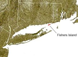
Fishers Island ist eine Insel in Southold, New York am östlichen Ende des Long Island Sound, 3 km vor der südöstlichen Küste von Connecticut. Die Insel ist von New London aus erreichbar per Flugzeug und Fähre.
Die Insel gehört zur Town Southold im Suffolk County, New York. Sie ist ein Census-designated place (CDP). Laut Volkszählung 2010 leben 236 Menschen des ganze Jahr über auf rund 10 km²;[1] während der Hochsaison im Sommer steigt die Einwohnerzahl auf 2000.
Geographie
Laut United States Census Bureau beträgt die Gesamtfläche rund 11 km², davon 3,48 % Wasser.[1]
Fishers Island ist Teil derselben Endmoräne, welche die North Fork von Long Island bildet. Während der Spätphase der Wisconsin glaciation, bildete sich der Lake Connecticut.
Klima

Dieser Artikel oder nachfolgende Abschnitt ist nicht hinreichend mit Belegen (beispielsweise Einzelnachweisen) ausgestattet. Angaben ohne ausreichenden Beleg könnten demnächst entfernt werden. Bitte hilf Wikipedia, indem du die Angaben recherchierst und gute Belege einfügst.
Das Wetter auf Fishers Island wird bestimmt durch die Nähe zum Long Island Sound und zum Atlantik sowie vorherrschende Winde. Es ist einer der wenigen Orte an der Ostküste der Nordhalbkugel mit ozeanischem Klima (Koppen Cfb). Durch die Wärmespeicherung des Atlantiks während der Herbst- und Wintermonate bleibt Fishers Island wärmer als das Festland (Connecticut) in diesem Zeitraum. Obwohl Sommertage auf Fishers Island heiß sein können, sind die Temperaturen niedriger als auf Festland-Connecticut und Rhode Island.
Sonstiges
Das Ehepaar John Hay und Betsey Whitney hatte ein Sommerhaus auf Fishers Island.
Weblinks
Commons: Fishers Island, New York – Sammlung von Bildern, Videos und Audiodateien
- FishersIsland.net
- Fishers Island School
- Fishers Island Ferry District
Einzelnachweise
- ↑ a b Geographic Identifiers: 2010 Demographic Profile Data (G001): Fishers Island CDP, New York. U.S. Census Bureau, American Factfinder, archiviert vom Original am 12. Februar 2020; abgerufen am 28. Dezember 2012.
V
Orte im Suffolk County im US-Bundesstaat New York County Seat: Riverhead
| Towns | Babylon • Brookhaven • East Hampton • Huntington • Islip • Riverhead • Shelter Island • Smithtown • Southampton • Southold | |
| Villages | Amityville • Asharoken • Babylon • Belle Terre • Bellport • Brightwaters • Dering Harbor • East Hampton • Greenport • Head of the Harbor • Huntington Bay • Islandia • Lake Grove • Lindenhurst • Lloyd Harbor • Nissequogue • North Haven • Northport • Ocean Beach • Old Field • Patchogue • Poquott • Port Jefferson • Quogue • Sag Harbor (New York) • Sagaponack • Saltaire • Shoreham • Southampton • Village of the Branch • West Hampton Dunes • Westhampton Beach | |
| CDPs | Amagansett • Aquebogue • Baiting Hollow • Bay Shore • Bayport • Baywood • Blue Point • Bohemia • Brentwood • Bridgehampton • Brookhaven • Calverton • Captree • Center Moriches • Centereach • Centerport • Central Islip • Cold Spring Harbor • Commack • Copiague • Coram • Cutchogue • Deer Park • Dix Hills • East Farmingdale • East Hampton North • East Islip • East Marion • East Moriches • East Northport • East Patchogue • East Quoque • East Setauket • East Shoreham • Eastport • Eatons Neck • Elwood • Farmingville • Fire Island • Fishers Island • Flanders • Fort Salonga • Gilgo • Gordon Heights • Great River • Greenlawn • Greenport West • Halesite • Hampton Bays • Hauppauge • Holbrook • Holtsville • Huntington • Huntington Station • Islip (CDP) • Islip Terrace • Jamesport • Kings Park • Lake Ronkonkoma • Laurel • Manorville • Mastic (CDP) • Mastic Beach • Mattituck • Medford • Melville • Middle Island • Miller Place • Montauk • Moriches • Mount Sinai • Napeague • Nesconset • New Suffolk • North Amityville • North Babylon • North Bay Shore • North Bellport • North Great River • North Lindenhurst • North Patchogue • North Sea (CDP) • Northampton • Northville (CDP) • Northwest Harbor • Noyack • Oak Beach • Oakdale • Orient • Peconic • Port Jefferson Station • Quiogue • Remsenburg-Speonk • Ridge (CDP) • Riverhead • Riverside • Rocky Point • Ronkonkoma • St. James • Sayville • Selden • Setauket • Shelter Island • Shelter Island Heights • Shinnecock (CDP) • Shirley • Smithtown • Sound Beach • South Huntington • Southold (CDP) • Springs • Stony Brook • Stony Brook University • Terryville • Tuckahoe • Wading River • Wainscott • Water Mill • West Babylon • West Bay Shore • West Hills • West Islip • West Sayville • Westhampton • Wheatley Heights • Wyandanch (CDP) • Yaphank | |
| Reservate | Poospatuck Reservation • Shinnecock Reservation |


